
Directions
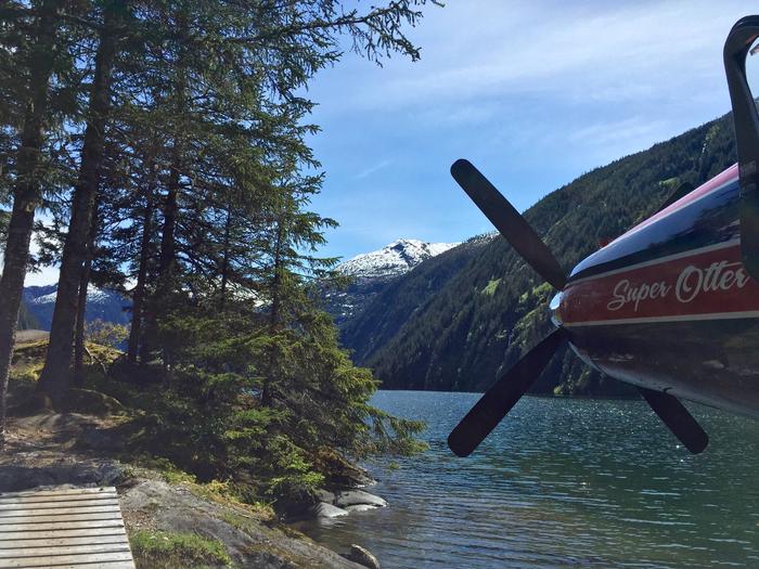
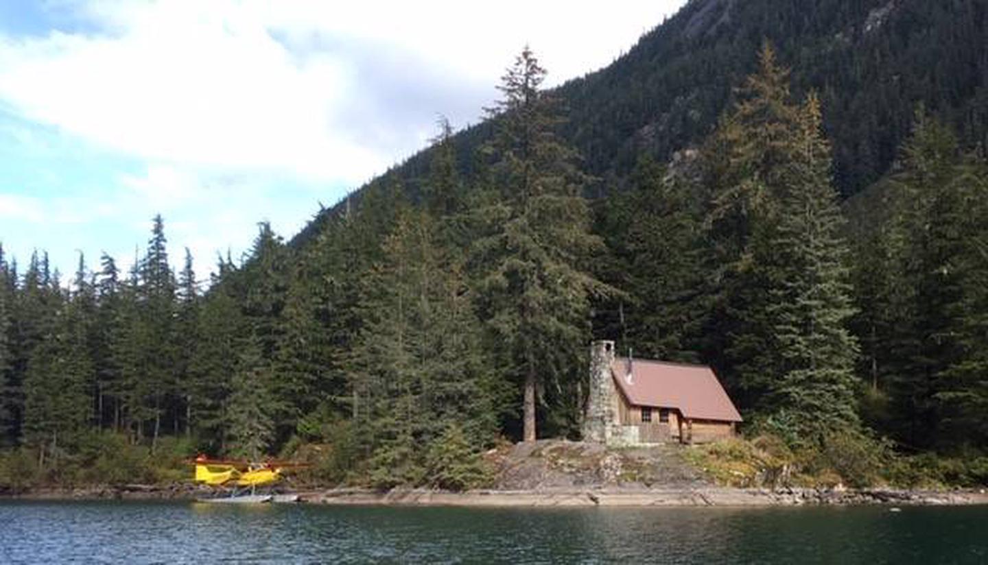
The cabin is located 18 miles east of Juneau at the west end of Turner Lake. Access is by float plane or by boating up Taku Inlet and hiking 0.8 miles to the cabin. In fall, winter and early spring, the cabin may be inaccessible due to frozen lake surface (float planes cannot land). Please call the Juneau Ranger District to check on conditions ahead of time at (907) 586-8800. Turner Lake is typically not ice-free until June. Some areas of Taku Inlet are quite shallow; be sure to check nautical charts and tide tables. Shallow draft boats or high tides for inboard/outboard boats are recommended.
Phone
907 789-6264
Activities
BOATING, CAMPING, FISHING, HUNTING, WILDLIFE VIEWING
Keywords
WTKE,TURNER LAKE WEST CABIN,TONGASS NF – FS
Related Link(s)
Overview
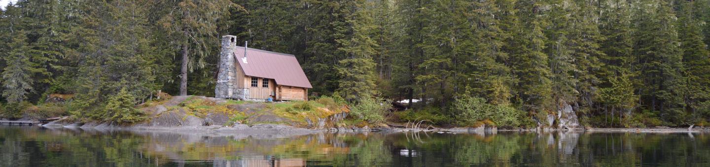
Turner Lake West Cabin is extremely popular and considered to be one of the most beautiful cabins on the Tongass National Forest. It is open for year-round enjoyment, offering scenic views and access to a variety of recreational activities. The site can be accessed by float plane, motor boat or kayak, depending on conditions. Guests are responsible for their own travel arrangements and safety and must bring several of their own amenities.
Recreation
Anglers can fish for cutthroat trout, Dolly Varden and kokanee salmon in Turner Lake. Pink salmon and Dolly Varden is available in the Turner River and Taku Inlet. A 0.8 mile trail goes from the ocean to the cabin. A skiff with oars is available at the cabin, but guests must provide their own flotation devices. Guests can bring a small outboard to attach to the skiff. The Turner Creek and mudflats may be difficult to navigate in lower tides, so a shallow draft boat or kayak is recommended. During high tides, larger inboard/outboard boats can navigate the inlet. Tide charts should be consulted; click here for more info. Bear, mountain goat and waterfowl hunting is allowed in designated seasons with the proper permits.
Facilities
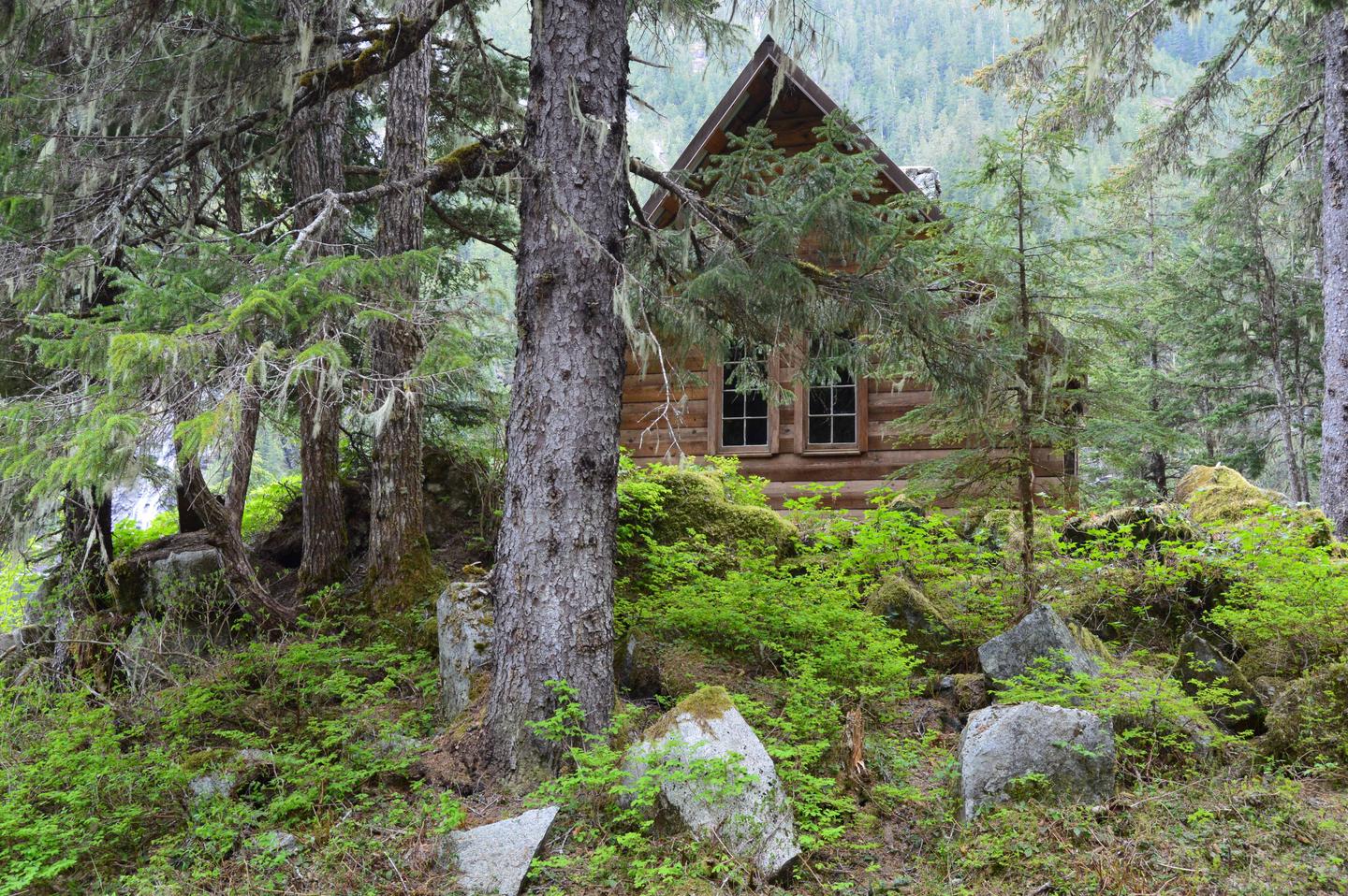
This is a chalet-style log cabin that has a fireplace with beautiful stonework. It sleeps six people with two single and two double bunks. The cabin also has a table and benches, broom, an oil heater, a cooler box for food storage, an outhouse and food preparation space. Water, firewood and electricity are not provided. Water is available from the lake or a nearby stream, but visitors should be sure to treat water before drinking or cooking with it ( water safety tips ). It is recommended that visitors bring their own water supply. Heating oil is not provided. Visitors must bring a supply of #1 diesel oil or kerosene (one gallon per day on lowest setting), in addition to sleeping bags, sleeping pads, a cooking stove, lanterns or flashlights, cookware, plates, utensils, food, toilet paper, garbage bags, a fire extinguisher and fire starter. Visitors are expected to pack out trash, empty the cabinets and clean the cabin before leaving ( click here for more cabin details).
Natural Features
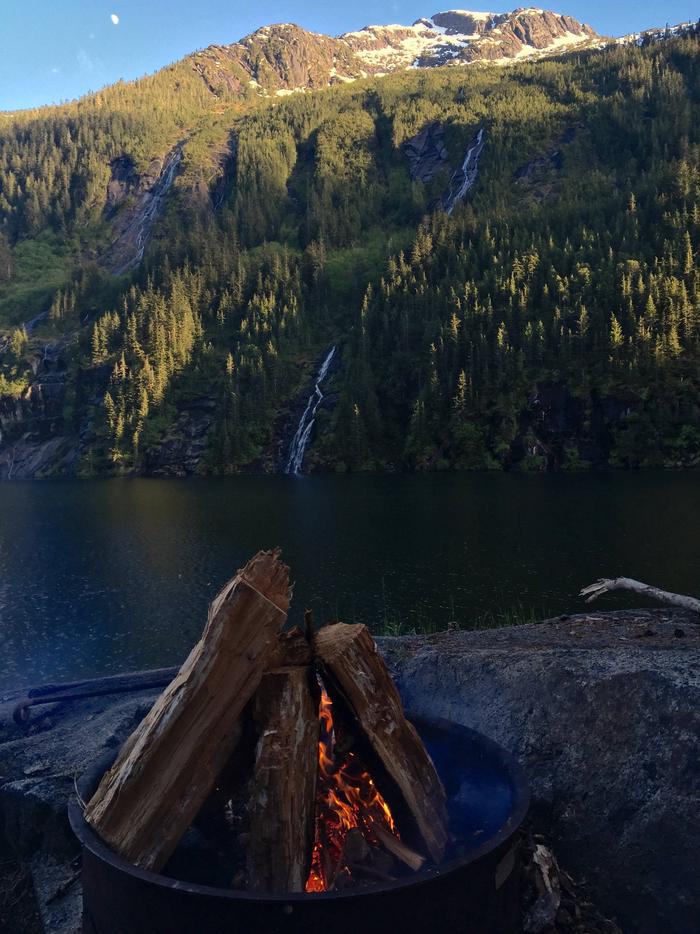
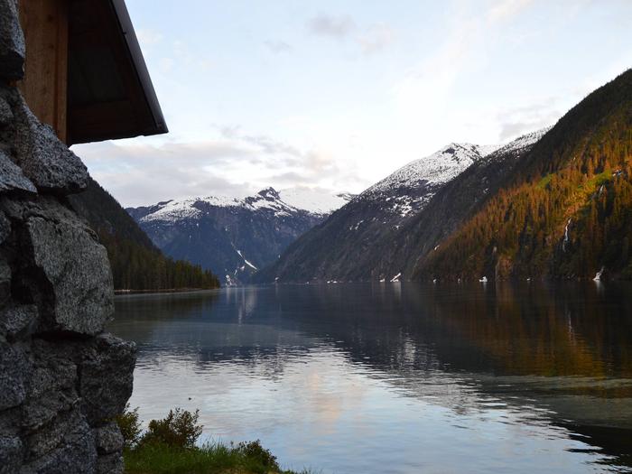
The cabin sits on rock that slopes directly to the water. The area has spectacular scenery with cliffs and numerous waterfalls cascading into the lake. This area is home to grizzly and black bears, moose and mountain goats ( bear safety information ). A variety of waterfowl can be seen on Turner Lake.