
Directions
The cabin is accessible by float plane 9 miles from Petersburg, or by a boat-trail combination, dependent on tides. At high tide (15 feet or higher), access by boating 4 miles up Petersburg Creek to the high tide trailhead, then hiking 6.5 miles along the Petersburg Creek Trail. At lower tides, go a half-mile to the low tide trailhead at the city of Kupreanof’s boat dock on the Wrangell Narrows. The hike from this trailhead is 10.3 miles.
Refer to USGS topographic map Petersburg D4. Maps are available online or by calling the Petersburg Ranger District at (907) 772-3871.
Phone
907-772-3871
Activities
CAMPING, FISHING, HUNTING, WILDLIFE VIEWING, WILDERNESS
Keywords
PEUR,TONGASS NF – FS
Related Link(s)
Overview
Petersburg Lake Cabin offers a tranquil place to stay on the shores of a Wilderness lake in southeastern Alaska. It provides access to outstanding fishing opportunities, as well as hunting and wildlife viewing. The cabin is accessible by float plane or by a boat-trail combination, dependent on tides. Guests are responsible for their own travel arrangements and safety and must bring several of their own amenities.
Recreation
The nearby creek offers outstanding steelhead, coho and sockeye fishing, while the lake boasts cutthroat trout and sockeye salmon. A rowboat and oars is available at the cabin, however, life jackets are not provided and guests should bring their own. Guests may also choose to bring a small outboard motor.
Attention Hikers: Petersburg Lake Trail is in very poor condition. The middle section of the trail, around mile marker 4 to 9.5, is very muddy, wet and not well marked. If you plan on hiking that part of the trail make sure and bring a map and compass and know how to use those tools. Rubber boots with non-slip soles are recommended. Portions of the trail have rotting and broken boards to beware of. We recommend avoiding this section of the trail if possible.
Hiking and hunting are popular activities. Hunting is available as per state or federal hunting regulations; click here for more information from the Alaska Department of Fish and Game.
Facilities
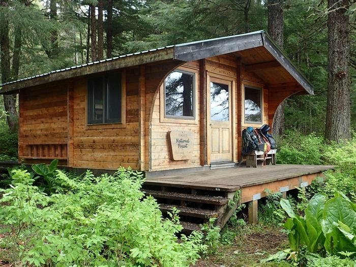
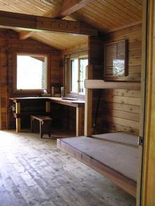
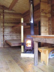
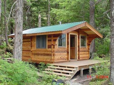
This pan-abode style cabin was constructed in 2003. It has two bunk beds with double space below and single above. The cabin is equipped with a table and benches and a wood stove for heat. Firewood is provided, but not guaranteed. An outhouse with a pit toilet is provided.
The only fresh water available is from the lake, creek or melted snow. Water taken from any outdoor source should be treated or boiled before consumption. Guests are encouraged to bring their own drinking water if possible.
Guests will need to bring their own sleeping bags and pads, lanterns and flashlights, cook stove and cooking gear, towels, food, clothing, fire starter and garbage bags, among other necessities. The cabin will need to be cleaned prior to leaving and all garbage and food needs to be carried out.
Click here for more cabin details and maps.
Natural Features
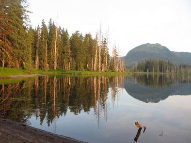
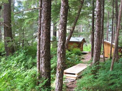
The cabin is located on Kupreanof Island, 9 miles northwest of Petersburg, in the Petersburg Creek-Duncan Salt Chuck Wilderness. The Petersburg Creek Valley is a glacial valley with a broad, flat bottom and steep sides. The area surrounding the lake and creek is flat; otherwise the terrain is steep. The setting is pristine, old-growth spruce and hemlock forest with scattered muskeg.
The area abounds with wildlife and wildflowers. The creek and lake are a haven for black bears and eagles, who feed on the spawning salmon there (learn about bear safety).