
Directions
Access is by boat or float plane only. From Petersburg the journey is 16 miles by float plane or 38 miles by boat. A 15-foot tide is required for boat access to the cabin. A 16-foot tide is recommended for float plane access. Lower tides may require up to a 2-mile hike across the tide flat to the cabin. Click here for more information.
The cabin can be found on USGS topographic map Petersburg D5. Maps are available online or by calling the Petersburg Ranger District at (907) 772-3871.
Phone
907-772-3871
Activities
BOATING, CAMPING, FISHING, HUNTING, WILDLIFE VIEWING
Keywords
TOWA,TONGASS NF – FS
Related Link(s)
Overview
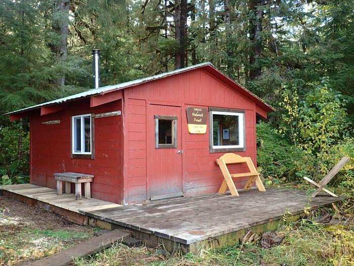
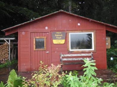
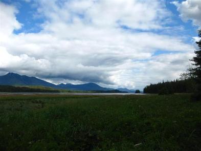
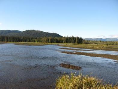
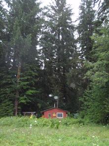
Towers Arm Cabin is one of the Petersburg Ranger District’s most remote cabins. A large tidal flat in front of the cabin provides excellent waterfowl viewing and hunting opportunities. Visitors also enjoy the area for its fishing and wildlife viewing.
The cabin is accessible by boat or float plane only.
Recreation
The location offers fishing in Towers Creek. Coho salmon is available from August through September, as well as steelhead trout in April through May.
Hunting for bears, deer, a variety of waterfowl and grouse is also popular in the area, as per state or federal hunting regulations; click here for more information from the Alaska Department of Fish and Game.
Facilities
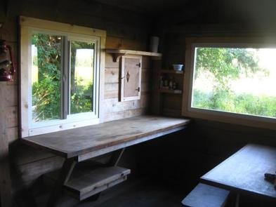
The hunter-style cabin has four single, wooden bunks to accommodate up to four people. It is equipped with a table, benches and a wood stove that is used to heat the cabin. The stove can also be used for cooking purposes. An outhouse with a pit toilet is provided.
Water for drinking, cooking and cleaning is not provided at the cabin. Fresh water available from a small stream located north of the cabin should be treated or boiled before consumption. Guests are encouraged to bring their own drinking water if possible.
Guests will need to bring their own sleeping bags and pads, cook stove and cooking gear, towels, food and clothing, fire starter and garbage bags, among other necessities. Firewood is generally provided, but not guaranteed. A broom, dust pan, axe and splitting maul are also typically available provided, but may be missing or damaged. Please report missing or damaged items to the Petersburg Ranger District.
Click here for more cabin details and maps.
Natural Features
The cabin is located on Kupreanof Island, at the mouth of Towers Creek on the west side of Towers Arm in Duncan Canal. Terrain surrounding the cabin is fairly flat, with hills at the rear and a vast tidal flat and the water’s edge to the front.
A variety of wildlife make its home in the area, including abundant waterfowl from September through November and shorebirds in early May. The region is also home to grouse, deer, wolves and black bears.