

Directions
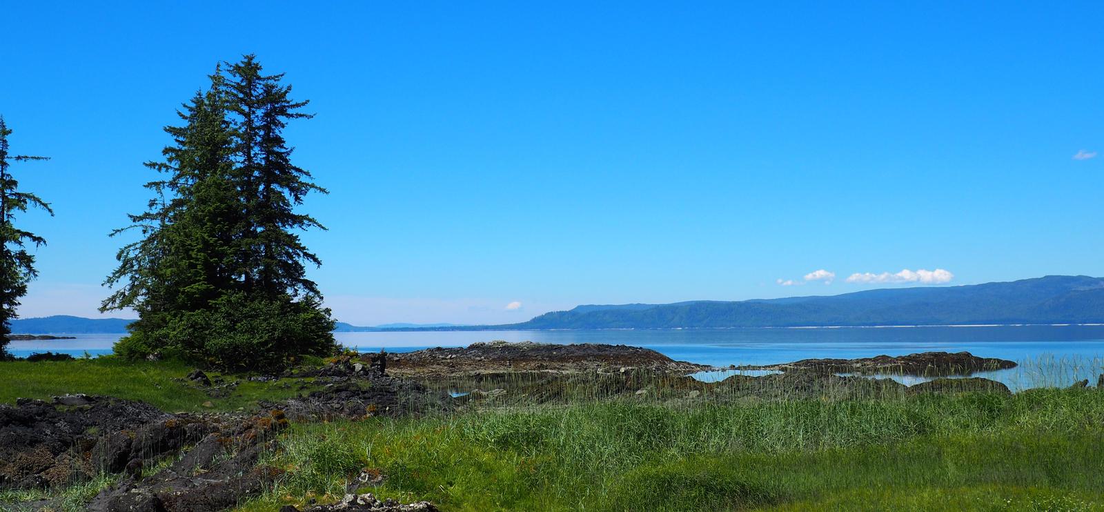
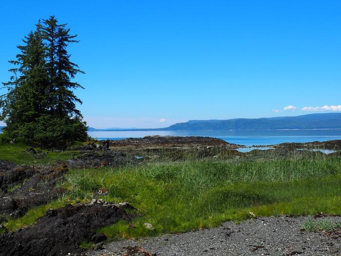
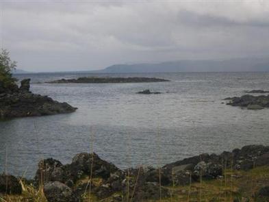
Steamer Bay Cabin is located on the northwest corner of Etolin Island on the east side of Steamer Bay. The cabin is accessible by boat or float plane only, and is 27 miles by boat or 25 miles by air from Wrangell. Use caution when anchoring the boat due to the rocky shoreline. Check local tide tables to determine the best time for arrival and departure, ideally at high slack tide. There is a mooring buoy anchored in the bay for cabin guests only.
Phone
907-874-2323
Activities
BOATING, CAMPING, FISHING, HIKING, HUNTING, WILDLIFE VIEWING
Keywords
STEA,TONGASS NF – FS
Related Link(s)
Overview
Steamer Bay Cabin is on the northwest corner of Etolin Island on the east side of Steamer Bay. Its location on saltwater provides access to fishing and paddling opportunities. The site can be accessed by float plane or boat, depending on conditions. Guests are responsible for their own travel arrangements and safety, and must bring several of their own amenities.
Recreation
Saltwater fishing for King salmon is possible from May through July, silver salmon in August and September, and halibut from June through September. Dolly Varden and pink salmon (July through August) are available in nearby Porcupine Creek.
Steamer Bay offers opportunities for crabbing, as well as digging for clams and abalone. The gravel beach, nearby islands and rocky shorelines invite beachcombing.
The surrounding area can be explored on foot or by water, but tide tables should be consulted before any boating, kayaking or canoeing excursion.
Facilities
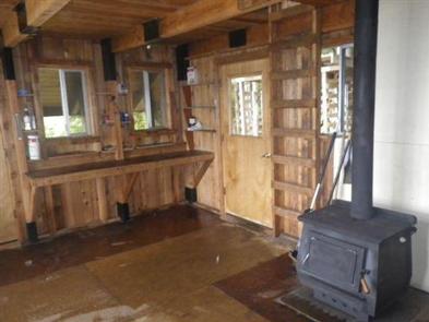
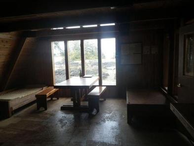
The 20-by-20 cabin ( modified A-frame style ) has two single bunks (one with a trundle bed) and a partial loft, to sleep up to seven people. It is also equipped with a table with benches, wood stove for heat, fire grill, broom and outhouse. A partially covered deck wraps around three sides of the cabin, and a wooden cooler box is provided for food storage. The cabin is fully accessible and includes a wheelchair ramp from the beach to the cabin. The mooring buoy located at the cabin is currently not safe to use; DO NOT USE.
Water and electricity are not provided. Water is available from a small stream, but guests should be sure to treat water taken from any outside source prior to consumption ( water safety tips ). It is recommended that guests bring their own water supply. Cooking facilities are not available. Guests should provide their own firewood, cook stove, sleeping bags, sleeping pads, lanterns or flashlights, cookware, plates, utensils, food, toilet paper, garbage bags, a fire extinguisher and matches, among other necessities. Guests are expected to pack out trash and clean the cabin before leaving ( click here for more cabin details).
Natural Features
The cabin sits near a gravel beach and overlooks Steamer Bay and Clarence Strait, as well as large rock outcroppings, a grassy estuary and tidal flats. The surrounding terrain is mountainous and densely forested with Sitka spruce and western hemlock rainforest. Muskeg is also common in the area. Brown and black bears, porcupine, deer, waterfowl, porpoises, whales and other marine life are commonly seen in the area (learn about bear safety ). Roosevelt elk were introduced here and thrive on Etolin Island.