


Directions
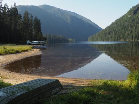
The cabin is located at the north end of Marten Lake, southeast of Wrangell. The lake is on the mainland (at an elevation of 178 feet) above Blake Channel and the Bradfield Canal. This cabin is accessible by float plane only and is 25 miles by air from Wrangell. Marten Lake is usually ice-free from May to October. In fall, winter and early spring, the cabin may be inaccessible due to frozen lake surface (float planes cannot land). The cabin floor can flood during high lake levels. Please check on local conditions before you go by calling the Wrangell Ranger District at (907) 874-2323.
Phone
907-874-2323
Activities
CAMPING, FISHING, HUNTING, WILDLIFE VIEWING
Keywords
MARK,TONGASS NF – FS
Related Link(s)
Overview
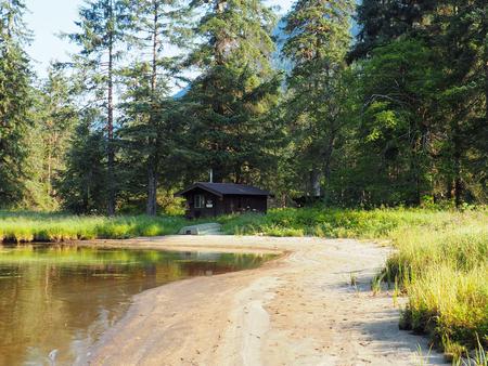
A stay at Marten Lake Cabin provides for a unique experience at a remote, backcountry lake only accessible by floatplane. It is situated on the north side of Marten Lake, above Blake Channel and Bradfield Canal, 25 miles southeast of Wrangell, Alaska. The site can be accessed by float plane, depending on conditions. Visitors are responsible for their own travel arrangements and safety, and must bring several of their own amenities.
Recreation
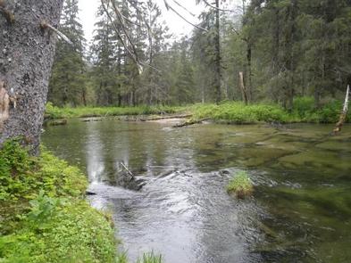
Anglers can fish for cutthroat trout and Dolly Varden in Marten Lake and nearby Clay Lake. Steelhead is available in lower Marten Creek. A skiff with oars is available at the cabin for rowing around the lake, but guests must provide their own flotation devices and ensure that the skiff is secured before leaving the cabin. Bear and mountain goat hunting is possible in designated seasons with the proper permits.
Facilities
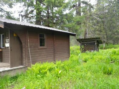
The 12-by-14 cabin ( pan-abode style ) has single and double bunks to sleep up to four people. The cabin also has a table and benches, a broom and a wood-burning stove for heat. An outhouse is located just outside the cabin. A wooden cooler box for food storage is located on the partially covered front porch. Water and electricity are not provided. Water is available from a stream behind the cabin, but guests should be sure to treat water taken from any outside source before drinking or cooking with it ( water safety tips ). It is recommended that guests bring their own water supply. In addition to bringing a cook stove, guests should provide their own firewood, sleeping bags, sleeping pads, lanterns or flashlights, cookware, plates, utensils, food, toilet paper, garbage bags, a fire extinguisher and matches, among other necessities. Guests are expected to pack out trash and clean the cabin before leaving ( click here for more cabin details).
Natural Features
The cabin sits in a relatively flat valley, with scenic views of Marten Lake and the steep mountains rising from the shoreline. The surrounding rainforest is primarily Sitka spruce and western hemlock with some cedar. There is a sand beach in front of the cabin at low and moderate lake levels. This area is home to brown and black bears, as well as moose ( bear safety information ). Mountain goats can sometimes been seen on the surrounding peaks.