KNUTSON DAM, MN Campground Reservation, Info, Images, Map, Directions

KNUTSON DAM, Minnesota Campground Images, Info & Reservations

Directions

The campground is located 6 miles east of Cass Lake on U.S. Highway 2, and 5 miles north on County Road 10.

Phone

218-835-4291

Activities

BOATING, CAMPING, FISHING, WATER SPORTS, WILDLIFE VIEWING, SWIMMING SITE

Keywords

KDam,Knutson

Related Link(s)

Rec Area Info & Images

Minnesota State Road Conditions

Minnesota State Tourism

Overview

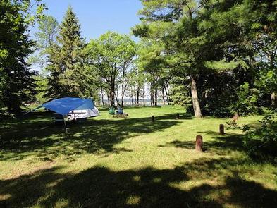
Knutson Dam Campground is located on the northeastern shores of Cass Lake and the Mississippi River.

Recreation

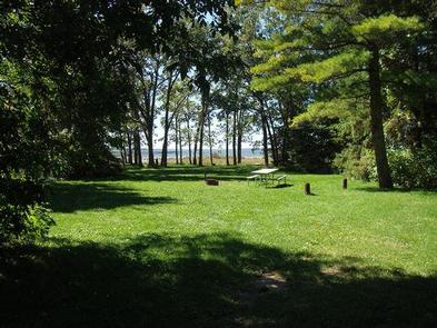
Cass Lake offers many recreational activities, including boating, water skiing and swimming. Anglers fish for walleye, northern pike, perch and trophy muskie. Boat ramps on the lake and river are located within the campground.

Canoeists love Knutson Dam’s location for its easy canoe access to the Mississippi River. Several canoe routes traverse the area waterways, including the Mississippi.

Facilities

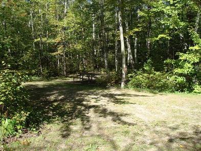
The campground offers 11 single family campsites and two walk-to tent sites. Picnic tables and campfire rings are provided, as are vault toilets, drinking water and trash collection. Firewood may be purchased when the host is available.

Natural Features

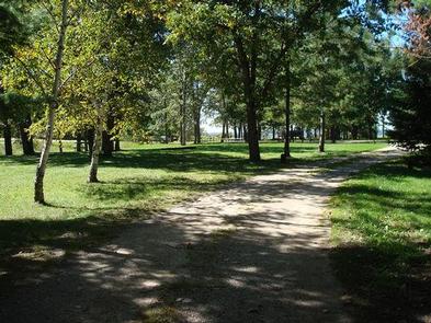
The campground consists of a single loop among beautifully manicured lawns, shaded by a forest of oak, spruce and pine. Every site affords scenic lake views.

Reservation

More from CampingHiking.net:

TELEGRAPH PICNIC PAVILION, Virginia Campground Images, Info & Reservations

Directions From Washington, D.C., and points north, take I-95 south to exit 150-B toward VA Route 619/Joplin Road. The park entrance is the second right. The Telegraph Picnic Area is located behind the visitor center, approximately 1.5 miles from the park entrance. From Fredericksburg, Virginia, and points south, take I-95

MAGRUDER RANGERS HOUSE, Montana Campground Images, Info & Reservations

Directions From Darby, Montana, travel south on Highway 93 for 4 miles to West Fork Road/Highway 473. Continue on this road for approximately 14 miles to the Nez Perce Road/Magruder Corridor Road and go another 34 miles on the one-lane gravel, and partially paved road. Just before the Deep Creek

HURRICANE CREEK, Kentucky Campground Images, Info & Reservations

Directions From Paducah, Kentucky: Take I-24 east to exit 45. Turn right on Highway 293 west and go 0.3 miles. Turn left on Highway 93 south, go 5.3 miles. Turn right on Highway 274 south, go 5.7 miles. Turn right on Hurricane camp road. Campground on left. From Nashville, Tenn.:

SHIRTTAIL CREEK, California Campground Images, Info & Reservations

Directions From either east bound or west bound Interstate 80 take exit 121, Auburn Ravine Road to Foresthill. Continue east for 17 miles, to Foresthill. Travel through town, about 9 miles, to Forest Road 10/Sugar Pine Road. Turn left and continue 9 miles to the Sugar Pine Campgrounds road (approximately