

Directions
East Bearskin Lake Campground is located 26 miles from Grand Marais, on the historic Gunflint Trail. From Duluth, take Highway 61 north to Grand Marais. Turn left (north) on Gunflint Trail and proceed about 26 miles to East Bearskin Road. Turn right and follow the signs to the campground.
Phone
(218)388 2292
Activities
BIKING, BOATING, CAMPING, INTERPRETIVE PROGRAMS, FISHING, HIKING, HUNTING, WINTER SPORTS, WILDLIFE VIEWING, SWIMMING SITE, OTHER RECREATION CONCESSION SITE
Keywords
EBLC,Bearskin Lake,East Bearskin,Bearskin
Related Link(s)
Minnesota State Road Conditions
Overview
East Bearskin Lake Campground is located on its namesake lake, at the edge of the Boundary Waters Canoe Area Wilderness in Northern Minnesota. It is a perfect spot for visitors who want the experience found in Boundary Waters and the convenience of car camping. Visitors can reserve standard or walk-in tent sites, or rent small cabins that accommodate up to five or seven people. Canoeing, kayaking and motorized boating is available on East Bearskin Lake. The facility can be conveniently accessed by vehicle. Guests are responsible for their own travel arrangements and safety, and must bring several of their own amenities.
Recreation
Over a million acres in size, the Boundary Waters Canoe Area Wilderness extends nearly 150 miles along the borders of the United States and Canada, containing over 1,200 miles of canoe routes, 12 hiking trails and over 2,000 designated campsites.
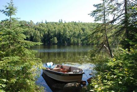
The two eastern bays of the lake are within the boundaries of Boundary Waters, thus the campground attracts canoe enthusiasts. Portages link to Flour Lake. Entering the wilderness area requires a special permit. Day permits for non-motorized use are available at the campground, but overnight and motor use permits must be obtained in advance. More information on the Boundary Waters region can be found here.
East Bearskin Lake features several shallow bays, making the campground and shoreline good places for wildlife watching. Moose, beavers, eagles, ducks, loons, songbirds and bears are the most common visitors. See recreation guides and maps of hiking trails and canoe routes in the national forest.
Fishing is also a huge draw for the area, with East Bearskin Lake offering great fishing for bass, walleye and lake trout. A boat ramp at the campground allows motorboats and canoes access to the lake. Back on shore, a variety of hiking, mountain biking and cross-country ski trails are nearby.
Facilities
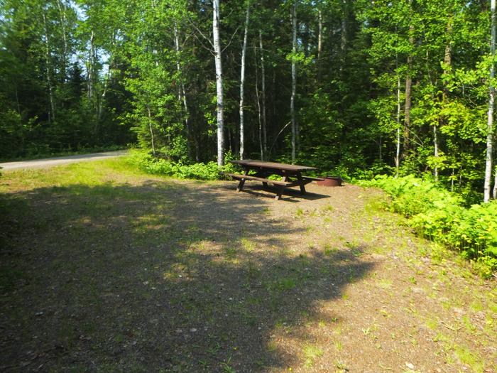
Campsites are arranged along one large loop and three smaller loops within the campground. A few sites provide a limited view of the water and all sites are within walking distance of the lake. Each campsite has an accessible fire ring with grill grates and a picnic table. Vault toilets and a solar-powered drinking water system are provided throughout the campground.
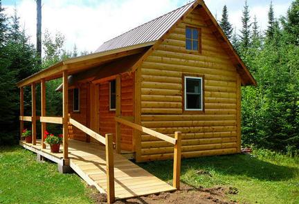
The four rental cabins sleep five or seven people, respectively. Each has a single bed, double bed and set of bunk beds, while one has an additional bed. The cabins have no running water, electricity, heating or cooking facilities. Cabin visitors must use the campground’s toilet and water facilities.
Cabin campers must bring their own sleeping pads, sleeping bags, cooking gear and food. Flashlights are also recommended.
Natural Features
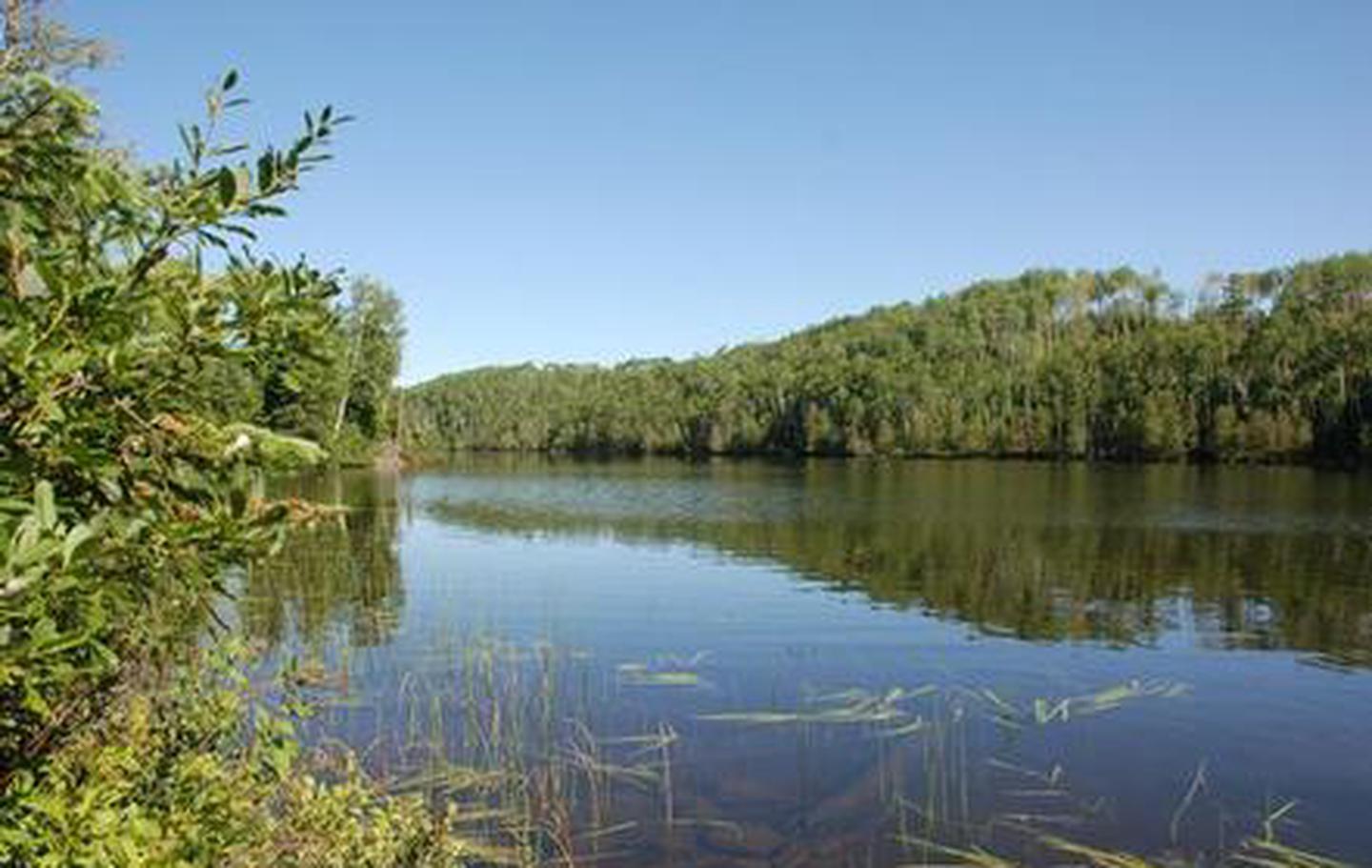
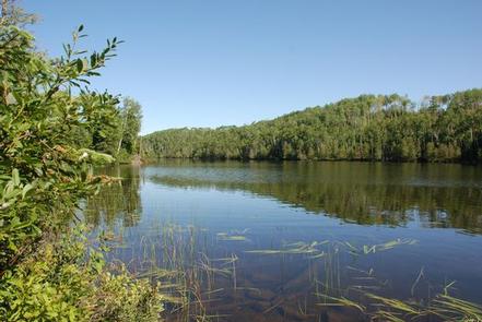
The campground and surrounding area is shaded with majestic red and white pines, balsam fir, spruce, birch and aspen trees. A thick understory offers plenty of shade and excellent privacy between campsites. The campground lies on the shore of the 643-acre East Bearskin Lake, a typical loon nesting site.
The surrounding Superior National Forest is located in northeastern Minnesota’s arrowhead region and is comprised of 3 million acres. The forest spans 150 miles along the border of the United States and Canada. Visitors can find recreation opportunities year-round, including travel in the famous Boundary Waters area.
Nearby Attractions
Boats, canoes and kayaks are available for rent at the neighboring Bearskin Lodge. The store also offers fishing licenses, day use permits, groceries, ice, firewood, maps and fishing guide services for sale.