BOYKIN SPRINGS RECREATION AREA, TX Campground Reservation, Info, Images, Map, Directions

BOYKIN SPRINGS RECREATION AREA, Texas Campground Images, Info & Reservations

Directions

From Zavalla, Texas, travel east on Highway 63 for approximately 10.5 miles. Turn right on Forest Road 313 and proceed 2.5 miles to the campground.

Phone

936-897-1068

Activities

BIKING, CAMPING, FISHING, HIKING, WILDLIFE VIEWING, NON-MOTORIZED BOATING

Keywords

None

Related Link(s)

Rec Area Info & Images

Texas State Road Conditions

Texas State Tourism

Overview

Located on Boykin Springs Lake in Angelina National Forest, this recreation area offers a little of everything, including camping, hiking, fishing, picnicking and relaxing in nature. It is situated in eastern Texas near the Louisiana border.

The facility has both a campground and day-use area. The group shelter must be reserved; the campground is first-come, first-served.

Recreation

The group picnic area provides direct access to the Sawmill Trail, a hiking trail that winds through the forest to the Aldridge Sawmill Historical Site.

Facilities

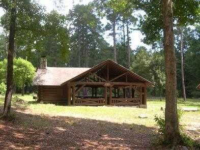
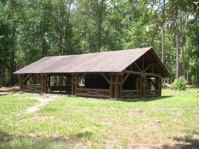
The group picnic shelter accommodates up to 74 guests and is available for reservation. It is adjacent to the hiking trail and creek. The campground has several standard sites for tents and RVs, as well as a few tent-only sites. All campsites are first-come, first-served. Drinking water, flush toilets and hot showers are available at the campground.

Natural Features

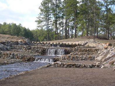
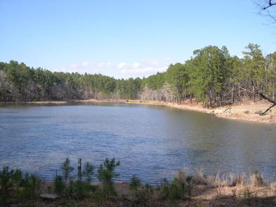
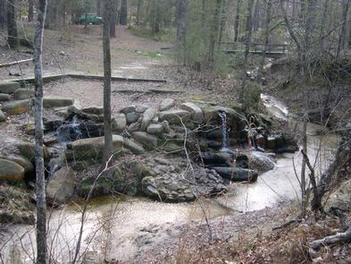
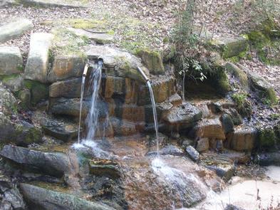
Boykin Creek and the nine-acre Boykin Springs Lake both pass through the facility, and the Sam Rayburn Reservoir is nearby.

The area is forested with pines and hardwoods. Wildlife is abundant, and the region is a hot spot for migratory birds.

Nearby Attractions

Sam Rayburn Reservoir

Reservation

More from CampingHiking.net:

MOSOMO POINT, Minnesota Campground Images, Info & Reservations

Directions From Deer River, travel north on Highway 46 for 19 miles. Turn west on Forest Road 2190 about a half-mile past the Cut Foot Sioux Visitor Center. Continue to the campground. Phone 218-246-2123 Activities BIKING, BOATING, CAMPING, INTERPRETIVE PROGRAMS, FISHING, HIKING, WATER SPORTS Keywords MOSO,CHIPPEWA NF – FS Related

PICNIC POINT (WI), Wisconsin Campground Images, Info & Reservations

Directions From Medford, take State Highway 13 north 4 miles. Turn left (west) onto County Highway M for about 7 miles. Turn right (north) onto County Highway E and continue for about 8 miles. Turn right (east) onto Forest Road 1563 and continue for 1 mile, then turn right (south)

CROSSROADS CAMPGROUND, Arizona Campground Images, Info & Reservations

Directions From Lake Havasu City, this campground is about 45 minutes south of town. Visitors will need to drive over the Parker Dam onto the California side of the Colorado River. (Note: Oversized vehicles and vehicles towing trailers are not permitted to cross the dam.) Located about 9 miles south

WILLOW PARK, Wyoming Campground Images, Info & Reservations

Directions From Worland, Wyoming, travel 50 miles east on U.S. Highway 16. Phone 406-587-9054 Activities BOATING, CAMPING, FISHING, HORSEBACK RIDING Keywords WILP,BIGHORN NF – FS Related Link(s) Rec Area Info & Images Overview Willow Park is located about 50 miles east of Worland, Wyoming on the west side of scenic