
Directions
From Bridgeport, take Route 8 N 23.5 miles to Exit 26/CT-63 S in Naugatuck. Head southeast on Main Street and turn onto CT-63 N. Travel approx. 3 miles. The park entrance is on the right side of the road at the intersection of CT-63 and CT-188. From Hartford, take I-84 W 31 miles to the CT-64 exit, Exit 17 (Watertown/Middlebury, Rte. 63). Go straight until you come to the intersection of CT-64 and CT-63. Turn left on CT-63. Travel approx. 1.5 miles. The park entrance is on the left side of the road at the intersection of CT-63 and CT-188. From Danbury, take I-84 E to the CT-63 exit, Exit 17 (Naugatuck/Watertown, Rte. 63). Take a right off the exit ramp. Travel approx. 1.5 miles. The park entrance is on the left side of the road at the intersection of CT-63 and CT-188.
Phone
203-729-8840
Activities
BIKING, BOATING, CAMPING, INTERPRETIVE PROGRAMS, FISHING, HIKING, PICNICKING, WILDLIFE VIEWING, DAY USE AREA, SWIMMING, MOUNTAIN BIKING, RANGER STATION, WATER ACTIVITIES, KAYAKING, CANOEING, NON-MOTORIZED BOATING, WATER ACCESS, CROSS COUNTRY SKIING, RECREATION PROGRAMS, SNOWSHOEING, SOFTBALL FIELDS
Keywords
None
Related Link(s)
Connecticut State Road Conditions
Overview
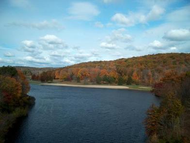
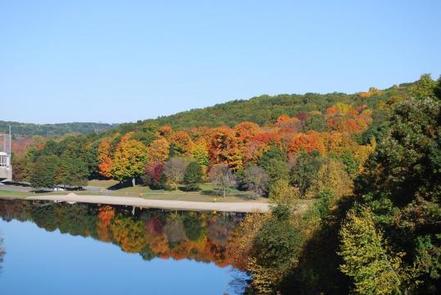
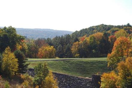
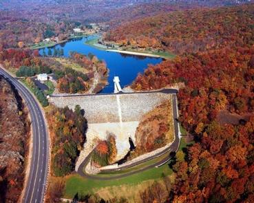
Hop Brook Lake Recreation Area is located within the towns of Middlebury, Naugatuck and Waterbury, Connecticut. Its 536 acres provide excellent recreation opportunities and a chance to escape from the growing suburbia surrounding the park. Visitors can enjoy picnicking, hiking, mountain biking, canoeing/kayaking, swimming and fishing.
Recreation
Exploring Hop Brook Lake by canoe, kayak or rowboat is a favorite activity of visitors. The park’s beach and designated swimming area are also a great place to relax in the warm summer sun. Fishing is welcome at the lake and its feeder streams, which are periodically stocked by the CT. DEEP with brown, brook, and rainbow trout. Largemouth bass, perch and panfish are also found in the lake. Hikers, walkers, mountain bikers, cross country skiers and snowshoers will find over seven miles of trails that wind throughout the woods and meadows at Hop Brook Lake.
Facilities
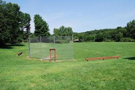
This day-use park offers (4) four picnic shelters with electrical outlets, picnic tables, and charcoal grills. An on-site ball field can also be reserved for various sporting events and activities. Regular picnic sites are also spread throughout the park and available on a first come, first served basis. User Fee’s are no longer charged to enter the park. Other amenities include restroom facilities with flush toilets/sinks/water fountains, beach/swimming area, hiking/mt. biking trails, ball field, volleyball courts, and horseshoe pits.
Natural Features
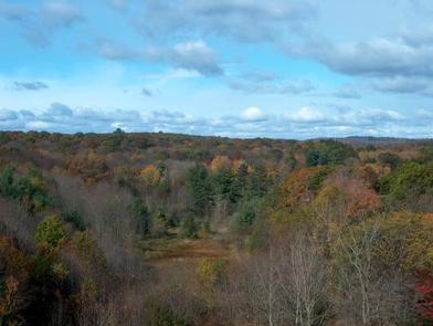
The forest surrounding Hop Brook Lake is made up of a wide variety of trees including maple, oak, hickory, ash, birch, white pine and hemlock. Wildlife is abundant in the area. Bird watchers have the opportunity to see hawks, owls, osprey, turkeys, waterfowl, numerous songbirds and the occasional bald eagle. White-tailed deer, black bears, coyotes, foxes, bobcats, raccoons, possums, beaver, squirrels and many other animals make Hop Brook Lake their home.