EDNA CREEK CAMPGROUND, ID Campground Reservation, Info, Images, Map, Directions

EDNA CREEK CAMPGROUND, Idaho Campground Images, Info & Reservations

Directions

Hayfork Group Cg (ID) HIGHWAY 21 Idaho City ID 83706

Phone

208-392-6681

Activities

CAMPING, FISHING, VISITOR CENTER, WILDLIFE VIEWING

Keywords

None

Related Link(s)

Rec Area Info & Images

Idaho State Tourism

Idaho State Road Conditions

Overview

Edna Campground is located 56 miles northeast of Boise, Idaho, in a scenic Ponderosa pine forest along Highway 21 at an elevation of 5,700 feet. Wildlife and summer wildflowers are abundant. Historic Idaho City is just 11 miles south. Crooked River runs near the site, offering whitefish and rainbow trout fishing.

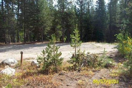
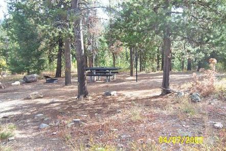
This campground contains 9 site that can accommodate up to 6 people each. Picnic tables, a BBQ grill, and fire ring with benches are provided. The site is in an open area with shade. Vault toilets and garbage service are provided. Parking spurs are graveled. Due to its proximity to the highway, some noise from passing traffic is to be expected.

Highway 21, also known as the Ponderosa Pine Scenic Byway, snakes along Mores Creek to Mores Creek Summit, Gold Fork, and Banner Ridge with breathtaking views of the surrounding mountains and forest. Numerous trail opportunities are in the area, offering hiking, biking, horseback riding, and ATVing. In winter, the area becomes a playground for backcountry skiers and snowmobilers.

Reservation

More from CampingHiking.net:

GREENTOP CABIN, Alaska Campground Images, Info & Reservations

Directions Located on the southwest tip of Yakobi Island, across Lisianski Strait from Chichagof Island, Greentop Cabin is accessible only by floatplane or boat. The cabin is tucked in the northeast corner of Greentop Harbor. Access by float plane 1 hour flight time (one way) from Sitka or Juneau, 35

KATHLEEN LAKE CABIN, Alaska Campground Images, Info & Reservations

Directions Access to the cabin is by floatplane. It is about a 30-minute flight from Juneau. In fall, winter and early spring, the cabin may be inaccessible due to frozen lake surface (floatplanes cannot land). The lake is normally ice free from mid-May through November. Refer to USGS topographic map

CHILCOOT, California Campground Images, Info & Reservations

Directions From Reno, Nevada, travel north on Highway 395. Merge onto Highway 70 west and continue 5 miles to Chilcoot. Turn north on Highway 284 and continue 5 miles to the campground. Phone 530-836-2575 Activities BOATING, CAMPING, FISHING, HIKING, WATER SPORTS, SWIMMING SITE Keywords CHCO,CHILLICOOT,FRENCHMAN LAKE,LITTLE LAST CHANCE LAKE,PLUMAS NF

CHERRY VALLEY, California Campground Images, Info & Reservations

Directions Campground can be reached from Hwy 120 using Cherry Lake Road also known as Forest Road (FR) 1N07 or from Cottonwood Road also known as FR 1N04.  -Traveling from Hwy 120, go East from Groveland 13.8 miles turn left on Cherry Lake Road/1N07 for 23.5 miles where it becomes