BRADY MOUNTAIN, AR Campground Reservation, Info, Images, Map, Directions

BRADY MOUNTAIN, Arkansas Campground Images, Info & Reservations

Directions

From Hot Springs, AR: Take US 270 west approximately 10 miles to Brady Mountain Access Road. Turn right and follow access road 6 miles north to the park.

Phone

501-760-1146

Activities

BIKING, BOATING, CAMPING, FISHING, HIKING, PICNICKING, WATER SPORTS, WILDLIFE VIEWING, DAY USE AREA, SWIMMING SITE, HOTEL/LODGE/RESORT PRIVATELY OWNED, PHOTOGRAPHY, SWIMMING, SNORKELING, MOTOR BOAT, MOUNTAIN BIKING, WATER ACTIVITIES, KAYAKING, CANOEING, BIRDING, WATER ACCESS, JET SKIING, WATER SKIING, SCENIC DRIVE, SAILING, SCUBA DIVING, AMPHITHEATER, TUBING, SKIING

Keywords

BRAN,LAKE OUACHITA,BRADY,LAKE OUACHITA

Related Link(s)

Rec Area Info & Images

Arkansas State Road Conditions

Arkansas State Tourism

Overview

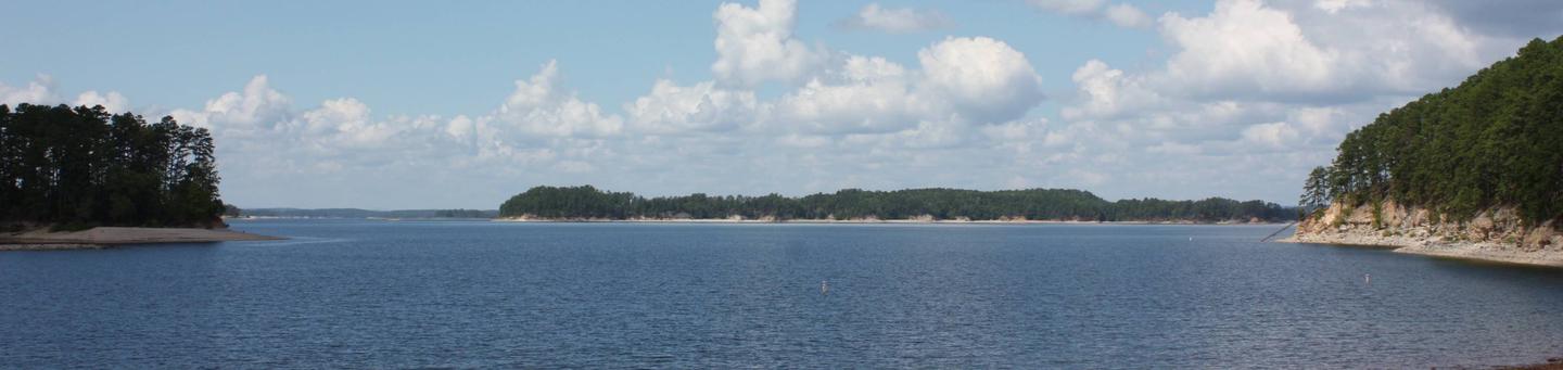
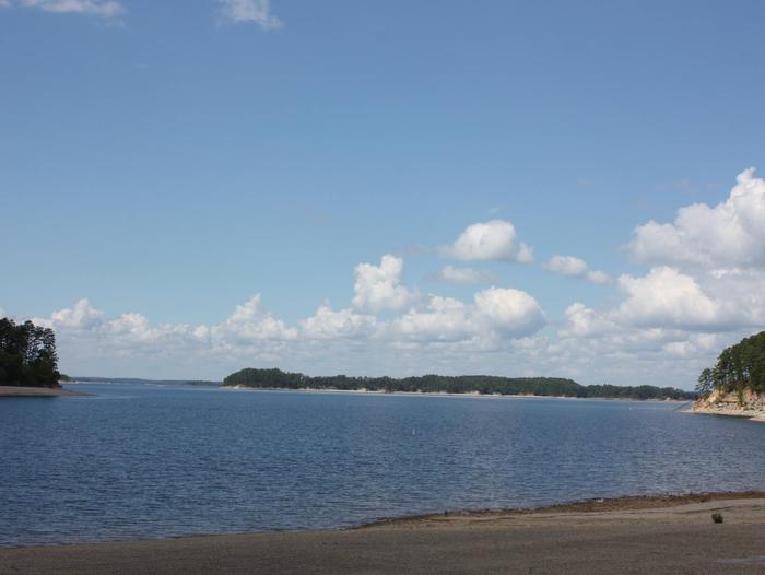
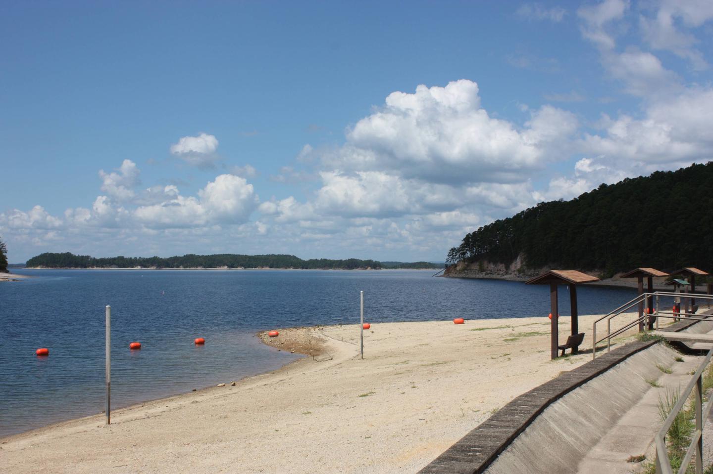
Brady Mountain Campground delights visitors with its family-friendly facilities, fabulous views and idyllic placement on Arkansas’s Lake Ouachita. The lake attracts visitors who come for the crystal clear waters and bountiful fishing opportunities.

Click here for the Lake Ouachita Virtual Tour.

Recreation

A unique way to explore the lake is to follow the Geo-Float Trail, coined as the first water-based interpretive trail included in the National Trails System. The self-guided boat tour leads visitors on a 16-mile trip to see incredible geologic features as it stretches from the Spillway Recreation Area to Brady Mountain Recreation Area.

Hikers enjoy the scenic land-based nature trail accessible from the campground. Boating, fishing and scuba diving among the remains of the flooded mountain valley are also popular here.

Facilities

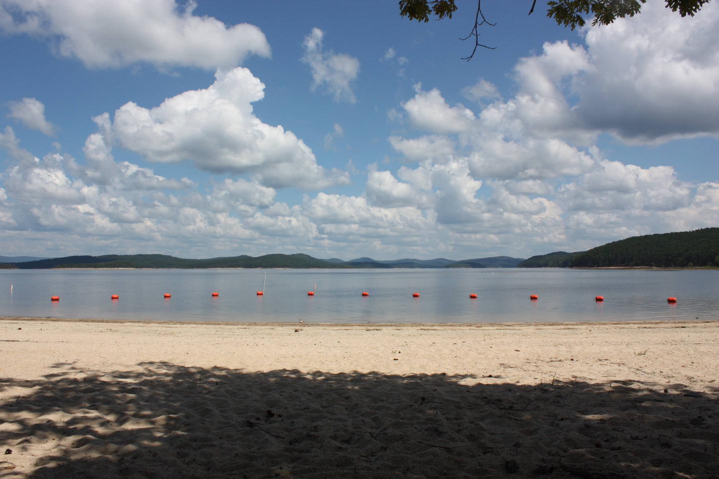
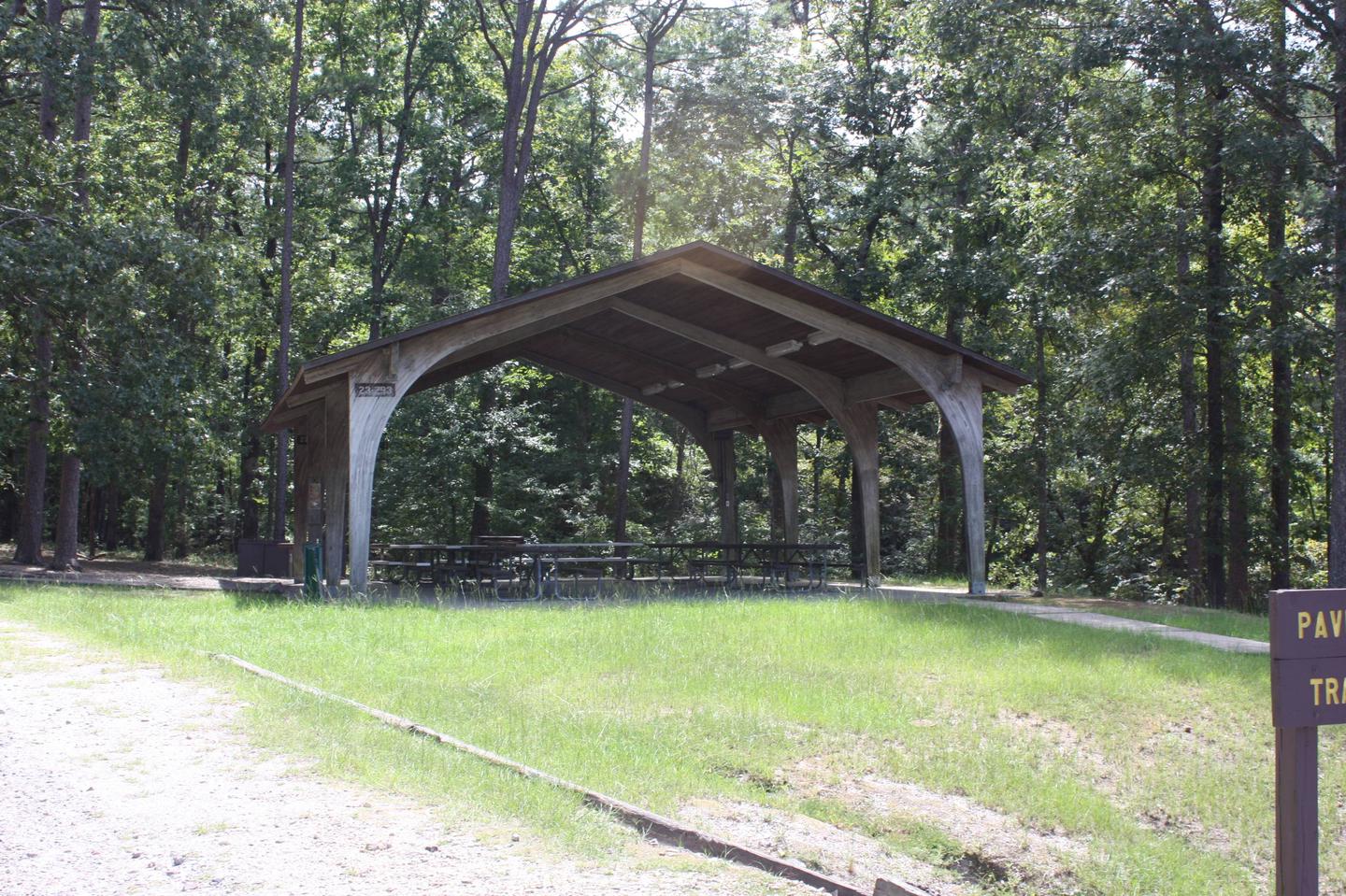
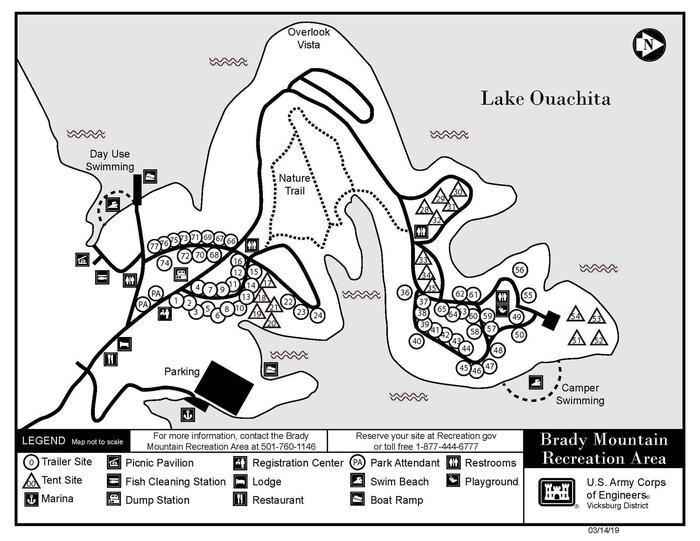
All 74 campsites have electric hookups. Other amenities include a dump station, fish cleaning station, hot showers, boat ramp, playground, and a swim beach.

Natural Features

Lake Ouachita sits in the heart of the Ouachita Mountains, just 10 miles west of Hot Springs National Park. The lake stems from the Ouachita River and boasts 692 miles of shoreline with 178 islands.

Nearby Attractions

Head to Hot Springs National Park and enjoy a traditional bath or modern spa experience with the natural spring water.

Reservation

More from CampingHiking.net:

CARLTON, California Campground Images, Info & Reservations

Directions From Downieville, travel south on Highway 49 for just over 13 miles. The campground is on the left side of the highway. Phone (530)478-6253 Activities BOATING, CAMPING, FISHING, HIKING, HUNTING, WATER SPORTS, SWIMMING SITE Keywords CRTN,TAHOE NF – FS Related Link(s) Rec Area Info & Images California State Road

RIVERSIDE (KS), Kansas Campground Images, Info & Reservations

Directions From Salina, KS: Take HWY 140 19 miles west to HWY 141. Travel 14 miles south on 141, then 1/2 mile east on Riverside Drive. Look for signs to the park. From Ellsworth, KS: Take HWY 140 15 miles east to HWY 141. Travel 14 miles South on Hwy

WILDERNESS GATEWAY, Idaho Campground Images, Info & Reservations

Directions From Lowell, travel east on Highway 12 for about 25 miles to the campground. The campground is located 120 miles east of Lewiston, Idaho; and 100 miles west of Missoula, Mont. It is located at milepost 122 on Highway 12. Phone 208-926-4258 Activities BIKING, BOATING, HISTORIC & CULTURAL SITE,

ARROW ROCK, Kansas Campground Images, Info & Reservations

Directions From US-75, take the Olivet exit. Continue onto K-276 west for 1 mile, then turn north onto South Fairlawn Road and continue another mile. Turn west onto Arrow Rock Parkway and follow to the campground. Phone 785-549-3318 Activities BOATING, CAMPING, FISHING, HUNTING Keywords ARRC,MELVERN LAKE,MELVERN PROJECT,LAKE ARROWHEAD,MELVERN STATE LAKE,MELVERN

STAR MEADOWS GUARD STATION, Montana Campground Images, Info & Reservations

Directions STAR MEADOW GUARD STATION 5250 Star Meadows Road Whitefish, Montana 59937 Travel from Whitefish west on Highway 93 approximately 12 miles to mile marker 139, turn left onto Farm to Market Road. Continue 1.7 miles; turn right at the "Tally Lake Campground" sign onto the "Star Meadows Road". Continue

PATCHING LAKE CABIN, Alaska Campground Images, Info & Reservations

Directions Approximately 20 miles north of Ketchikan, Alaska, on the north end of Patching Lake near the inlet of the Naha River. Access is by float plane only. Refer to USGS Ketchikan C-5. In fall, winter, and early spring, the cabin may be inaccessible due to frozen lake surface (float