
Directions
- From Nashua, MT, travel on Highway 117 south for 10.5 miles continue straight onto Yellowstone Rd for 1 mile and the campground will be on the left.
- From Glasgow, MT, travel on Highway 24 south for 18 miles to Fort Peck Dam. Turn Left onto Highway 117 travel 2.5 miles. Turn right at intersection onto Yellowstone Rd continue 1 mile and the campground will be on the left.
- From Interstate 94, Glendive/Circle exit, take MT highway 200 west to MT highway 24 north 55 miles; turn right onto Yellowstone Rd drive 1.5 miles and campground will be on the right.
Phone
406-526-3224
Activities
BIKING, BOATING, HISTORIC & CULTURAL SITE, CAMPING, FISHING, HIKING, VISITOR CENTER, FISH HATCHERY, DAY USE AREA, OBSERVATION SITE, ENVIRONMENTAL EDUCATION, PHOTOGRAPHY, RECREATIONAL SHOOTING, STAR GAZING, BIRDING, AMPHITHEATER
Keywords
DOW1,KIWANIS CAMPGROUND,FORT PECK RESERVOIR,KIWANIS PARK,FORT PECK,FORT PECK PROJECT,FORT PECK LAKE,KIWANIS,WEST END SHELTERS,KIWANIS SHELTERS,WEST END
Related Link(s)
Overview
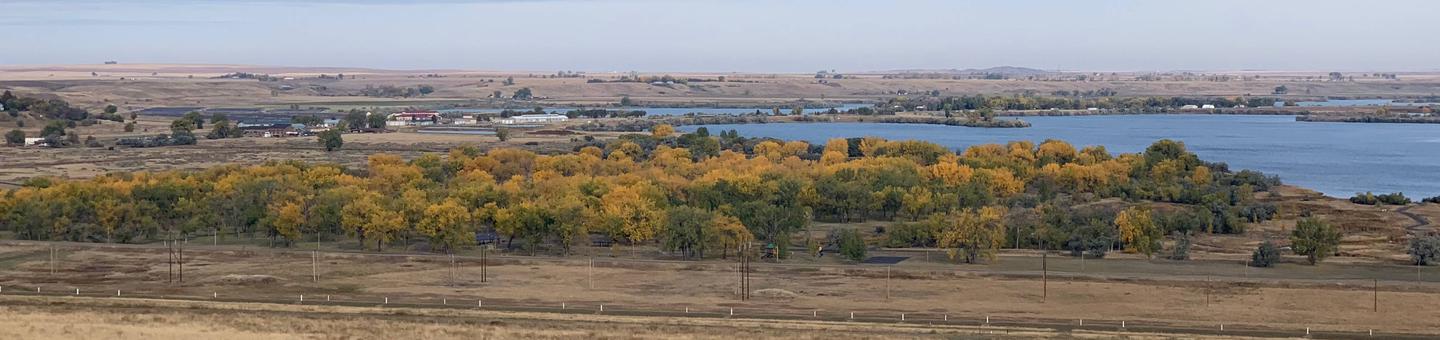
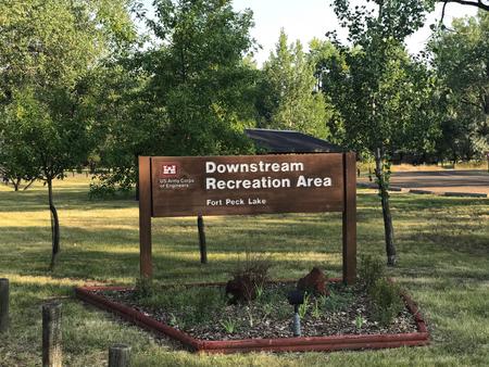
Downstream Campground is located just below Fort Peck Dam on the Missouri River in northeastern Montana. Recreation enthusiasts and sportsmen enjoy the beauty of Fort Peck Lake’s 1,500 miles of shoreline. A variety of high quality outdoor activities are available, including camping, boating, fishing, hunting, sightseeing and wildlife viewing.
Fort Peck Dam, which impounds Fort Peck Lake is the first dam built in the upper Missouri River Basin. The area surrounding Fort Peck was first charted by Lewis and Clark in 1804, and the pristine natural condition of the river and surrounding area awed the renowned explorers. When President Franklin D. Roosevelt authorized the Fort Peck project in 1933, thousands of people from all over the country migrated to Montana during the midst of the Great Depression in hopes of earning a living. Today, Fort Peck Lake is a sportsman’s paradise with excellent fishing, wildlife viewing and other countless outdoor recreation opportunities.
For more information, visit the Fort Peck Project Website or call 406-526-3411.
Recreation
The vast size of Fort Peck Lake and its remoteness from major population centers provide a variety of high quality outdoor experiences. Popular recreation activities include camping, boating, fishing, hunting, sight-seeing, picnicking, biking, hiking, photography, watching wildlife and just relaxing.
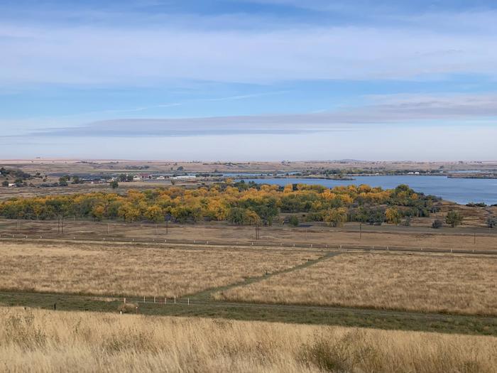
Fort Peck Lake: Fifteen hundred miles of pristine shoreline serve as a haven for those wishing to get away from the stresses of modern life. There are 27 recreation areas located around the reservoir. The areas near and around the dam offer paved roads, electricity, showers and playgrounds while facilities around the rest of the lake are more primitive with gravel roads, picnic tables and vault toilets. Access roads to many of the remote areas may be impassable in inclement weather.
Fishing: Fort Peck Lake enjoys nationwide recognition as a hot spot for walleye fishing. Fort Peck Lake provides excellent boating and fishing opportunities. The lake also offers excellent fishing for sauger, smallmouth bass, lake trout, chinook salmon and northern pike. The introduction of cisco as a forage fish in 1983 proved successful and has increased both the size and number of game fish.
Wildlife Viewing/Hunting: The Fort Peck Lake Area and the Charles M. Russell Wildlife Refuge provide superb hunting of deer, elk, big horn sheep, and prong horn. The Missouri River Breaks are known for producing large elk and other game animals.
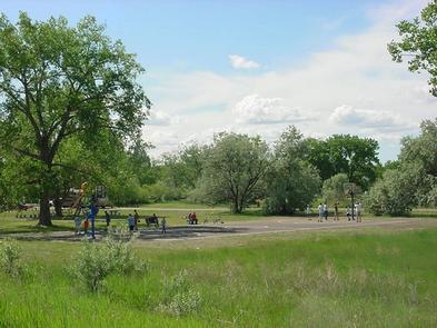
Trails: Three miles of paved nature trails wind along the Missouri River and through the surrounding wooded area. This trail area is a popular birding and wildlife viewing area.
Interpretive Center & Museum: The Fort Peck Dam Interpretive Center and Museum offers displays of wildlife dioramas, aquariums, dinosaur fossils and dam construction history. Free guided tours of the powerhouse are available daily from Memorial Day through Labor Day.
Facilities
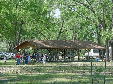
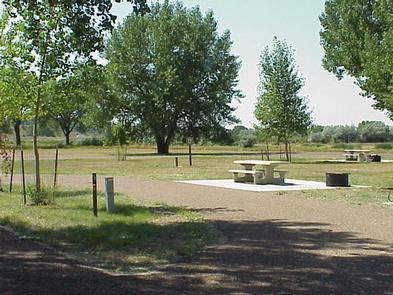
Downstream Campground offers 85 family campsites, 70 of which have electrical hookups; 15 sites are tent-only. One large group campsite is available with electrical hookups. Seven day-use picnic shelters are available for reservations, all with electrical hookups.
The campground offers flush and vault toilets, showers, playgrounds, a basketball court and horseshoe pits. A dump station and fish cleaning station are located on-site.
West End Tent & Trailer is located nearby, providing additional campsites on a first come, first served basis. 13 sites have 30-amp electrical hookups; overflow sites are non-electric.
Natural Features
A shady grove of cottonwoods covers the grassy campground, making Downstream a pleasant place during the heat of the summer. In autumn, the leaves turn a beautiful golden yellow. Three fishing ponds, including scenic Winter Harbor, dot the landscape below the dam.
Nearby Attractions
- Fort Peck Lake is a Montana treasure for its vast size and outdoor recreation opportunities. Six recreation areas within a few miles of the dam provide access for water sports, fishing and hunting.
- The Fort Peck Interpretive Center and Museum, is located just downstream of Fort Peck Dam. For more information, call 406-526-3411.
- The Leo B. Coleman Wildlife Pasture, located just outside the Town of Ft. Peck and Downstream Campground provides an excellent wildlife viewing auto route.
- The Historic Fort Peck Theater is located in the town of Ft. Peck is a popular historic destination in summer months.
- The Charles M. Russell National Wildlife Refuge surrounds Fort Peck Lake and helps preserve the natural habitat for numerous wildlife species.
Charges & Cancellations
For more information about reservation fees, changes and cencellations, please click here.