MAIN DAY USE, WI Campground Reservation, Info, Images, Map, Directions

MAIN DAY USE, Wisconsin Campground Images, Info & Reservations

Directions

From Minneapolis/St. Paul, take I-94 east to Exit 24. Take County Road B south approximately 6 miles and follow the highway signs to the park.

Phone

715-778-5562

Activities

BIKING, BOATING, FISHING, HIKING, PICNICKING, VISITOR CENTER, WILDLIFE VIEWING, SWIMMING SITE, PHOTOGRAPHY, SWIMMING, KAYAKING, CANOEING, STAR GAZING, BIRDING, NON-MOTORIZED BOATING, WATER ACCESS, SNOWSHOEING, ICE FISHING

Keywords

MADU,EAU GALLE LAKE PROJECT,EAU GALLE SHELTERS,MAIN DAY USE SHELTERS,SPRING VALLEY LAKE,O’GALLE,LAKE GEORGE,SPRING VALLEY SHELTERS,EAU GALLE LAKE

Related Link(s)

Rec Area Info & Images

Wisconsin State Tourism

Wisconsin State Road Conditions

Overview

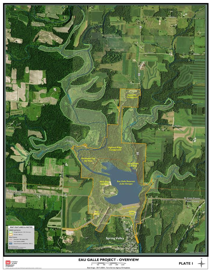
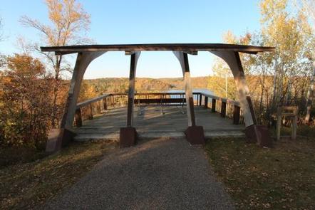
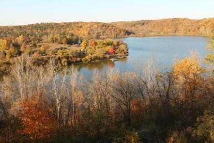
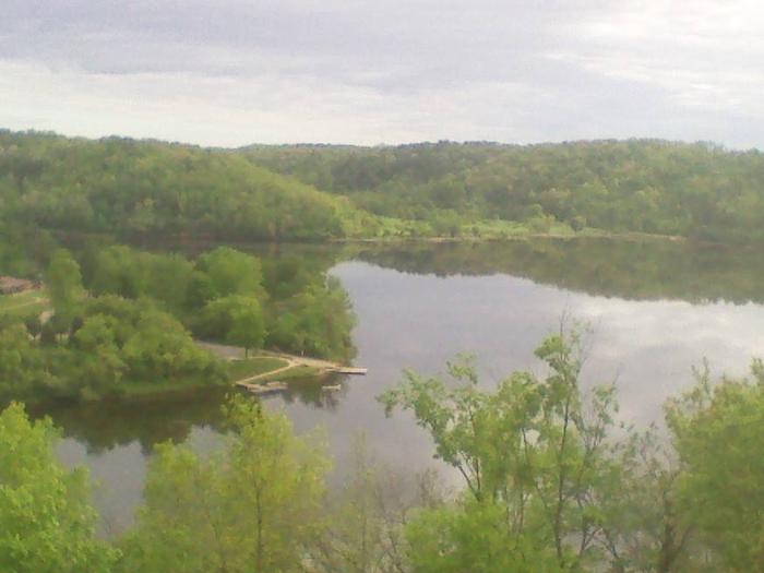
Main Day Use Are at Eau Galle Lake offers many family-friendly outdoor activities including fishing, boating and hiking, in the lush Wisconsin woodlands.

Recreation

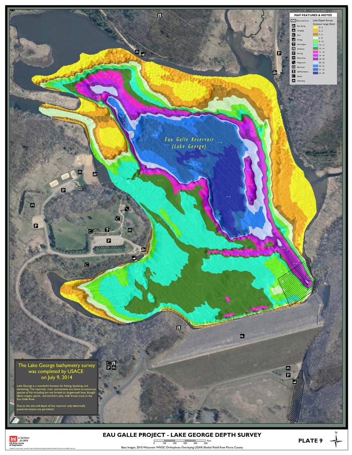
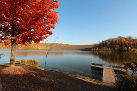
In summer, the lake is a popular place for canoe, kayak and other non-gasoline powered boating. Fishermen cast their reels year-round for a chance to catch Bass, Panfish, Pike, and Trout

Facilities

Amenities include flush toilets, playgrounds, horseshoe pits, volleyball courts, a large sandy swimming beach, boat ramp, and a fishing dock.

Natural Features

Eau Galle Lake is a 150-acre impoundment surrounded by densely wooded hills and bluffs. Its waters are fed by the 35-mile Eau Galle River, shaded with scenic mixed hardwoods.

Nearby Attractions

Crystal Cave, Wisconsin’s longest cave, is approximately 1 mile southwest of Spring Valley, WI. A series of steps and ramps allow visitors to descend over 70 ft. among stalagmites and rippling flowstone.
Spring Valley Golf Course is nearby.

Reservation

More from CampingHiking.net:

PIPER ISLAND CABIN, Alaska Campground Images, Info & Reservations

Directions Accessible year round by floatplane or boat, weather permitting. Located 30 miles north of Sitka within Schulze Cove, on the north side of Fish Bay, the northwest coast of Baranof Island. From Sitka, boat access is 90 minutes, air access is 20 minutes. For geographic features surrounding the cabin,

ALLRED FLATS GROUP PICNIC SITE, Wyoming Campground Images, Info & Reservations

Directions From Afton, Wyoming, take Highway 89 south for approximately 21 miles over Salt Pass and look for a brown sign signaling the right-hand turn for Allred Flats Campground. The picnic area is on the left, just before the campground entrance kiosk. Phone 307-828-5100 Activities BIKING, CAMPING, FISHING, HIKING, WILDLIFE

KOOK LAKE CABIN, Alaska Campground Images, Info & Reservations

Directions Accessible May through November. Located near the eastern shore of Chichagof Island between the outlets of Tenakee Inlet and Peril Strait, about 45 miles northeast of Sitka. Access is by floatplane, 30 minutes from Sitka or Juneau; or by boating to Corner Bay and hiking 7 miles on logging

HOLMES BEND, Kentucky Campground Images, Info & Reservations

Directions From Columbia, KY, take Cumberland Parkway to exit 49 and merge onto Highway 55 north. Continue for 1.5 miles, then turn right on Highway 551. After a mile turn left on Holmes Bend Road and follow directional signs to the campground. Phone 270-384-4623 Activities BIKING, BOATING, CAMPING, INTERPRETIVE PROGRAMS,