
Directions
From Texarkana, Arkansas, take Interstate 30 east for 46 miles to Prescott. Continue onto Highway 19 north to Narrows Dam. After crossing the bridge across the Little Missouri River, proceed about 3 miles to the campground.
Phone
870-285-2151
Activities
BOATING, CAMPING, FISHING, HIKING, HUNTING, SWIMMING SITE
Keywords
PARR,Couch Valley,LAKE GREESON
Related Link(s)
Arkansas State Road Conditions
Overview
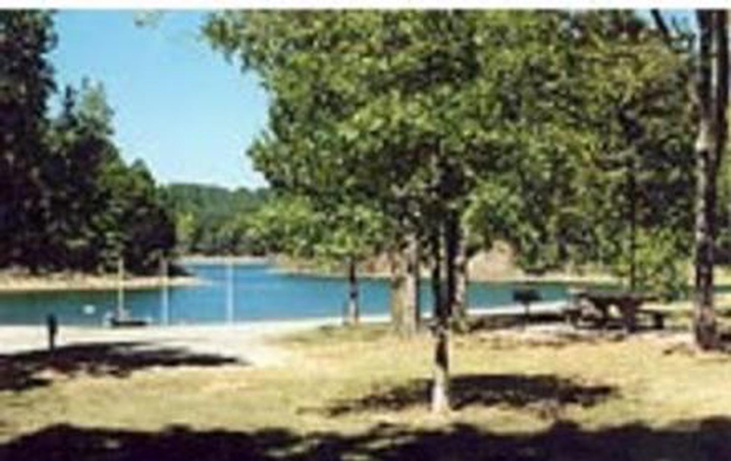
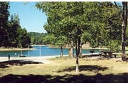
Parker Creek Campground is located on Lake Greeson on the beautiful Little Missouri River in Pike County, Arkansas.
The lake is approximately 12 miles long with 7,260 surface acres of water for water sports, picnicking and hiking along the forested lake shore.
Recreation
Lake Greeson is recognized for its rich variety of game fish, including large mouth, stripped, spotted, small mouth and white bass, as well as flathead and channel catfish, black and white crappie, walleye and blue gill.
The tail-waters of the Little Missouri River below the dam also support a healthy population of rainbow trout and small mouth bass.
Boating is another popular activity. The beautiful clear waters offer an excellent opportunity for many boating activities including water skiing, tubing, cruising and fishing. Four marinas at Lake Greeson offer boaters fuel, boat rentals and picnic and fishing supplies.
Lake Greeson offers 30 miles of walking, nature and cycling trails for public use. There is a short nature trail in the campground for naturalists, birders and families to enjoy.
The best opportunity for hunting lies within the Lake Greeson Wildlife Management Area. Deer, quail, turkey, squirrel and rabbits are the primary game.
Facilities
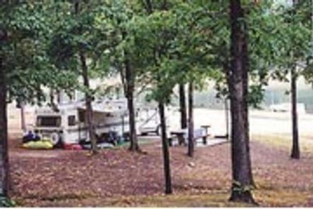
Parker Creek offers 60 campsites, most of which have electric hookups. There are also three tent-only, non-electric sites.
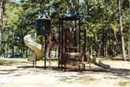
Each campsite has a picnic table, grill and lantern pole. Other amenities include a dump station, drinking water, two bathrooms with hot showers, a boat ramp, playground and swimming beach.
Natural Features
Central Arkansas is mild and somewhat humid in spring and fall, hot and very humid in summer and variable in winter, where temperatures may range from below freezing to the 60s.
Loblolly pine, shortleaf pine, sweet gum and oak are the dominant tree species on upland areas of the lake, while bottomland hardwoods are common along rivers, creeks and streams that enter the lake.
The public lands around Lake Greeson provide a variety of habitats for numerous species of wildlife, including white-tailed deer, wild turkey, geese, southern bald eagles, migratory waterfowl and songbirds. Bald eagles are an attraction for visitors each winter.
Nearby Attractions
Ouachita National Forest and Hot Springs National Park are within a two-hour drive from the campground.