PINE CREEK COVE, OK Campground Reservation, Info, Images, Map, Directions

PINE CREEK COVE, Oklahoma Campground Images, Info & Reservations

Directions

From Valliant, OK, travel Pine Creek Road 7 miles north to the access road. Follow signs into the campground.

Phone

580-933-4215

Activities

BOATING, CAMPING, FISHING, PICNICKING, DAY USE AREA, SWIMMING SITE, SWIMMING, WATER ACCESS

Keywords

PICR,PINE CREEK LAKE,PINE CREEK LAKE

Related Link(s)

Rec Area Info & Images

Oklahoma State Road Conditions

Oklahoma State Tourism

Overview

Pine Creek Cove is located on the western shore of Pine Creek Lake near the main dam. Visitors enjoy boating, fishing, swimming and birding.

Recreation

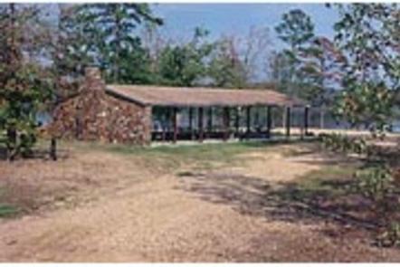
The beach attracts swimmers, sunbathers and sandcastle builders. Boating and picnicking are also popular. The park’s location near the dam is convenient for reaching prime fishing spots.

Facilities

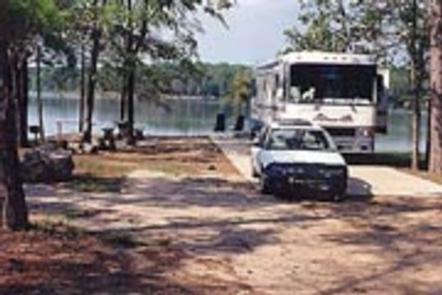
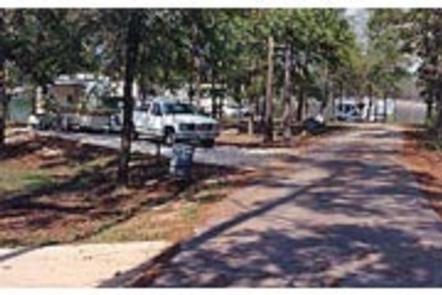
Pine Creek Cove’s 41 campsites have electric and water hookups. A group camping shelter with electric hookups is also available. Additional amenities include flush toilets, showers, a dump station and boat ramp.

Natural Features

Pine Creek Lake, fed by the Little River, boasts 3,750 acres with 74 miles of shoreline. The lake is in southeastern Oklahoma at the edge of the Ouachita Mountains.

Nearby Attractions

Beavers Bend and Raymond Gary State Parks are within driving distance. Also, the historic ruins of Fort Towson, a confederate command post that was built in 1824, are interesting as well.

Reservation

More from CampingHiking.net:

EASTWOOD, Wisconsin Campground Images, Info & Reservations

Directions From Medford, Wisconsin, travel north on State Highway 13 for about 15 miles. Turn left on County Road D for about 6 miles, then turn left onto Forest Road 104 for about 2 miles and continue into the campground. Phone 715-748-4875 Activities BOATING, CAMPING, FISHING, HIKING, WILDLIFE VIEWING, SWIMMING

LITTLE CULTUS CAMPGROUND, Oregon Campground Images, Info & Reservations

Directions From Bend, OR: Travel 46.0 miles southwest on Cascade Lakes Hwy (46), then 0.8 miles west on Forest Road 4635, then 1.7 south on Forest Road 4630, and then 1.0 miles west on Forest Road 4636 Phone 541-323-1746 Activities BOATING, CAMPING Keywords Related Link(s) Rec Area Info & Images

TILLICUM, Oregon Campground Images, Info & Reservations

Directions The campground is on Highway 101, 3 miles north of Yachats and 4 miles south of Waldport, Oregon. Look for campground and beach signs on 101. Physical Address: 8199 Hwy 101 N Yachats, OR 97498 Phone 541-547-3679 Activities CAMPING, FISHING, HIKING, SWIMMING Keywords TILI,SIUSLAW NF – FS Related Link(s)

OLD KUTTAWA, Kentucky Campground Images, Info & Reservations

Directions From Nashville, take I-24 West to Exit 40. Turn left on 62 and then right on Highway 295. Follow Highway 295 to recreation area entrance. Phone LAKE BARKLEY RESOURCE MANAGERS OFFICE: 270-362-4236 Activities BOATING, FISHING, DAY USE AREA, SWIMMING SITE Keywords OLDK,LAKE BARKLEY,KUTTAWA,OLD KUTTAWA,BARKLEY LOCK & DAM Related Link(s)

ACKER ROCK LOOKOUT, Oregon Campground Images, Info & Reservations

Directions Important note regarding GPS use: please be advised that GPS units can, and have sent guests down the wrong roads to access the Lookout. Please consider following the directions below rather than your GPS unit. Directions: From Canyonville take West 1st Street and turn onto SE 3rd St/OR-227. Continue