POKEGAMA DAM CAMPGROUND, MN Campground Reservation, Info, Images, Map, Directions

POKEGAMA DAM CAMPGROUND, Minnesota Campground Images, Info & Reservations

Directions

From Grand Rapids, Minnesota, take Highway 2 west for 2 miles, turn left at signs and follow to campground.

Phone

218-326-6128

Activities

BIKING, BOATING, CAMPING, FISHING, VISITOR CENTER, DAY USE AREA, INFORMATION SITE, MOTOR BOAT, MOUNTAIN BIKING, KAYAKING, CANOEING, BERRY PICKING, BIRDING, CROSS COUNTRY SKIING, ANTIQUING

Keywords

POKE,GOVERNMENT DAM,MISSISSIPPI HEADWATER

Related Link(s)

Rec Area Info & Images

Minnesota State Tourism

Minnesota State Road Conditions

Overview

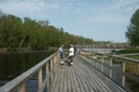
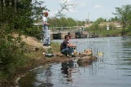
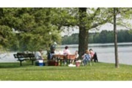
Pokegama Dam Campground is situated in the heart of northern Minnesota’s lake country next to the Mississippi River. Popular activities include boating, fishing, picnicking and wildlife viewing.

Recreation

The Mississippi River offers great opportunities for boating and fishing. Anglers will find Walleye, Northern Pike, Blue gills, sunfish, Large and Small mouth Bass among other species. Birders enjoy viewing Bald eagles, loons, ducks, geese and many other species from the banks of the park.

Facilities

The campground, pronounced “po-KEG-uh-muh,” offers 19 electric back in sites, two primitive tent-only sites (non-electric) and one day-use picnic shealter with electric. Amenities include flush toilets, showers, drinking water, a dump station, boat ramp, playground and a fish cleaning station.

Natural Features

A forest of mixed hardwoods and towering red pines cover the area, housing an abundance of wildlife including bald eagles, porcupines, black bears chipmunks and many others. Wild blackberries, raspberries, and blueberries grow seasonally on the forest floor.

Nearby Attractions

Judy Garland Museum, Forest History Center, Itasca County historical Society, Childerns Discovery Museum, Tioga Beach, Mesabi Bike Trail

Reservation

More from CampingHiking.net:

REEDER BAY, Idaho Campground Images, Info & Reservations

Directions From I-90 at Post Falls, turn north onto Highway 41 to Newport. Turn right on Highway 2/200 east to Priest River. Turn north (left) on Highway 57 to Nordman 37 miles, then turn right at Y junction and drive 3 miles to Reeder Bay. Phone 435-245-6521 Activities BIKING, BOATING,

FORKLAND, Alabama Campground Images, Info & Reservations

Directions From Demopolis, Alabama, go nine miles north on U.S. Highway 43, then turn left on County Road. Continue about a mile to the campground entrance. Phone 334-289-5530 Activities BOATING, CAMPING, FISHING, HIKING Keywords FORK,DEMOPOLIS LAKE,MC CONNICO,BLACK WARRIOR Related Link(s) Rec Area Info & Images Alabama State Tourism Alabama State

NORTH DICKEY LAKE, Montana Campground Images, Info & Reservations

Directions From Eureka, travel south on Highway 93 for approximately 13 miles to Fortine. Continue south on Highway 93 for over a mile to the campground. Phone 406-296-2536 Activities BIKING, BOATING, CAMPING, FISHING, HIKING, WATER SPORTS, SWIMMING SITE Keywords NODI,DICKEY LAKE,KOOTENAI NF – FS Related Link(s) Rec Area Info &

BOOT LAKE CAMPGROUND, Wisconsin Campground Images, Info & Reservations

Directions From the intersection of Highway 32 and County Road T in Townsend, drive south on T 5.6 miles to the campground. Phone 715-276-6333 Activities BOATING, CAMPING, FISHING, HIKING, WINTER SPORTS, WATER SPORTS, WILDLIFE VIEWING Keywords Related Link(s) Rec Area Info & Images Wisconsin State Road Conditions Wisconsin State Tourism

WARRIOR CREEK, North Carolina Campground Images, Info & Reservations

Directions From Winston-Salem, North Carolina, take Highway 421 North (approximately 55 miles) to Exit 286B, turn left onto Highway 268 and continue for approximately 8 miles. Turn right immediately after crossing the bridge and follow signs to the campground. From Charlotte, North Carolina, take I-77 North (approximately 60 miles) before