
Directions
The physical location for Rudd’s Creek Park is: 16064 Highway 58, Boydton, VA 23917. It is located about 3 miles west of Boydton, VA.
Phone
IN RECREATION SEASON ONLY: (434) 738-6827; ALL OTHER INQUIRIES CALL VISITOR ASSISTANCE CENTER: (434) 738-6143
Activities
BOATING, CAMPING, FISHING, HIKING, HUNTING, DAY USE AREA, SWIMMING SITE
Keywords
RUDD,BUGGS ISLAND,RUDDS CREEK REC. AR.,JOHN H KERR DAM
Related Link(s)
Virginia State Road Conditions
Overview
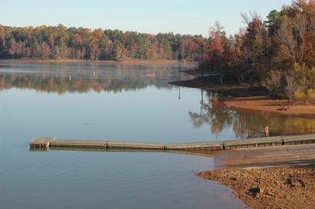
Rudds Creek Park is located on John H. Kerr Reservoir, a 50,000-acre lake that extends 39 miles up the wooded, cove-studded shoreline of the Roanoke River in Virginia and North Carolina. Rudd’s Creek Campground is open April 1 – October 31. The Day Use Park, located across Hwy 58, is open year-around. Kerr Reservoir, also known as Buggs Island Lake, was created with the construction of the John H. Kerr Dam in 1952. Its 800 miles of wooded shoreline stretch across six counties in two states and offer countless recreation opportunities for visitors.
Recreation
Public lands around the lake are open to hunting with appropriate state licenses. Game species include whitetail deer, wild turkey, bobwhite quail, mourning dove, gray squirrel, cottontail rabbit, fox and raccoon. Resident waterfowl species include wood duck, black duck, mallard and Canadian geese. There are 26 Wildlife Management Areas around the lake that provide year-round opportunities for hiking, wildlife viewing, birding and more. The Robert Munford Trail is about 5.5 miles long and is multipurpose. A trailhead is located within 7 miles of Rudd’s Campground, at Eagle Point Landing. The lake is widely known for fishing, with large-mouth bass, striped bass, crappie and catfish available. Virginia Dept of Game and Inland Fisheries regulate fishing and hunting on the Virginia side.
Facilities
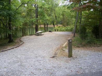
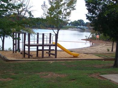
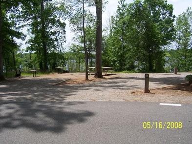
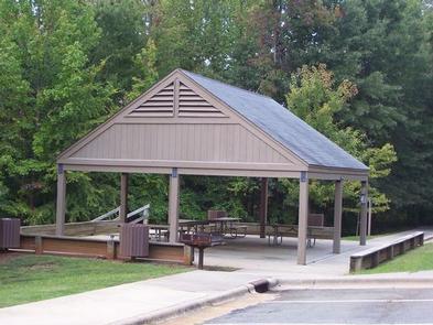
There are 98 sites for tents or RVs, and amenities like hot showers, flush toilets and a dump station provide a comfortable camping experience. A swimming beach and picnic shelter make the campground ideal for families. The campground has its own boat ramp and courtesty dock for campers only. All electric sites have water hook-ups.
Natural Features
Rudds Creek Park is forested and offers plenty of shade. It is located 2 miles from the town of Boydton, VA, and has a marina less than a mile away. The campground road has very little shoulder, so care should be taken with bicycle riders and children.
Nearby Attractions
The Corps Visitor Assistance Center is located about 30 minutes away at Kerr Dam. Gas, groceries and shopping are available just minutes away, in Boydton. THe park is about 20 minutes from Clarksville, Virginia and 30 minutes from South Hill, VA.