SHADY CREEK, IA Campground Reservation, Info, Images, Map, Directions

SHADY CREEK, Iowa Campground Images, Info & Reservations

Directions

From Davenport, Iowa, drive west on Highway 22 about 17 miles and turn at the Shady Creek sign.

Phone

563-419-0857

Activities

BOATING, CAMPING, FISHING, HIKING, DAY USE AREA

Keywords

SHAD,MISSISSIPPI RV. RI

Related Link(s)

Rec Area Info & Images

Iowa State Tourism

Iowa State Road Conditions

Overview

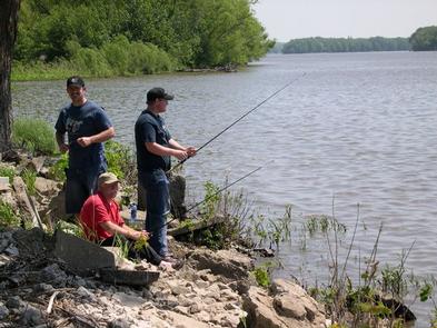
Shady Creek Campground is a 22-acre park where campers enjoy getaways on the banks of the Mississippi River. A nature trail, shore fishing and fantastic bird watching are offered at Shady Creek.

Recreation

The Mississippi River draws many anglers annually. The most popular fish species is the channel catfish; bluegill, walleye and northern pike are also found in the river.

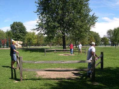
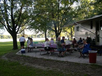
Picnicking and playing horseshoes is a popular activity in the park.

Facilities

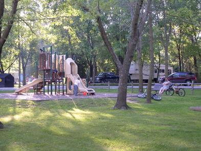
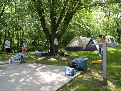
The park’s campsites contain 50-amp electric hookups, campfire rings and picnic tables. Flush toilets and showers are provided. A boat ramp and playground are on-site.

Natural Features

The park has spectacular views of the Mississippi River. Many trees throughout the campground provide great places to lounge in the shade.

The Upper Mississippi River begins at the headwaters of Lake Itasca, Minnesota and flows 1,250 miles to Cairo, Illinois where it joins the Ohio River.

Nearby Attractions

Wildcat Den State Park is just north of Shady Creek, offering hiking trails and the historic Pine Creek Grist Mill built in 1848.

The Mark Twain National Wildlife Refuge is a 40-minute drive downstream. Trails and observation decks are open to the public. Hunting and fishing are allowed in many area of the refuge.

Reservation

More from CampingHiking.net:

BLOOMINGTON WEST, Kansas Campground Images, Info & Reservations

Directions From Lawrence, Kansas, take 6th Street/Highway 40 west for 4 miles. Take a left onto Douglas County Road 442 and go 5 miles to Stull, Kansas, then take another left onto Douglas County Road 1023 and go 6 miles to Douglas County Road 6. Make a left turn on

DEWDROP, Pennsylvania Campground Images, Info & Reservations

Directions From Warren, Pennsylvania, take PA-59 east for 13 miles. Turn onto Longhouse Scenic Byway/Forest Road 262 south and continue 3 miles to the campground. From the east, take PA-59. Just after crossing the Morrison Bridge over the Kinzua Arm of the reservoir, turn left and proceed 3 miles to

THE NARROWS, Kentucky Campground Images, Info & Reservations

Directions From Glasgow, KY: Take 31-E south for 10 miles, turn right on 1318. Follow signs into campground entrance. Phone 270-646-3094 Activities CAMPING, HIKING, DAY USE AREA Keywords NARROWS,THE NARROWS,THEN,BARREN RIVER LAKE,BARREN RIVER,BARREN LAKE Related Link(s) Rec Area Info & Images Kentucky State Tourism Kentucky State Road Conditions Overview The

ISLET CAMPGROUND, Oregon Campground Images, Info & Reservations

Directions Located 37.3 miles east of Oakridge, Oregon. From Oakridge, Oregon: At the intersection of Crestview Street and Oregon State Highway 58, travel east on Highway 58 for 23.3 miles. Turn left on the Waldo Lake Road/Forest Road 5897. Travel for 12.8 miles and turn left at the T intersection

EVANS GROUP CAMP, Washington Campground Images, Info & Reservations

Directions Take Washington state Highway 395 north from Spokane. Travel 83 miles to the town of Kettle Falls, take Highway 25 north and travel 11 miles. Follow signs to the campground. It is on the west side of the highway. Phone 509-754-7889 Activities BOATING, HISTORIC & CULTURAL SITE, CAMPING, INTERPRETIVE