
Directions
To access the Iron Creek Horse Camp from Custer, travel east on US Highway 16A for approximately 9 miles. Turn left, or north, onto State Highway 87 and travel approximately 6 miles to FSR 345. Turn right, or north, onto FSR 345. Turn left into the campground.
Phone
605-673-9200
Activities
CAMPING, HIKING, HORSEBACK RIDING, WILDLIFE VIEWING
Keywords
IRON,BLACK HILLS NF -FS
Related Link(s)
South Dakota State Road Conditions
Overview
Located 13 miles outside Custer, South Dakota, Iron Creek Horse Camp offers a peaceful setting for guests seeking recreation and relaxation in Southeastern South Dakota’s Black Hills National Forest. The camp is adjacent to Iron Creek and surrounded by Ponderosa pine forests. Horse enthusiasts will find this setting ideal for exploring wilderness areas and historical sites.
Recreation
Black Hills National Forest offers visitors a multitude of recreational opportunites throughout all seasons. Hiking, fishing, horseback riding, mountain biking, and riding off-highway vehicles are popular in summer and early autumn. Winter landscapes are ideal for snowshoeing, skiing and snowmobiling.
From this campground, visitors can access the Centennial Trail, and parts of the Black Elk Wilderness and Norbeck Wildlife Preserve. Trails weave through the wilderness offering primitive, non-motorized recreational experiences.
Facilities
This campground has 9 equestrian sites and corrals that can accommodate to 2-3 horses. Sites have picnic tables, campfire rings with grills, vault toilets and parking areas. Drinking water and electricity are not available. Water tanks specifically for horses are available. Access roads to Iron Creek Horse Camp are curvy and the sites cannot accommodate rigs over 50 feet in length. For larger rigs, please use Willow Creek Horse Camp.
Natural Features
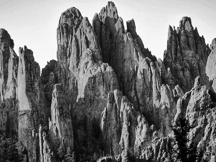
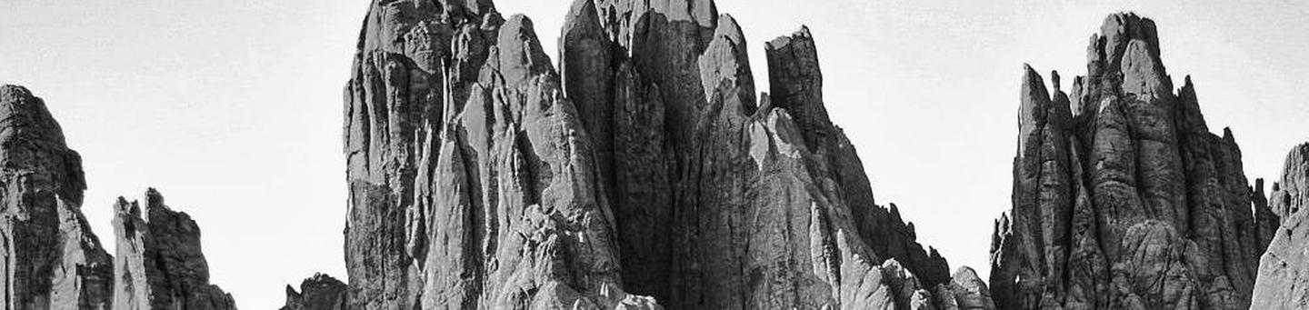
Stretching across northeastern Wyoming and western South Dakota, Black Hills National Forest encompasses nearly 1.25 million acres of rugged rock formations, canyons and gulches, open grassland parks, tumbling streams, deep blue lakes, and unique caves.
Derived from the Lakota language, the words “Paha Sapa,” meaning “hills that are black,” honor the dark, pine-covered hills rising several thousand feet above the surrounding prairie.
Nearby Black Elk Wilderness lies in the center of the Black Hills National Forest in western South Dakota. The wilderness encompasses the Harney Range, an area long held sacred by American Indians. The wilderness is named after Black Elk, a Oglala Lakota holy man, and is the only wilderness in the Black Hills.
Bighorn sheep navigate mountainous terrain, while elk, deer and pronghorn gather in forests and prairies. Bald eagles, hawks, osprey, peregrine falcon, and hundreds of other bird species can be found in the forest, especially along streams, lakes and rivers. Mountain lions, although rarely seen, also call this area home.
Nearby Attractions
Explore Mount Rushmore National Memorial, host to almost 3 million visitors a year from across the country and around the world. Visitors have the opportunity to learn about the birth, growth, development and the preservation of the United States, and take in the beauty of South Dakota’s Black Hills.
Nearby Jewel Cave is the second longest cave in the world at 159.29 miles. It features sparkling calcite crystals and other rare formations, as well as some of the largest concentrations of passageways in the world.
Other possible day trips include Custer State Park, Crazy Horse Monument and Wind Cave National Park.
Charges & Cancellations
No refunds will be given for weather or related events.