
Directions
Route 281 South from points north: continue south through Confluence and over the Casselman & Youghiogheny Rivers. Make an immediate left into the campground.
Route 281 North from Route 40: continue north 7 miles past the Youghiogheny River Lake entrance. Make next right into the campground.
Route 523 North from Route 40: continue north 7 miles to Confluence. Turn left onto Route 281 South, over the Casselman & Youghiogheny Rivers. Make next left into the campground.
Phone
877-444-6777
Activities
BIKING, CAMPING, FISHING, HIKING, DAY USE AREA, WATER ACTIVITIES, WATER ACCESS
Keywords
OUTC,YOUGH LAKE,YOUGHIOGHENY RIVER LAKE,YOUGHIOGHENY LAKE,YOUGHIOGHENY RIVER
Related Link(s)
Pennsylvania State Road Conditions
Overview
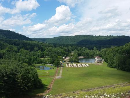
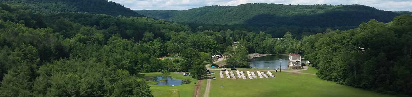
The Outflow Camping Area is located on Youghiogheny River Lake in the heart of the Laurel Highlands. The lake spans the Mason-Dixon Line between Pennsylvania and Maryland. Clean waters, forested mountains and steep-sided valleys provide an unsurpassed setting for recreational opportunities.
Recreation
Camping, fishing, boating, water skiing, hiking, biking, picnicking and sightseeing are the area’s most popular activities. Boaters consider Youghiogheny River Lake, with its 16-mile length and channels up to one-half mile wide, the best powerboating and water skiing lake in southwestern Pennsylvania.
Youghiogheny Lake’s outflow area is renowned for its excellent trout fishing and is stocked from April to September each year. A fishing pier is located in the campground.
Facilities
The campground contains a variety of sites, including walk-to group sites, RV sites and tent-only sites. Electric hookups are available in many sites. Flush toilets, showers, drinking water and a dump station are provided. The park also offers an amphitheater and children’s playground. Hammock Stations have been added to the Bike and Hike and Group Camping sites.
Natural Features
The country surrounding the lake is made up of narrow valleys and high rounded hills with steep slopes. Much of the land is covered with northern hardwoods including Beech, Sugar Maple, White Ash, Yellow Poplar and Basswood.
A variety of wildlife makes its home around Youghiogheny River Lake, including deer, turkey, grouse, rabbit and squirrel.
Nearby Attractions
Some of Pennsylvania and Maryland’s finest state parks surround Youghiogheny Lake. Ohiopyle State Park is known for some of the best whitewater in the East and is often the location of national kayaking competitions.
Cyclists enjoy the many miles of bike trails in the area. For the history buff, the area boasts many historical sites and parks. For sheer natural beauty, Youghiogheny Lake can’t be beat.