
Directions
From St. Louis: Take I-55 south to Highway 67. Go south and turn left on State Highway D. Take Highway D south for 20 miles and look for signs.
From Poplar Bluff: Take Highway 60 east to Highway T. Take exit toward Wappapello Lake (north). Continue and look for signs.
Phone
573-222-8233
Activities
CAMPING, FISHING, HIKING, PICNICKING, VISITOR CENTER, DAY USE AREA, SWIMMING SITE, WATER ACCESS
Keywords
RED2,REDMAN CREEK CAMPGROUND,REDMAN CREEK EAST CAMPGROUND,REDMAN CREEK WEST CAMPGROUND,VISITOR CENTER AREA,GATE HOUSE AREA,REDMAN PICNIC AREA,REDMAN BEACH AREA,WAPPAPELLO LAKE,LAKE WAPPAPELLO
Related Link(s)
Missouri State Road Conditions
Overview
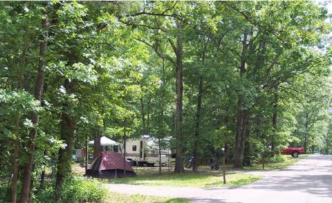
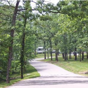
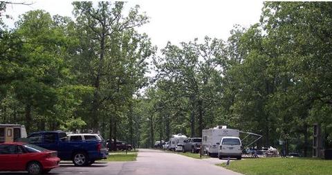
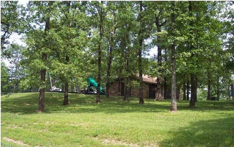
Visitors at Redman Creek get a chance to enjoy family picnics, peaceful strolls or a day of boating on Wappapello Lake. The large park is ideal for visitors with a variety of recreational interests. Redman Creek consists of 109 campsites in Redman Creek East and West Campgrounds, the 10-site Redman Creek Picnic Area, with large day-use shelter, the Redman Creek Recreation Area with basketball court, tennis court, playground, sand volleyball courts, three separate day-use shelters, a three-lane boat ramp with courtesy dock, and a swimming beach.
Every holiday season, Redman Creek Campground hosts the Festival of Lights Auto Tour. Visitors can help decorate campsites and tour the campground to enjoy the festive lights. Other fun events are held throughout the year, as well.
Click here to take a virtual tour of the facilities at Wappapello Lake!
Recreation
Boaters enjoy the lake’s seemingly endless string of secluded coves, lined with wooded shorelines. Water skiing is a very popular activity on the lake, as is fishing and hiking.
Facilities
The day-use portion of Redman Creek includes the visitor center, four picnic shelters, basketball, volleyball, and tennis courts, horseshoe pits and more. The campground portion provides 109 full service campsites with 50-AMP electric, water and sewer hookups in addition to six non-electric boat-in island camp sites.
Natural Features
Wappapello Lake is fed by the St. Francis River and boasts 8,400 acres on a whopping 45,000-acre expanse of public land in the foothills of the Ozark Mountains.
Nearby Attractions
Explore the Pine Ridge Nature Trail and enjoy fishing opportunities in the lake and St. Francis River.