

Directions
From Bend, travel southwest on Cascade Lakes Scenic Byway for 31.2 miles to the campground entrance.
Phone
541-323-1746
Activities
BIKING, CAMPING, FISHING, HIKING, HORSEBACK RIDING, DAY USE AREA
Keywords
QUIN,DESCHUTES NF – FS
Related Link(s)
Overview
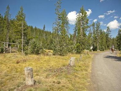
Quinn Meadow Horse Campground is situated along the Cascasde Lake Highway within Central Oregon’s Cascade range.
Recreation
Quinn Creek Trail, which begins in the campground, follows Quinn Creek past the north end of Hosmer Lake and ties into the Metolius-Windigo Trail. With only a short shuttle between Sparks and Devils Lake, a longer, 11-mile loop can be made by connecting the Katsuk Pond Trail from Devils Lake Trailhead to Quinn Creek, and then on to Sparks Lake via the Metolius-Windigo Horse Trail.
The Metolius-Windigo Trail is a long-distance trail open to horseback riders, hikers and mountain bikers. It can be accessed from several trailheads. At over 100 miles in length, this trail begins near the Metolius River headwaters west of Sisters and runs south to Windigo Pass near Crescent Lake.
The trail was created in the 1980s, primarily to serve long-distance horseback riders seeking an alternative to the Pacific Crest Trail. Because of its lower elevation, this trail is snow-free longer than trails at higher elevations. It passes through a wide variety of scenic terrain and forest types.
Facilities
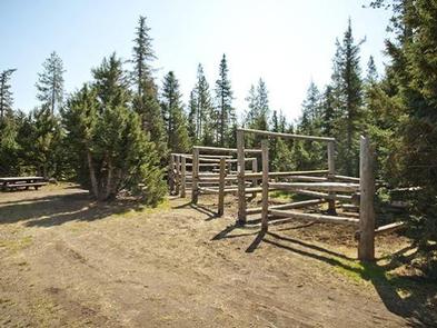
Sites are equipped with double or quadruple corrals and horse stalls. A manure pit and watering hole are on-site. Horses may be watered only at Sink Creek, and cleaning up manure, hay and trash is required prior to detarture.
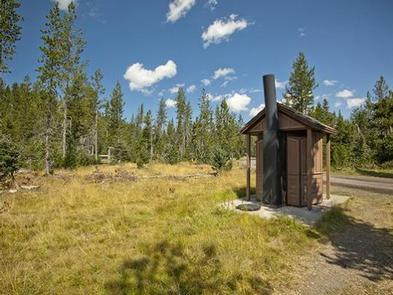
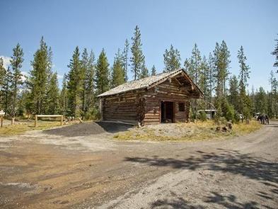
The campground is equipped with a picnic shelter, tables, campfire rings, vault toilets and drinking water. Electrical hookups are not available. Ample room for parking vehicles and trailers is available at each site.
Horse campgrounds have been designed to accommodate campers with horses. With a limited number of these kinds of facilities, please consider camping in one of the many other campgrounds nearby if you do not have a horse.
Natural Features
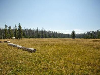
Spring-fed Quinn Creek, which flows into Hosmer Lake, sits adjacent to the campground. Quinn Meadow spreads south from the campground. The area provides habitat for mammals such as mule deer, coyotes and bears. Migratory birds and native fish also call the area home.
Nearby Attractions
Visitors enjoy traveling the Cascade Lakes Scenic Byway, a 66-mile drive through the Cascade Mountain Range that weaves through snow-capped peaks and alpine lakes, highlighting the beauty of central Oregon.