MOON LAKE CAMPGROUND, UT Campground Reservation, Info, Images, Map, Directions

MOON LAKE CAMPGROUND, Utah Campground Images, Info & Reservations

Directions

From Duchesne, Utah, take State Hwy 87 north to Mountain Home, then north 12 miles to the Forest Boundary and Forest Road 131. The campground is about 36 miles from Duchesne on paved roads although some spots have pot-holes.

Phone

435-738-2482

Activities

BIKING, BOATING, CAMPING, FISHING, HIKING, HORSEBACK RIDING, WILDLIFE VIEWING, SWIMMING SITE

Keywords

MONL,ASHLEY NF – FS

Related Link(s)

Rec Area Info & Images

Utah State Road Conditions

Utah State Tourism

Overview

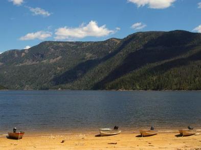
Moon Lake Campground is located on the shores of the scenic two mile long Moon Lake on the southern slope of the 13,000 foot peaked Uinta Mountains. Visitors come to Moon Lake to enjoy cool mountain air, fishing, canoeing and motor- boating, scenic vistas, hiking trails and horse rides.

Recreation

Moon Lake offers great canoeing and motor-boating. Anglers fish for tiger, rainbows and brook trout, kokanee salmon and splake. Tiger and rainbow trout are actively stocked annually. The Lake Fork Trail and Brown Duck Mountain Loop hiking/equestrian trails begin at this site offering excellent opportunities in the High Uintas Wilderness where numerous alpine lakes provide great backcountry fishing. The Fish Creek National Recreation Trail begins at the Moon Lake Dam and ascends northeast up to center park, climbing from 8,200’ to 10,400’ over 5.6 miles.

The Moon Lake Resort is adjacent to the campground and offers small engine boat rentals. Flying J Outfitters is located one mile before the campground, at the Lake Fork trailhead, offering both scheduled and walk-up horse rides as well as drop and pack trips into the High Uintas Wilderness.

Facilities

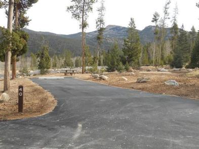
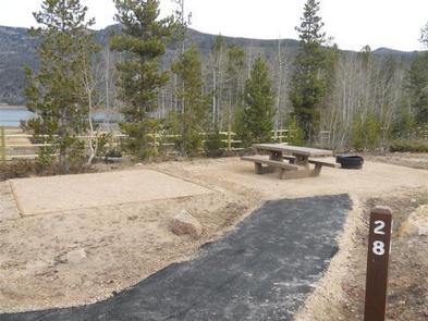
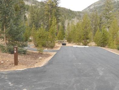
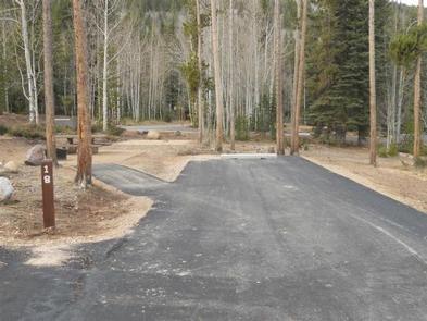
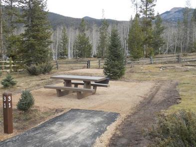
This large campground contains numerous single-family sites, each with a picnic table and campfire ring with grill. Generally, parking spurs are 16 X 65 feet. Please see individual campsites for exact dimensions. Most sites have lake views; some have lake access.
Flush toilets, drinking water and trash collection are provided. Water spigots are located throughout the campground and roads and parking spurs are paved. A host is on-site and firewood is available for purchase at the nearby Moon Lake Resort.
Moon Lake Resort is adjacent, offering convenience groceries, ice, soda pop, fishing bait and gear.

Natural Features

The campground is situated on the lakeshore at an elevation of 8,100 feet where lodgepole pine, aspen and Douglas fir provide some shade away from the lake. Wildlife and flowers both flourish in the canyon

Reservation

More from CampingHiking.net:

SAN AUGUSTINE, Texas Campground Images, Info & Reservations

Directions From Pineland, TX, take FM 83 west 6 miles, then south on FM 1751 for 4 miles to the park entrance. Phone 409-384-5716 Activities BOATING, CAMPING, FISHING, HUNTING, SWIMMING SITE Keywords SATX,SAM RAYBURN RESERVOIR,SAM RAYBURN LAKE,SAN AUGUSTINE PARK,SAM RAYBURN RESERVOIR Related Link(s) Rec Area Info & Images Texas State

Axolotl Cabin, Montana Campground Images, Info & Reservations

Directions From Ennis – Most Direct Route – 4 WD/High Clearance Vehicle Strongly Recommended -Take State Highway 287 towards Virginia City – About 1/4 mile east of mile marker 11 (or 3/4 mile west of mile marker 10) turn South into the paved parking area near the top of Virginia

LOGGER CAMPGROUND, California Campground Images, Info & Reservations

Directions From Truckee, Calif., travel east on Interstate 80 for 10 miles, to the Hirschdale Road exit. Follow Hirschdale Road/Stampede Dam Road north for eight miles, to the Stampede Reservoir. Take a left on Dog Valley Road to go over Stampede Dam. Go past Emigrant Group Campground and in a

WINHALL BROOK, Vermont Campground Images, Info & Reservations

Directions From Brattleboro, Vermont, travel 30 miles north on Route 30. Turn north onto Route 100 and continue for 2.5 miles. Turn onto to Winhall Station Road and follow for a mile to the campground. From Manchester, Vermont, travel 5 miles east on Route 11. Turn right onto Route 30

OWENS CREEK CAMPGROUND, Maryland Campground Images, Info & Reservations

Directions For GPS Use Only: The street address is 15882 Foxville Deerfield Road, Sabillasville, MD. This is not the mailing address. The Park mailing address is: Catoctin Mountain Park, 6602 Foxville Road, Thurmont, MD 21788. From Washington DC Take the George Washington Memorial Parkway north to I495 to I270 north

AUSABLE RIVER CAMPING, Michigan Campground Images, Info & Reservations

Directions Designated campsites are spread along 55 miles of river shoreline between the AuSable River Access at 4001 Bridge (7 miles northwest of Glennie, MI) to near the Whirlpool AuSable River Access (4 miles west of Oscoda, MI). For more information on specific campsites, click here. Phone 989-362-8961 Activities BOATING,