UINTA RIVER GROUP, UT Campground Reservation, Info, Images, Map, Directions

UINTA RIVER GROUP, Utah Campground Images, Info & Reservations

Directions

From Roosevelt, Utah, take State Highway 121 north to Neola, then travel on Uinta and Ouray Indian Reservation Road to Forest Road 118.

Phone

435-722-5018

Activities

BIKING, CAMPING, HIKING, WILDLIFE VIEWING

Keywords

UNIR,ASHLEY NF – FS

Related Link(s)

Rec Area Info & Images

Utah State Road Conditions

Utah State Tourism

Overview

Uinta River Group Campground is located about 25 miles from Roosevelt near the Uinta River at an elevation of 7,600 feet. Visitors come to enjoy the area’s fishing and trail opportunities.

Recreation

Anglers fish for rainbow, brown, brook and cutthroat trout on the Uinta River.

The Uinta River Trailhead is just up the road, providing access to the Chain Lakes region of the High Uintas Wilderness. Hiking, backpacking and horseback riding are popular in the wilderness area, and numerous sparkling lakes provide great backcountry fishing opportunities.

Facilities

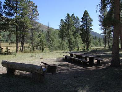
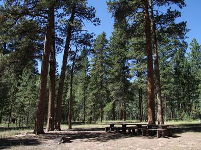
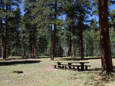
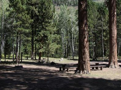
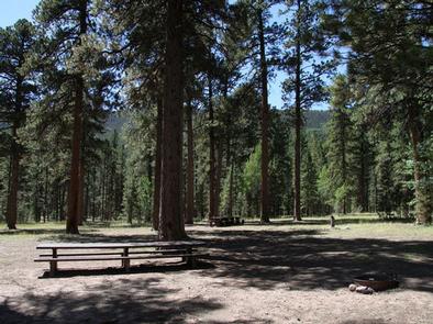
The campground contains one large group site that can accommodate up to 150 people. Several picnic tables and campfire rings with grills are scattered throughout the area.

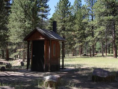
Vault toilets and trash collection are provided. The available water is not potable. Campers must bring their own supply. Roads and parking spurs are gravel.

Natural Features

The campground lies in an open meadow beneath towering Ponderosa pines. Summer wildflowers and wildlife are abundant.

Reservation

More from CampingHiking.net:

HOPPER CREEK GROUP CAMP, Virginia Campground Images, Info & Reservations

Directions From I-81 North, take Exit 175 just south of Natural Bridge. Go north on U.S. Highway 11 toward Natural Bridge (left turn facing the Exxon station). From Natural Bridge, follow Route 130 East at the intersection with U.S. Highway 11 (right turn at the Natural Bridge parking lot). Continue

WINSTANLEY LAKE CABIN, Alaska Campground Images, Info & Reservations

Directions The cabin is located on Winstanley Lake approximately 33 air miles northeast of Ketchikan on the mainland, east of Winstanley Island. The cabin is accessible by float plane or by trail from saltwater (skiff provided at end of trail; please return it to the trail after use). Access by

Rohrbach Group Campground, Maryland Campground Images, Info & Reservations

Directions The visitor center is located at 5831 Dunker Church Rd. off of MD Rt 65, ten miles south of I-70 and one mile north of historic Sharpsburg, Maryland. The campground is located at 18316 Burnside Bridge Road, Sharpsburg, MD 21782. Phone (301) 432-5124 Activities BIKING, HISTORIC & CULTURAL SITE,

NOTCH CABIN, Montana Campground Images, Info & Reservations

Directions Notch Cabin is about 62 miles from Ennis, Montana. The final 28 miles are gravel, dirt or primitive two-track. From Ennis, take Montana Highway 287 west for 23 miles to Alder. At Alder, turn south toward Ruby Reservoir (County 248) and travel 21 miles. Turn right on Ledford Creek

LOST CREEK CAMPGROUND, Utah Campground Images, Info & Reservations

Directions From Salt Lake City, Utah, take I-80 east for approximately 30 miles to Exit 146 for Highway 40 toward Park City/Heber City/Vernal. Take Exit 4 onto Highway 248 toward Kamas. Take left onto UT 32 then right onto Highway 150 (Mirror Lake Scenic Byway). Go 27 miles to campground.