GREEN RIVER LAKES, WY Campground Reservation, Info, Images, Map, Directions

GREEN RIVER LAKES, Wyoming Campground Images, Info & Reservations

Directions

From Pinedale, drive 7 miles west on U.S. Highway 191. Turn north onto Wyoming Highway 352 and continue 25 miles to the forest boundary, where the pavement ends. Continue on the dirt road for 18 miles to the campground. While the dirt road to the campground is suitable for 2 wheel drive vehicles, weather can make this road impassable to all but 4 wheel drive vehicles, call the district office to inquire on road conditions.

Phone

1-307-367-4326

Activities

BIKING, BOATING, CAMPING, FISHING, HIKING, HORSEBACK RIDING, WILDLIFE VIEWING, SWIMMING SITE

Keywords

GRRI,BRIDGER-TETON NF – FS,Flaming Gorge National Recreation Area

Related Link(s)

Rec Area Info & Images

Overview

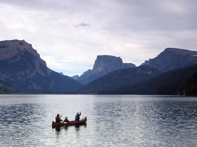
Green River Lakes Campground is located near the shores of beautiful Lower Green River Lake, at an elevation of 8,000 feet. The lake sits on the western edge of the rugged Wind River Range in Wyoming. Visitors enjoy hiking and backpacking into the adjacent Bridger Wilderness, as well as fishing and canoeing on the lake.

Recreation

The lake is open to small watercraft only, making it an excellent location for canoeing and kayaking. A primitive, carry-down boat launch is located at the lakeshore. Anglers fish for brook, cutthroat, rainbow and mackinaw trout. Hiking and horseback riding into the Bridger Wilderness and Wind River Range are popular activities enjoyed by visitors to the area. Trails in the area include the Continental Divide Trail, Highline Trail and Lakeside Trail. A trailhead parking area, horse corral and water trough are just outside the campground.

Facilities

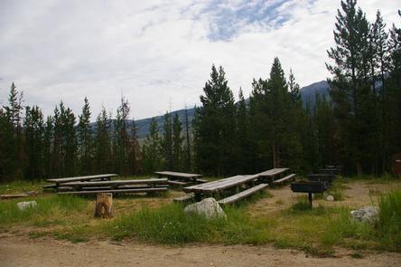
The campground contains three large-group campsites with picnic tables, food storage locker, campfire circles and grills. Sites A and B can accommodate up to 35 people each, and site C can accommodate up to 50 people. Vault toilets and drinking water are available. A campground host is located on-site. Roads and parking spurs within the campground are dirt. Parking for the group sites are not designed for large RVs or trailers.

36 additional single sites are available within the campground, they are first come/first served. No reservations.

Natural Features

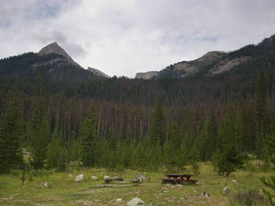
Square Top Mountain towers over scenic Green River Lakes. This unique peak is part of the Wind River Range and tops out at an elevation of 11,581 feet. Most campsites afford scenic views of the peak and the lake below. Lodgepole pines dot the campground, offering very limited shade. Wildlife and summer wildflowers are abundant in the area.

Nearby Attractions

Pinedale is the nearest full service community, and is located 50 miles south of the campground.

Reservation

More from CampingHiking.net:

JACKS GULCH, Colorado Campground Images, Info & Reservations

Directions From Fort Collins, take Highway 14 northwest for 42 miles, then County Road 63 E (Pingree Park Road) south for 6 miles. Phone 970-295-6700 Activities BIKING, CLIMBING, CAMPING, FISHING, HIKING, HORSEBACK RIDING, WILDLIFE VIEWING, MOUNTAIN BIKING, BIRDING Keywords JAGU,ARAPAHO AND ROOSEVELT NF – FS Related Link(s) Rec Area Info

SUSQUEHANNOCK, Pennsylvania Campground Images, Info & Reservations

Directions From Huntingdon, Pennsylvania, take Route 26 south for 6 miles. Turn left onto Seven Points Drive and continue 3 miles. Turn left again onto Baker’s Hollow Road. Campground entrance is two miles ahead on the right. Phone 814-658-6806 Activities BIKING, BOATING, CAMPING, FISHING, HIKING, WILDLIFE VIEWING Keywords SUSQ,RAYSTOWN LAKE,RAYSTOWN

NORTH OVERLOOK PICNIC SHELTER (IA), Iowa Campground Images, Info & Reservations

Directions 1007 Hwy T15 Knoxville, Iowa 50138 From Pella, Iowa, take County Highway T-15 southwest for 3 miles, then follow signs to North Overlook Picnic Shelter. Phone 641-828-7522 Activities CAMPING, PICNICKING, BIRDING Keywords Related Link(s) Rec Area Info & Images Iowa State Road Conditions Iowa State Tourism Overview North Overlook

MATHER CAMPGROUND, Arizona Campground Images, Info & Reservations

Directions Mather Campground is located within the park in Grand Canyon Village on the South Rim. From the south entrance station, proceed for about three miles and turn left on Center Road. Travel 1/4 mile and turn right onto Market Plaza Road. The campground is about one mile down Market

SANTA ROSA ISLAND, California Campground Images, Info & Reservations

Directions Boat transportation can be arranged with Island Packers from Ventura Harbor. Air transportation can be arranged with Channel Islands Aviation from Camarillo airport. To park headquarters in Ventura, California: Highway 101, exit Victoria or Seaward to Ventura Harbor. Phone 805-658-5730 Activities BOATING, HISTORIC & CULTURAL SITE, CAMPING, INTERPRETIVE PROGRAMS,

INDIAN FLATS CABIN, Montana Campground Images, Info & Reservations

Directions Indian Flats Cabin is located 40 miles northeast of Helena. Take Highway 280 east from Helena. Several miles after crossing the Missouri River, you will come to the small community of York. Turn left at the York Bar and proceed 5 miles to the smaller community of Nelson, where