SOUTH FORK GROUP (CA), CA Campground Reservation, Info, Images, Map, Directions

SOUTH FORK GROUP (CA), California Campground Images, Info & Reservations

Directions

Travel 21 miles east from Placerville on Highway 50 and turn left on the Ice House Road. Go 25 miles north and turn left on South Fork Road. The campground is a mile from the turn-off, on the right side of the road.

Phone

530-644-2324

Activities

BIKING, BOATING, CAMPING, FISHING, HIKING, HUNTING, SWIMMING SITE

Keywords

SOUF,SOUTH FORK CAMPGROUND,Crystal Basin,Icehouse Road,South Fork Group,ELDORADO NF – FS

Related Link(s)

Rec Area Info & Images

California State Tourism

California State Road Conditions

Overview

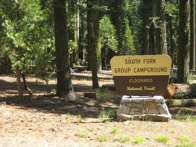
South Fork is the largest group campground in the Crystal Basin Recreation Area, nestled in the vast expanse of the Eldorado National Forest. The remote location affords visitors a true outdoor camping experience.

Recreation

With the South Fork of the Rubicon River located within walking distance, the group camp provides excellent fishing, swimming and other water sports and activities.

Facilities

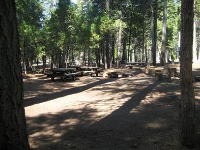
While the campground can be used as a single group site that can accommodate up to 125 guests, it can also be reserved as multiple single-family sites.

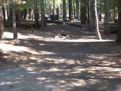
A group cooking area with food preparation tables and double grills is available, as well as campfire rings with grills at each site. Vault toilets are provided, however, drinking water is not available at the campground. Visitors can boil stream water or fill up at nearby boat ramps. A parking area is also available.

Natural Features

Situated at an elevation of 5,200 feet, the campground sits between the Union Valley Reservoir and Loon Lake.

It is also just minutes away from Gerle Creek Reservoir, a serene mountain lake where motorized boating is prohibited in order to preserve a peaceful and quiet atmosphere for visitors.

Nearby Attractions

Swimming and non-motorized boating are available at Gerle Creek Reservoir, 5 miles north of the campground.

Reservation

More from CampingHiking.net:

EAGLE CREEK CAMPGROUND, Oregon Campground Images, Info & Reservations

Watch the Stunning Eagle Creek Trail Video Directions From Portland, OR: Travel east on Interstate 84 to exit #41 “Eagle Creek Recreation Area” which is just past the interstate tunnel…make sure you are in the right lane before entering the tunnel. Take a right at the end of the off

FRANKLIN LAKE, Wisconsin Campground Images, Info & Reservations

Directions Drive approximately 8 miles east from Eagle River on Highway 70. Turn south onto Military Road/Forest Road 2178 and continue about 2 miles, to Butternut Lake Road/Forest Road 2181, and continue approximately 4 miles to the campground. Phone 715-479-2827 Activities BOATING, HISTORIC & CULTURAL SITE, CAMPING, INTERPRETIVE PROGRAMS, FISHING,

MANZANITA LAKE, California Campground Images, Info & Reservations

Directions From Redding, California drive 48 miles east on State Highway 44. Turn right into Lassen Volcanic National Park and continue one mile south to Manzanita Lake Campground. Phone 530 595-6121 Activities BOATING, HISTORIC & CULTURAL SITE, CAMPING, INTERPRETIVE PROGRAMS, FISHING, HIKING, PICNICKING, VISITOR CENTER, DAY USE AREA, SWIMMING SITE

YELLOWSTONE GROUP CAMPGROUND, Utah Campground Images, Info & Reservations

Directions From Duchesne, Utah: Take Highway 87 north to Mountain Home, then travel on Uinta and Ouray Indian Reservation Road to Forest Road 131 to Forest Road 119. FR 119 is rough and rocky in places. Phone 435-722-5018 Activities BIKING, CAMPING, FISHING, HIKING, WILDLIFE VIEWING Keywords YELL,ASHLEY NF – FS