
Directions
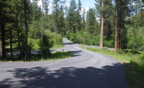
From Sula, travel 6 miles south on Highway 93, then 1 mile southwest on Forest Road 729. Road to campground is gravel, but the campground and parking spurs are paved.
Phone
406-821-3913
Activities
BIKING, HISTORIC & CULTURAL SITE, CAMPING, FISHING, HIKING, HUNTING, SWIMMING SITE
Keywords
INDT,BITTERROOT NF -FS
Related Link(s)
Overview
Indian Trees Campground is a quiet place to stay 3/4 miles off of Highway 93 in the mountains of southwest Montana. It provides access to a number of enjoyable recreational activities, as well as the vast scenery of the rugged Bitterroot National Forest. The area boasts wild game, high quality water and wild and scenic rivers.
Recreation
Visitors enjoy a variety of recreational opportunities, including hiking, mountain biking and horseback riding. A number of trails can be accessed near the campground, including the Nez Perce National Historic Trail and the Lewis and Clark National Historic Trail. The Nez Perce NHT is a 3.1-mile trail begins near the turnoff to the campground and follows a portion of the original Nez Perce route. Explorers in the early 1800s also used the route, and wagon ruts are still visible along parts of the trail. The Continental Divide National Scenic Trail is also nearby. Fishing is available in nearby Camp Creek. Anglers will find mostly cutthroat trout but other species are available. A variety of wildlife, including big game like mule and white-tailed deer, elk and moose, makes its home in the area.
Facilities
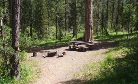
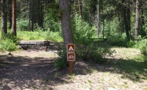
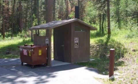
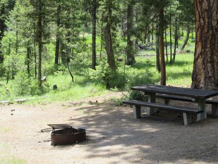
The campground offers 15 single-family campsites, available for tent and RV camping. Most sites can accommodate up to 10 people and two vehicles, however, one site can accommodate up to 15 people. Site #6 is accessible, while Site #2 is designated for use by bicyclists. Each site is equipped with a table and campfire ring with grill. Accessible vault toilets and drinking water are provided. A campground host is on-site. Utility hookups are not available.
Natural Features
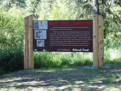
The campground is conveniently located near Highway 93, at an elevation of about 5,100 feet. It is named for the numerous scarred ponderosa pine trees in the area. Native American populations that once lived in or frequented the area stripped the trees of bark to expose and extract the tree’s sweet cambium layer for food. The trees remain historically significant and provide shade to the campground.
Nearby Attractions
Popular Lost Trail Hot Springs is located less than a half-mile from the campground. Unlike the majority of natural hot springs, Lost Trail lacks sulfur, making it odorless and very comfortable for swimming.
A general store and lodging is located in Sula Store, about 5 miles north.