

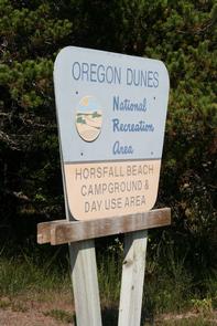
Directions
From North Bend, OR, proceed north on HWY 101 1.5 miles to Transpacific Lane at the Horsfall Dunes and Beach road sign. Turn left and proceed 1 mile, turning right across railroad tracks. Travel 100 feet cross the railroad tracks and turn righ on Horsfall Beach Road. Proceed 2 miles to the Horsfall Beach Campground & Day Use Area at the end of the road. From Reedsport, Oregon, take Highway 101 south for 22 miles to the Horsfall Dunes and Beach road sign. Turn right on Transpacific Lane. Turn left and proceed 1 mile, turning right across railroad tracks. Travel 100 feet cross the railroad tracks and turn righ on Horsfall Beach Road. Proceed 2 miles to the Horsfall Beach Campground & Day Use Area at the end of the road.
Phone
541-271-6000
Activities
CAMPING, FISHING, SWIMMING, BEACHCOMBING
Keywords
HORB,SIUSLAW NF – FS
Related Link(s)
Overview
Horsfall Beach Campground is located along the central Oregon coast, about 2 miles north of Coos Bay. The campground is ideal for off-road vehicle riders or for visitors looking to take it easy on the beach or go for a swim. Other activities in the area include hiking and horseback riding.
Recreation
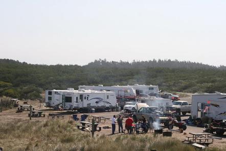
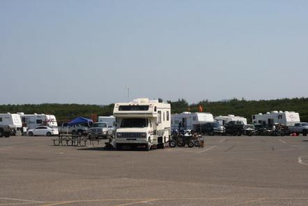
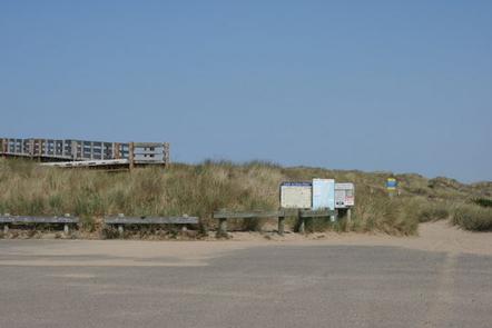
The number one activity is off-roading on the dunes. Trails and open riding zones are due north of the campground. Take in incredible views of the Pacific on the campsite’s accessible beach viewing platform. Or hang out on the sandy beach for beachcombing, sunbathing and swimming.
The Wild Mare Horse Trail #4500 is another way to see the scenery and is open to hikers and horseback riders.
Facilities
Flush toilets, drinking water, trash collection, recycling and an accessible beach viewing platform are on-site. All tent sites have picnic tables and fire rings, pull through RV sites do not. The day-use area provides a paved parking area for pedestrian beach access. The self-pay station for this area is located on Horsfall Beach Road. There are no dump stations or RV hookups. Thirty-three of the thirty-four sites are reservable. One site and any sites that are not reserved are available on a first-come first-serve basis.
Natural Features
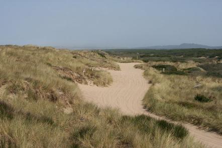
The campground sits on a beach of the Pacific Coast, within the Oregon Dunes National Recreation Area. The dune field is a 47-mile stretch of wind-sculpted sand dunes towering up to 500 feet above sea level. The dunes cover 1,076 acres of land, surrounded by forests and the Pacific coast.
Nearby Attractions
Head to Coos Bay, a picturesque inlet where the Coos River flows into the Pacific Ocean. The waterway is about 3 miles wide and 10 miles long, creating a flourishing habitat for sea birds.