CARTER LAKE, OR Campground Reservation, Info, Images, Map, Directions

CARTER LAKE, Oregon Campground Images, Info & Reservations

Listen

Directions

From Florence, travel south on Highway 101 for 11 miles. Carter Lake Campground entrance is on the west side of Highway 101.

Phone

541-271-6000

Activities

BOATING, CAMPING, FISHING, SWIMMING

Keywords

CARL,OREGON DUNES,SIUSLAW NF – FS

Related Link(s)

Rec Area Info & Images

Oregon State Tourism

Oregon State Road Conditions

Overview

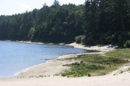
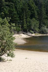
Carter Lake Campground is a family favorite in the Oregon Dunes Recreation Area. This campground is located on Carter Lake, perfect for fishing, swimming and boating. The Pacific coast is just a short drive away.

Recreation

Hike the Carter Dune Trail, which attracts campers and locals alike. Fishing for rainbow trout is a good way to pass the time, and canoeing and kayaking are excellent on Carter Lake.

The dunes region is famous for off-road vehicle riding trails, too.

Facilities

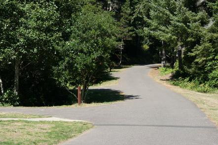
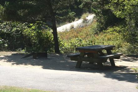
There are 23 total sites, 15 are reservable and 7 are first-come first-serve. Drinking water and flush toilets are available and each site has a campfire pit, picnic table, trash and recycling collection. Parking aprons are paved.

Natural Features

Campsites are nestled among shore pine, sitka spruce and Douglas fir, with hedges of rhododendron. Carter Lake spans 28 acres at an altitude of 100 feet. The campground is part of the Oregon Dunes National Recreation Area, known for its wind-sculpted sand dunes towering up to 500 feet above sea level.

Nearby Attractions

Explore the waterways of the region, including Oregon’s lovely Pacific Ocean, Tahkenitch Lake and Siltcoose Lake.

Reservation

More from CampingHiking.net:

EL PRADO GROUP, California Campground Images, Info & Reservations

Listen Directions The campground is located 50 miles east of San Diego, California. Take I-8 to the Sunrise Highway (State Route S1) exit. Go approximately 15 miles north to Laguna/El Prado Campground, just beyond the 26 mile marker. Stop at the entrance station for information and site location. Phone 619-445-6235

ANCHOR PASS CABIN, Alaska Campground Images, Info & Reservations

Listen Directions The cabin is approximately 50 air miles north of Ketchikan, located on the mainland shore of Anchor Pass across from the east end of Bell Island. It is accessible by floatplane or by boat. A mooring buoy is provided at the site on a first come-first serve basis.

CANYON VIEW GROUP SITES, California Campground Images, Info & Reservations

Listen Directions From Fresno, CA follow California State Highway 180 East, to its end. Canyon View Campground is on the left (north) side of the road. Phone 559-565-3341 Activities BIKING, CAMPING, HIKING, HORSEBACK RIDING, VISITOR CENTER Keywords Related Link(s) Rec Area Info & Images California State Tourism National Park Services

ALUM CREEK BELOW DAM AREA, Ohio Campground Images, Info & Reservations

Listen Directions From Columbus, Ohio, take I-71 north to exit 121 for Polaris. Turn right on Polaris Parkway, left on Worthington Road, left on Africa Road, then left on Lewis Center Road. Shelters are in the Below Dam Area. Phone 740-548-6151 Activities BIKING, BOATING, CAMPING, INTERPRETIVE PROGRAMS, FISHING, HIKING, HORSEBACK