MANZANITA., AZ Campground Reservation, Info, Images, Map, Directions

MANZANITA., Arizona Campground Images, Info & Reservations

Listen

Directions

From Phoenix, take I-17 north to Exit 298 for Highway 179. Take 179 north to Sedona. Turn right (north) onto Highway 89A in Oak Creek Canyon and travel 6 miles to the campground.

From Flagstaff, take I-17 south and exit for Highway 89A toward Sedona. Travel 23 miles south on 89A (a winding mountain road) into Oak Creek Canyon. The campground is located just south of Slide Rock State Park.

Phone

928-204-2034

Activities

CAMPING, FISHING, SWIMMING

Keywords

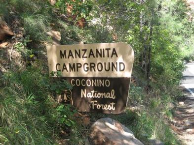
MAN2,OAK CREEK,COCONINO NF – FS

Related Link(s)

Rec Area Info & Images

Forest Service Concessionaire

Arizona State Road Conditions

Arizona State Tourism

Overview

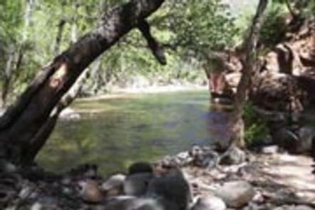
Manzanita Campground is a small, year-round, tent-only facility with campsites that fill up very quickly. Visitors enjoy the campground for its fishing and swimming holes along Oak Creek, beautiful scenery and excellent wildlife watching. Oak Creek Canyon is very crowded, especially on weekends; to get a campsite, it is best to reserve a weekday.

Recreation

Recreation and relaxation abound in Oak Creek Canyon. Camping, fishing, swimming, wading and hiking are some of the activities awaiting visitors. Anglers have the convenience of creekside campsites, where they can cast a line for trout.

Families love driving down the road to nearby Slide Rock State Park, one of Arizona’s most popular swimming spots, or trying out several nearby hiking trails.

Facilities

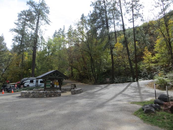
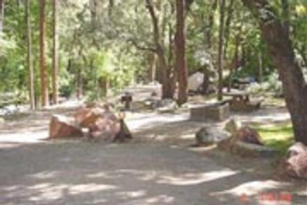
The campground is very easy to access and has paved parking. It is made up of single-family campsites that are fairly close together. Each site has a picnic table, campfire ring and grill. A campground host is available for visitor assistance. Firewood can be purchased on-site.
Coin-operated showers ($4 minimum) are available at Cave Springs Campground just up the road.

Campground has 7 first-come-first-serve sites which are often occupied. Campground host is unable to “hold” any first-come-first-serve sites for customers.

Natural Features

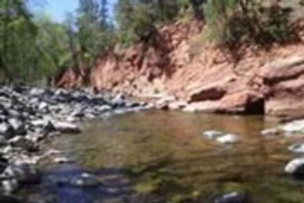
The campground borders Oak Creek in a lush, forested riparian zone with Arizona ash and box elders, gravel beaches and stream-bed boulders. Colorful songbirds add flashes of brilliance to the trees. The creek’s crystal clear waters are cool and refreshing on hot summer days.

Nearby Attractions

The well-known town of Sedona is popular for its red rock vistas, resorts and shopping. Slide Rock State Park is a great local spot for swimming and only a few minutes away.

Campers can also explore the 1.8 million-acre Coconino National Forest, which boasts a spectacular variety of scenery and outdoor activities.

Reservation

More from CampingHiking.net:

PINE RIDGE, Arkansas Campground Images, Info & Reservations

Listen Directions From DeQueen, AR, take Highway 71 north for 3 miles. Turn west onto DeQueen Lake Road and continue for 5.5 miles, then turn west again onto County Road and follow signs into the campground. Phone 870-642-6111 Activities BOATING, CAMPING, FISHING, HUNTING Keywords PINR,DEQUEEN LAKE,DEQUEEN LAKE Related Link(s) Rec

DAVIDOF LAKE CABIN, Alaska Campground Images, Info & Reservations

Listen Directions Accessible early June through October. Located 40 air miles southeast of Sitka, east of Whale Bay, within South Baranof Wilderness Area. Access is by float plane only, and takes 35 minutes from Sitka. For geographic features surrounding cabin, refer to USGS topographic map Port Alexander C-3. Phone 907-747-6671

COLD SPRINGS PEAK CABIN, Idaho Campground Images, Info & Reservations

Listen Directions From Missoula, Montana, drive to Greer, Idaho. Follow State Highway 11 to Weippe. Continue on toward Pierce. Turn right onto French Mountain Road 250. Follow Road 250 (paved for 17 miles, gravel thereafter) to the Bungalow Bridge, which spans the North Fork Clearwater River. Turn right and remain

SHEPPARD POINT, Oklahoma Campground Images, Info & Reservations

Listen Directions From Sapulpa, take SH33 and go 7 miles west of Kellyville. Exit on Turner Turnpike. Follow signs 3.5 miles south from SH33. From Bristow, take SH48 to 48/33 intersection. Go east on SH33 3.5 miles to 305th W. Ave. Follow signs south from SH33. Phone 918-865-2621 Activities BIKING,

SQUAW PEAK LOOKOUT, Oregon Campground Images, Info & Reservations

Listen Directions Starting in Jacksonville, drive on Highway 238 west 8 miles to the town of Ruch. Turn left on Upper Applegate Road and proceed 10.2 miles to Forest Road 20, (Beaver Creek Road). Turn left and go 4.1 miles to the junction of Forest Road 20 and Forest Road

DOG CREEK (KY), Kentucky Campground Images, Info & Reservations

Listen Directions From Louisville, take I-65 south to exit 76 and turn west onto Highway 224. Continue for 9 miles, then turn left onto Highway 479. After 8 miles make another left onto Highway 88 and continue for about 2 miles to Highway 1015. Turn right and follow signs to