Directions
Follow the mileage indications below and look for signs when traveling to Colton Guard Station. Leave with plenty of time to arrive at the guard station before dark.
From Vernal, travel north on U.S. Highway 191/Vernal Avenue for approximately 20 miles. Turn left (west) on Forest Road 020. A paved parking lot with a restroom is located at the intersection. Continue northwest on the paved Forest Road 020 for approximately two miles. Turn left (southwest) at Forest Road 019 and continue for less than a mile, reaching an intersection (Forest roads 028 and 019). Turn left, continuing south on Forest Road 019. Continue approximately 1.75 miles, where the road turns sharply to the right (west). Follow the hairpin turn down into a ravine to Colton Guard Station.
Phone
4357891811
Activities
BIKING, CAMPING, HIKING, WINTER SPORTS, WILDLIFE VIEWING
Keywords
COLT,COLTON RANGER STATION,COLTON CABIN,COLTON HOLLOW,ASHLEY NF – FS
Related Link(s)
Overview
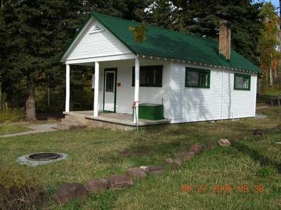
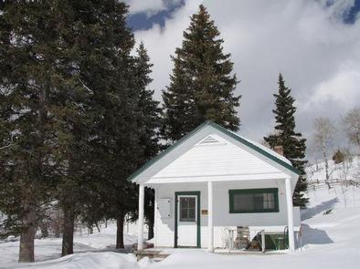
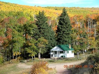
Colton Guard Station is located in the Colton Hollow area, approximately 5 miles west of U.S. Highway 191. It is near Vernal, Utah, in the Ashley National Forest. The Civilian Conservation Corps built the complex in 1933 as part of Franklin D. Roosevelt’s New Deal instituted during the Great Depression. It was a residence for rangers who patrolled the forest on horseback prior to the age of modern vehicles.
The Ashley National Forest Vernal Ranger District has chosen to rent this guard station to the public so that guests can enjoy a RUSTIC experience similar to that of the first rangers. Colton Guard Station is open for reservations all months of the year, except November, April and May.
The cabin can be accessed by vehicle throughout warmer months and during the winter, access is by snowmobile, cross-country ski or snowshoe travel. Guests are responsible for their own travel arrangements and safety, and must bring several of their own amenities.
Call the District Office at (435) 789-1181 three business days prior to a reserved visit to confirm door lock combination. Disrict Office is closed Saturday and Sunday. Lock combination is REQUIRED to enter guard station.
Recreation
In summer months, numerous hiking, biking, horseback riding and off-road vehicle trails crisscross the area. In winter months, endless snowmobiling, cross-country skiing and snowshoeing opportunities are right out the front door.
Facilities
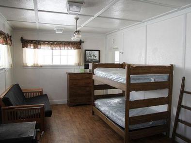
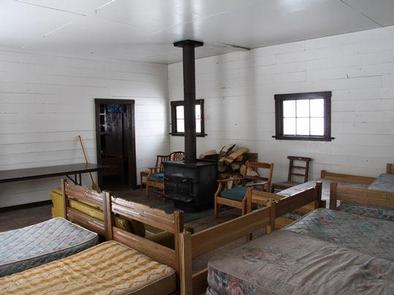
A cabin and bunkhouse are located within the complex. The cabin can sleep three-four people on one twin-size bunk and one double-size futon. No linens, bedding or pillows are provided. The bunkhouse behind the cabin can sleep up to eight additional people, on several provided twin mattresses. Tent camping is allowed outside. The maximum capacity for overnight guests is 12 people.
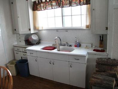
From mid-June to mid-September, the cabin has running water in the sink. The kitchen has basic amenities including a sink, propane range, table and four chairs. A BASIC assortment of pots, pans, dishes and utensils are provided, but guests are strongly encouraged to bring their own supplies. The cabin has a wood-burning stove for heat. A campfire ring is located outside. Solar lights are provided, however, due to varying weather conditions, they are not reliable. Please be prepared with battery powered lanterns or flashlights.
From mid-September to mid-June, most amenities are shut off. There is NO WATER and NO INDOOR TOILET. The operable amenities include the propane range, wood-burning stove and outdoor vault toilet.
Due to antiquated septic and water systems, guests are STRONGLY ENCOUAGED to use the outdoor vault toilet verses the indoor toilet for solid waste. There is NO WORKING SHOWER OR HOT WATER.
Natural Features
The complex sits in Colton Hollow, at an elevation of 8,500 feet. Aspens and pines surround the site, offering nice shade. Wildlife and summer wildflowers are abundant in the area.
Nearby Attractions
Flaming Gorge National Recreation Area is known not only for its beautiful red cliffs, but also for its world-class fishing for lake, brown and rainbow trout. Boating, water skiing, jet skiing, canoeing, kayaking, swimming and scuba diving are popular activities on the reservoir, which can be accessed within 30 miles.
The Ashley-Karst National Geologic Recreation Area offers dramatic canyons, densely forested backcountry areas, and vast networks of caves.

