

Directions
From Great Falls, go east on U.S. Highway 87/89 about 22 miles (just past Belt) and turn right (south) at the rest area onto U.S. Highway 89 (heading toward Monarch and Neihart). Go about 9.5 miles and turn right on County Road 340. Drive 8 miles to the junction with Road 349 and turn left (south), then drive 4.3 miles to Forest Road 839 and turn right (south). Go 8.5 miles and turn right on Road 268. Drive 3.5 miles to the lookout.
Snowmobiles, cross-country skis or snowshoes are required for access during most of the winter.
Phone
406-632-4391
Activities
CAMPING, HIKING, HUNTING, PHOTOGRAPHY, MOUNTAIN BIKING, BACKPACKING
Keywords
MONU,MONUMENT,PEAK,LOOKOUT,LEWIS AND CLARK NF – FS
Related Link(s)
Overview
Monument Peak Lookout offers guests an impressive yet rustic room with a view. The lookout, built in 1936 by the Civilian Conservation Corps, is perched atop Monument Peak, boasting spectacular 360 degree views of the Little Belt Mountains. The lookout was once used to spot forest fires but was left unused since the 1970s. In 1999, the lookout was removed from its 50 foot pole, restored and placed on a short, solid foundation for public rental use. A high clearance vehicle is recommended, as the 2 miles of road leading up to the cabin are rough and rocky. During wet conditions the entie road may be muddy and often times slippery. The Lookout/Cabin is avaialble for rental between June 1 and Novemebr 30 and is closed for the remainder of the year .
Recreation
Small and big game hunting is popular in the area. Hiking, OHVing and wildlife viewing are also enjoyed.
Facilities
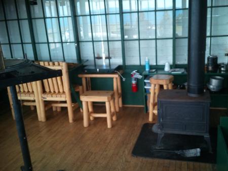
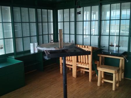
The rustic lookout has two beds with mattresses, two propane lanterns, a table and chairs and a propane cooking stove. Pots, pans, dishes and utensils are included but are limited. A vault toilet is about 100 feet from the structure. No water, electricity or plumbing is available. Recommended items to bring include drinking water, bedding, flashlights, food, small propane canisters, firewood, matches and a cooler. ( Click here ) for more cabin details.
Natural Features
The lookout sits at 7,395 feet in elevation, offering views of Monument Ridge and Strawberry Ridge. The surrounding region is a dense coniferous forest with fir, spruce and pine trees. Lewis and Clark National Forest has many miles of streams and fishing opportunities. Native wildlife includes black bears, mule-deer, white-tailed deer, elk, bald eagles, mountain lions and other species.