

Directions
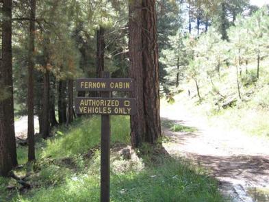
Fernow Cabin is located approximately 22 miles south of Flagstaff on Forest Road 231. All roads are suitable for passenger vehicles, with caution required for the last mile. High-clearance vehicles are recommended. During periods of heavy rainfall, roads may become difficult to navigate. Roads are not always maintained after each weather event. From Phoenix, travel north on Interstate 17 to the junction with Interstate 40 in Flagstaff. Go west on Interstate 40. Turn right at the Flagstaff Ranch Road exit and continue to the stop sign. Turn right onto historic U.S. Route 66. Turn right at the Woody Mountain Campground, onto Forest Road 231 (Woody Mountain Road) and continue for 21 miles. At Forest Road 231A, continue along Forest Road 231 for less than a mile, taking the second right, onto Forest Road 231E/Fernow Draw. The cabin is a quater-mile further on Forest Road 231E. From Flagstaff, take Milton Road south and turn right onto historic U.S. Route 66. Turn left onto Forest Road 231/Woody Mountain Road at the Woody Mountain Campground. Stay on Forest Road 231 for 21 miles. At Forest Road 231A, continue along Forest Road 231 for less than a mile, taking the second right, onto Forest Road 231E/Fernow Draw. The cabin is a quarter-mile further on Forest Road 231E.
Phone
928-526-0866
Activities
BIKING, CAMPING, HIKING, HUNTING, WILDLIFE VIEWING
Keywords
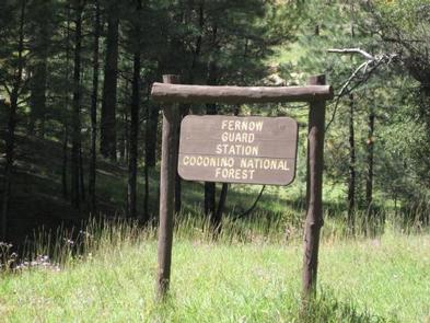
FERO,COCONINO NF – FS
Related Link(s)
Overview
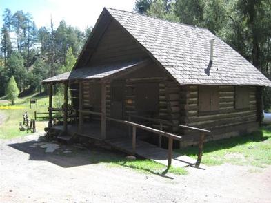
Fernow Cabin offers a quaint, forested retreat near Flagstaff and Sedona, in central Arizona. The rustic, three-bedroom log cabin is a retired U.S. Forest Service guard station constructed in the 1970s to house firefighters during wildfire season. Now, it offers groups of up to eight people a unique recreation opportunity in a beautiful Southwest setting. The cabin can be accessed by passenger vehicle, however caution required for the last mile; high clearanance recommended. Roads are not always maintained after each weather event. Guests are responsible for their own travel arrangements and safety, and must bring several of their own amenities.
Recreation
The area is a hub for hiking, mountain biking and off-road vehicle riding. The cabin is adjacent to the Sycamore Canyon and Red Rock/Secret Mountain Wilderness areas, which boast numerous hiking trails. Bikes and off-road vehicles are only allowed on designated roads and trails.
Flora, fauna and unique rock formations in the surrounding area also present excellent opportunities for photography.
Facilities
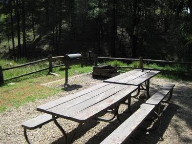
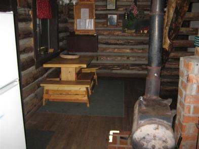
The cabin has running water from mid-May through mid-October. It also has an indoor shower, hot water heater, solar lights, a small dining area, kitchen, two bedrooms, a loft, wood stove and covered porch. It is furnished with beds and mattresses, dressers and a small dining table with chairs. There is no electricity available. If visiting before mid-May or after mid-October, guests must bring their own water. The kitchen includes a stove, oven, small refrigerator, pots, pans, utensils, dishes, coffee pot. The vault toilet is a short walking distance from the cabin, and an outdoor campfire circle and grill are also provided. The ramp to the front porch is accessible. Firewood and propane are provided (click here for more cabin details ). Visitors must bring their own sheets (two double beds and four single beds) and blankets, or sleeping bags, flashlights, towels, garbage bags, dish soap, dish towels, extra firewood, an axe for splitting wood, and matches and newspaper for lighting the wood stove. There are two picnic tables outside. Lawn chairs are not provided, but are a nice treat for summer months.
Natural Features
The site lies in a ponderosa pine forest on the Mogollon Rim, a 200-mile slope that ranges between 5,000 and 7,000 feet in elevation. At an elevation of 6,656 feet, the cabin is fairly isolated, offering a private location for visitors to enjoy nature.
The area is characterized by warm summer days and cool nights, with afternoon thunderstorms common from mid-June through mid-September.
Nearby Attractions
The nearby city of Flagstaff offers ample lodging, shopping and dining opportunities. Grand Canyon National Park is about a two-hour drive northwest of the cabin.