

Directions
Approximately 4 miles from I-70 on US 9 heading South towards Breckenridge, turn left, heading east, onto Swan Mountain Rd. (Co Rd 1). Continue for approx. 2 miles to the top of the hill to Sapphire Point parking lot. Approximately 5 miles from I-70 on US 6 heading South towards Keystone, turn right, heading west, onto Swan Mountain Rd. (Co Rd 1). Continue for approx. 4 miles to the top of the hill to Sapphire Point parking lot.
Phone
970-468-7681
Activities
BIKING, BOATING, CAMPING, INTERPRETIVE PROGRAMS, FISHING, HIKING, WILDLIFE VIEWING
Keywords
SAPP,Sapphire Point Trail,Swan Mountain Overlook,WHITE RIVER NF -FS
Related Link(s)
Colorado State Road Conditions
Overview
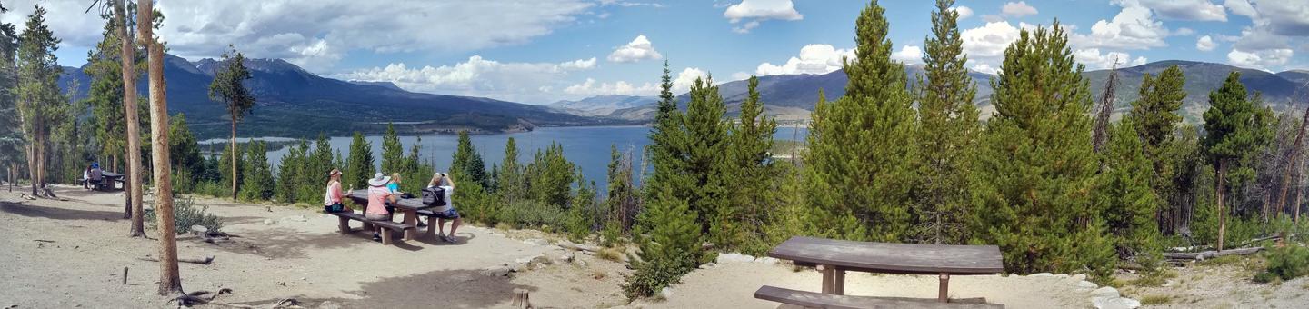
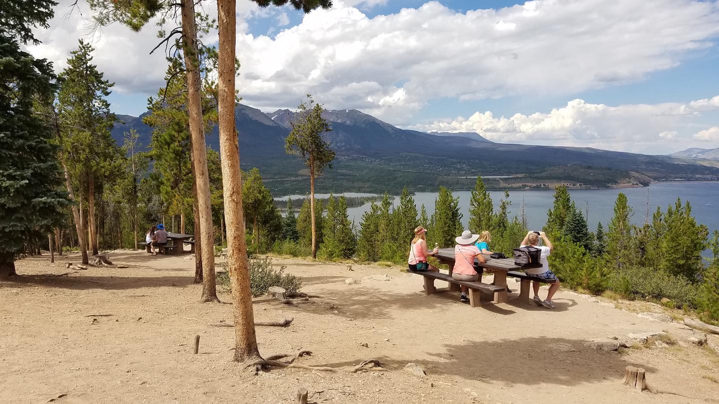
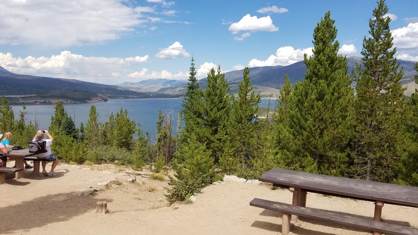
Sapphire Point Overlook sits between Keystone and Breckenridge on Swan Mountain Road, at an elevation of 9,500 feet. The overlook offers a stunning view of Dillon Reservoir, hemmed in by the Gore and Tenmile mountain ranges.
Sapphire Point is a day-use area that can be reserved for two-hour blocks for private gatherings. It is the only designated site where wedding ceremonies are permitted to take place on the Dillon Ranger District.
Recreation
Encompassing a landscape of rivers, mountains, trails and forest roads, the White River National Forest is one of the top recreation Forests in the nation.
The area surrounding Sapphire Point Overlook provides visitors with a variety of recreational opportunities.
Dillion Reservoir is the greatest draw to the area. At 3,233 acres and 26.8 miles of shoreline, the reservoir is an ideal spot for fishing, boating and sailing. Anglers will find that the reservoir supports a healthy population of rainbow and brown trout, with an occasional cutthroat trout finding its way into the lake from feeder streams.
Opportunities for hiking and biking in this area abound as well, including more than 7 paved miles of the 50-mile Summit County trail system.
The Old Dillion Reservoir trail is a favorite among visitors. This short, easy trail has spectacular views of the Tenmile Range and the Continental Divide. The Old Dillon Reservoir was built in the 1930s to supply water to the original town of Dillon, which is now covered by the new Dillon Reservoir.
Facilities
This is a non-exclusive day-use area, able to accommodate up to 35 people for small events such as wedding ceremonies. Although the site may be reserved, all visitors have access to the site.
Use of portable chairs and other furniture is allowed, however, commercial services, such as delivery of rental or catering items, are prohibited unless the vendor has a valid permit from the U.S. Forest Service.
Click here for photographs and more information about wedding ceremonies at Sapphire Point Overlook.
Natural Features
In the heart of the Rocky Mountains, this overlook is part of the 2.3 million acre White River National Forest. Recognized as a place of serenity and adventure, the area boasts eight wilderness areas, four defined seasons and ten peaks surpassing 14,000 feet in elevation.
Described as being more vertical than horizontal, the nearby Eagles Nest Wilderness Area, designated in 1976, is a playground of craggy cliffs, sheer rock faces, alpine lakes and deep, forested valleys.
Wildlife in the area abounds. Bighorn sheep navigate rocky ridges and bull elk bugle at dusk. Scenic rivers sustain populations of cutthroat, rainbow and brown trout. Alpine regions provide habitat for pika and ptarmigan. These species, along with many others, depend on surrounding undeveloped wilderness, clean streams and diverse forests to live.
Nearby Attractions
Arapahoe Basin, Keystone, Breckenridge and Copper Mountain ski resorts are all located within ten miles from Dillon Reservoir. These resorts stay open year-round.