BULL RIVER PAVILION, MT Campground Reservation, Info, Images, Map, Directions

BULL RIVER PAVILION, Montana Campground Images, Info & Reservations

Directions

From Noxon, travel 6 miles northwest on Highway 200. Bull River Pavilion is located at the back of Bull River Campground.

Phone

406-827-3533

Activities

BOATING, CAMPING, FISHING, WATER SPORTS, WILDLIFE VIEWING

Keywords

BRPA,KOOTENAI NF – FS

Related Link(s)

Rec Area Info & Images

Montana State Tourism

Montana State Road Conditions

Overview

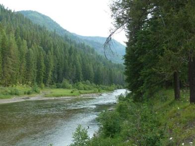
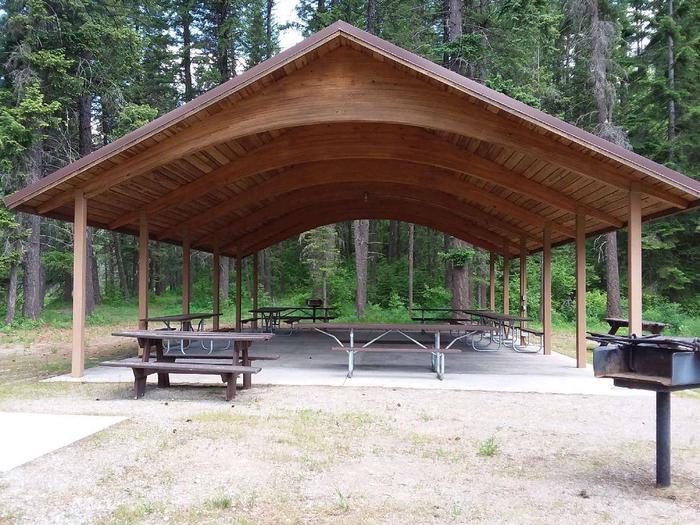
Bull River Pavilion offers an excellent view of the Bull River and surrounding forest. It’s located right in the thick of a variety of recreational opportunities and provides a large group with the perfect place to picnic in northwestern Montana.

Recreation

The rivers give visitors ample opportunity for fishing, swimming and boating. Large and smallmouth bass, perch, rainbow and brown trout and squawfish can be found in the clear, cool waters. Boating, sailing and water skiing are also popular activities on the reservoir.

Visitors enjoy tours of the Noxon Rapids Dam, which is located less than 10 miles southeast of the pavilion. It is an earthen, gravity-type, hydroelectric dam that has been in operation for more than 50 years.

Facilities

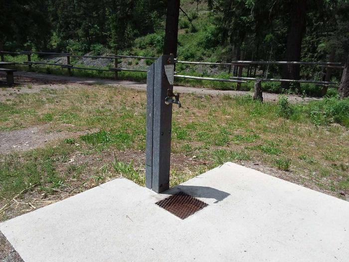
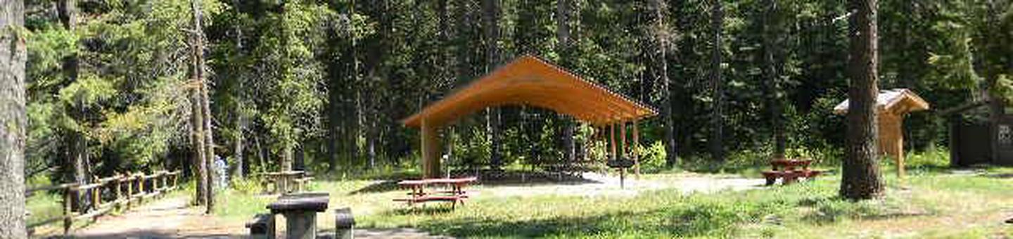
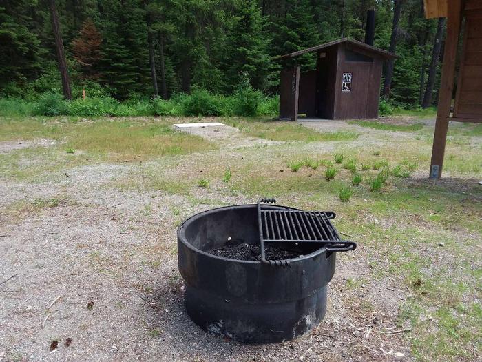
The accessible pavilion can accommodate up to 200 people and 20 vehicles. Electricity is available within the structure. It is also equipped with picnic tables, campfire rings and grills. Accessible vault toilet and drinking water are provided.

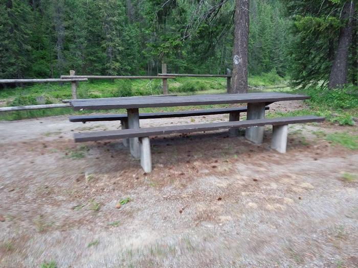
The adjacent campground offers over a dozen accessible sites for tent and RV camping. A boat ramp, fishing dock and access to the reservoir are available within the campground. All parking surfaces are gravel.

Natural Features

The pavilion is located in a wooded area at the confluence of the Bull River and the Clark Fork River. The rivers empty into 3,200-acre Cabinet Gorge Reservoir, at an elevation of about 2,200 feet. A variety of trees forest the area, including cedar and Douglas fir.

Nearby Attractions

Reservation

More from CampingHiking.net:

DELTA, Oregon Campground Images, Info & Reservations

Directions Located 51 miles from Eugene OR on HWY 126 to the Cougar Reservoir turn off. Take a right turn (south) on Aufderheide Drive and cross the McKenzie River, turn right on to the campground entrance road Forest Road 400. Follow the road approximately 1 mile to the campground. Phone

PICNIC POINT (ID), Idaho Campground Images, Info & Reservations

Directions From Cascade, turn east on Warm Lake Highway. Travel approximately 26 miles along the paved road to Forest Road 489 and turn south. Continue about a half-mile past the Shoreline Campground and North Shore Lodge. The campground will be located just past the lodge, on the left side of

PORCUPINE CABIN, Montana Campground Images, Info & Reservations

Directions From Livingston, Montana, travel north on Highway 89 to Wilsall. Just north of Wilsall, turn northeast onto Shields River Road. Continue 8 miles to Porcupine Road, turn east (right) and then drive another 8 miles to the cabin. Four-wheel drive vehicles are recommended due to the road condition. During

MIRROR LAKE, Utah Campground Images, Info & Reservations

Directions From Salt Lake City, Utah, take I-80 east for approximately 30 miles to Exit 146 for Highway 40 toward Park City/Heber City/Vernal. Take Exit 4 onto Highway 248 toward Kamas. Take left onto UT 32 then right onto Highway 150 (Mirror Lake Scenic Byway). Go 32 miles to campground.

MORAINE PARK CAMPGROUND, Colorado Campground Images, Info & Reservations

Directions Take Highway 36 west from Estes Park, CO or Highway 34 east from Grand Lake, CO. Off the main park road, take the Bear Lake Road, which is near the Beaver Meadows Entrance Station, and follow the signs to the campground. Phone 970-586-1206 Activities CAMPING, FISHING, HIKING, HORSEBACK RIDING,