ALLRED FLATS GROUP PICNIC SITE, WY Campground Reservation, Info, Images, Map, Directions

ALLRED FLATS GROUP PICNIC SITE, Wyoming Campground Images, Info & Reservations

Directions

From Afton, Wyoming, take Highway 89 south for approximately 21 miles over Salt Pass and look for a brown sign signaling the right-hand turn for Allred Flats Campground. The picnic area is on the left, just before the campground entrance kiosk.

Phone

307-828-5100

Activities

BIKING, CAMPING, FISHING, HIKING, WILDLIFE VIEWING

Keywords

ARED,ALLRED FLAT,ALLRED FLATS,ALLRED FLATS GROUP,ALLRED FLATS PICNIC SITE,BRIDGER-TETON NF – FS

Related Link(s)

Rec Area Info & Images

Overview

Allred Flats Group Picnic Site is located below Salt River Pass in the lush forests of western Wyoming. Visitors enjoy exploring local trails on foot, horseback or by off-road vehicle, where allowed.

Recreation

Numerous hiking, mountain biking and horseback riding trails are in the area, ranging from easy 1/2-mile paths to challenging 14-mile trails in the backcountry. Free trail maps can be found at the District Office.

Facilities

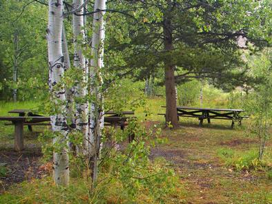
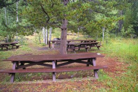
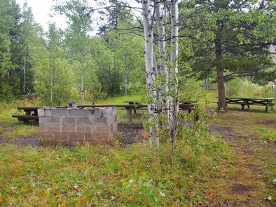
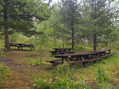
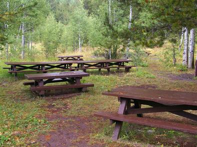
This group picnic site, located only 1/2-mile off the main highway, can accommodate up to 50 guests and 10 vehicles. Vault toilets and drinking water are provided.

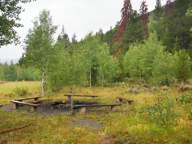
The site offers several large picnic tables, a fire ring with benches and a grill. Roads and parking spurs within the site are gravel.

Natural Features

Little White Creek runs alongside the Allred Flats at an elevation of 6,500 feet, where pines and aspens offer partial shade. Summer wildflowers are abundant and fall colors are breathtaking in the area.

The Bridger-Teton National Forest offers more than 3.4 million acres of public land for outdoor recreation. With its pristine watersheds, abundant wildlife and immense wildlands, the forest comprises a large part of the Greater Yellowstone Ecosystem, the largest intact ecosystem in the lower 48 United States.

Nearby Attractions

Salt River Pass offers miles of scenic driving with access onto Smiths Fork Road (#10072), and expansive views of the Wyoming and Salt River Ranges.

Fishing Salt Creek just across the highway is popular.

Reservation

More from CampingHiking.net:

BOCA CAMPGROUND, California Campground Images, Info & Reservations

Directions 2019 Season Access Due to Boca Dam Closure – From Truckee, start up Highway 89 north and turn right onto Prosser Dam Road at the last roundabout. Go through neighborhood, keep right at Y and go over Prosser Dam. At next 4-way intersection, turn right onto Rd 73. At

CUMMINGS CABIN, Montana Campground Images, Info & Reservations

Directions The cabin is located 8.5 miles east of Lincoln, Montana and can be reached via Hogum Creek Road, which is approximately 6 miles east of Lincoln on Highway 200. Follow Hogum Creek Road to the junction of Black Diamond Road and Lower Hogum Creek Road. Lower Hogum Creek Road

COPPERAS CREEK, Texas Campground Images, Info & Reservations

Directions From Comanche, Texas, take HWY 67/377 northeast for 5 miles, then turn left on FM 2861. Follow for 2.5 miles to the park entrance. Park entrance is on the North side of FM 2861. Phone 254-879-2498 Activities BOATING, CAMPING, FISHING, HIKING, HUNTING Keywords COPP,PROCTOR LAKE,LAKE PROCTOR,COPPERAS COVE,PROCTOR LAKE Related

CANAL CREEK, Oregon Campground Images, Info & Reservations

Directions From Waldport, Oregon, take State Route 34 east 7 miles to the campground sign at Canal Creek Rd../Forest Service Rd. 3462. Turn right onto Canal Creek Rd./FSR 3462 and go 4 miles to another campground sign and turn left into the campground. Phone 541-528-7725 Activities FISHING, HIKING, BERRY PICKING,

ASPEN GLADE, Colorado Campground Images, Info & Reservations

Directions From Antonito, Colorado, go west on Highway 17 for approximately 15 miles to the Aspen Glade Campground. Phone 435-245-6521 Activities CAMPING, FISHING Keywords ASGL,RIO GRANDE NF- FS Related Link(s) Rec Area Info & Images Colorado State Road Conditions Colorado State Tourism Overview Aspen Glade Campground sits on the Conejos