SYLVANIA WILDERNESS BACKCOUNTRY CAMPING, MI Campground Reservation, Info, Images, Map, Directions

SYLVANIA WILDERNESS BACKCOUNTRY CAMPING, Michigan Campground Images, Info & Reservations

Directions

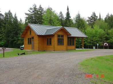
Wilderness campsites can be accessed from Sylvania Recreation Area or from entry points on the perimeter of the wilderness (see map). To reach Sylvania Entrance Station and Recreation Area: From Watersmeet, travel approximately 3.5 miles west on US 2 to County Road 535, then drive south on CR 535 approximately 4 miles to the Sylvania Wilderness and Recreation Area entrance.

Phone

906-358-4724

Activities

BOATING, CAMPING, FISHING, HIKING, HUNTING, PICNICKING, WINTER SPORTS, SWIMMING, CANOEING, CROSS COUNTRY SKIING, SNOWSHOEING

Keywords

SWBC,OTTAWA NATIONAL FOREST,WATERSMEET,SYLVANIA,SYLVANIA WILDERNESS,OTTAWA NF – FS

Related Link(s)

Rec Area Info & Images

Michigan State Tourism

Michigan State Road Conditions

Overview

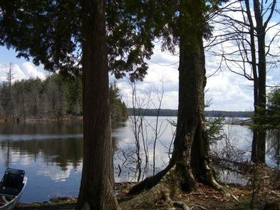
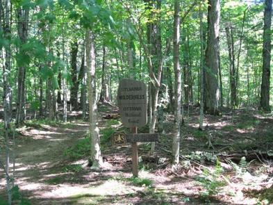
The Sylvania Wilderness encompasses 18,327 acres of primitive lands and is part of the National Wilderness Preservation System. Visitors can camp in 50 designated campsites within the Sylvania Wilderness. Visitors enjoy endless canoeing, fishing, hiking and wildlife viewing opportunities.

Recreation

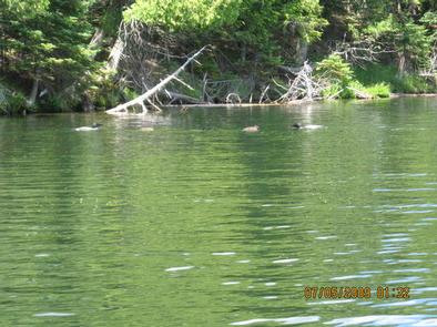
Sylvania’s abundant lakes provide plentiful non-motorized boating, canoeing, kayaking and fishing opportunities. Other popular activities include hiking and viewing wildlife.

Facilities

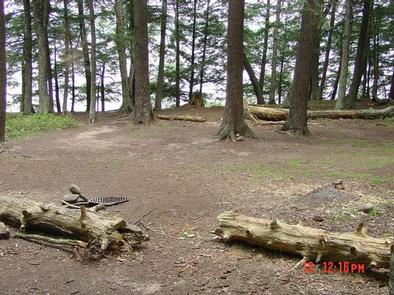
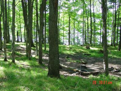
Sylvania Wilderness Backcountry Camp is not a physical campground located at one location. The 50 individual sites are located along eight lakes within the Sylvania Wilderness. Camping is allowed only at designated sites. Campsites are primitive, but each is equipped with a campfire ring and a wilderness latrine.

Natural Features

The old-growth forests and pristine lakes in the region provide habitat for a wide range of animal and plant life, including rare orchids, bald eagles, loons and osprey. The wilderness contains 34 named lakes, some with sandy beaches and others surrounded by record-size red and white pines. The Ottawa National Forest is comprised of nearly 1 million acres and is located in the western reaches of Michigan’s Upper Peninsula. The forest’s rolling, tree covered hills extend from the south shore of Lake Superior to the Wisconsin border. Lakes, rivers and waterfalls are found throughout this beautiful landscape.

Reservation

More from CampingHiking.net:

AVERY CREEK CABIN, Idaho Campground Images, Info & Reservations

Directions From I-90, take Exit 43 (Kingston); travel 23 miles north on Forest Highway 9, then continue straight for 3 miles on Forest Road 208 (2-lane paved highway) to Avery Cabin. The cabin is approximately 200 feet past milepost 26. Avery Picnic Area is directly across Forest Road 208. From

FINDLEY CAMPGROUND, California Campground Images, Info & Reservations

Directions Take Interstate 80 to the Truckee/Highway 89 North exit. Follow Highway 89 north for 17 miles, to the Jackson Meadows turnoff. Travel west on Forest Road 07 for 18 miles, to Jackson Meadows Reservoir. Proceed across the dam and continue on a paved/gravel road for approximately four miles. Turn

PIONEER POINT, California Campground Images, Info & Reservations

Directions From Bakersfield, California, take Highway 178 east to the town of Lake Isabella. From Lake Isabella take 155 north about 1.5 miles to Pioneer Point Campground. Phone 760-376-1815 Activities BOATING, CAMPING, FISHING Keywords PIOP,LAKE ISABELLA,KERN VALLEY,SEQUOIA NF – FS Related Link(s) Rec Area Info & Images California State Road

FORKS OF HUNTINGTON, Utah Campground Images, Info & Reservations

Directions The campground is 16 miles west of Huntington, Utah, along Highway 31. Phone (435)384-2372 Activities BIKING, CLIMBING, CAMPING, FISHING, HIKING, WILDLIFE VIEWING Keywords FORH,MANTI-LASAL NF -FS Related Link(s) Rec Area Info & Images Utah State Tourism Utah State Road Conditions Overview Forks of Huntington Campground is located in beautiful

WHITE STAR, Colorado Campground Images, Info & Reservations

Directions From Leadville, travel 15 miles south on Highway 24 to Highway 82. Turn right and go west 5.5 miles on Highway 82, turn left into the White Star Campground. Phone 719-486-0749 (FOR INFORMATION ONLY, NO RESERVATIONS) Activities BOATING, CAMPING, FISHING, HIKING, MOUNTAIN BIKING Keywords WSTR,TWIN LAKES,PIKE AND SAN ISABEL