CARLTON, CA Campground Reservation, Info, Images, Map, Directions

CARLTON, California Campground Images, Info & Reservations

Directions

From Downieville, travel south on Highway 49 for just over 13 miles. The campground is on the left side of the highway.

Phone

(530)478-6253

Activities

BOATING, CAMPING, FISHING, HIKING, HUNTING, WATER SPORTS, SWIMMING SITE

Keywords

CRTN,TAHOE NF – FS

Related Link(s)

Rec Area Info & Images

California State Road Conditions

California State Tourism

Overview

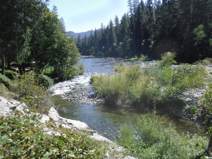
Carlton Campground is located along the North Yuba River, adjacent to Highway 49 and 13 miles from Downieville. Visitors enjoy a wide variety of recreational activities in the area, including hiking, hunting, fishing, canoeing and biking. This facility is operated and maintained by the Tahoe National Forest.

Recreation

The North Yuba River offers swimming, wading and rainbow trout fishing. Seasonal rafting and kayaking are popular water activities. A network of trails through the surrounding area providing opportunities for hiking, biking and OHV use.  The North Yuba River Trail can be accessed from the nearby Rocky Rest trailhead.

Facilities

The campground offers single-family campsites suited for both tent and trailer camping. Each site is equipped with a picnic table and campfire ring. Vault toilets and drinking water are provided.

Natural Features

The campground stretches along the North Yuba River, next to the highway.  Stands of cedar, ponderosa pine and oak trees cover the area providing shade from the afternoon sun. 

Reservation

More from CampingHiking.net:

Rim Campground, Arizona Campground Images, Info & Reservations

Directions Located on Road 300 approximately 1 mile off of High 260. Phone 928-535-9859 Activities BOATING, CAMPING Keywords Related Link(s) Rec Area Info & Images Arizona State Road Conditions Arizona State Tourism Overview Rim Campground is situated close to the edge of the Mogollon Rim. Spectacular 100-mile views are seen

TWIN CREEKS PICNIC PAVILION, Tennessee Campground Images, Info & Reservations

Directions From downtown Gatlinburg Tennessee, Turn south at stoplight #8 in Gatlinburg. Follow Historic Nature Trail Road to 4-way junction at access road to Park Vista Hotel. Go straight and continue 1.4 miles into the Park. turn right at Twin Creeks sign. Phone 865-436-1261 Activities CAMPING, FISHING, HIKING, WILDLIFE VIEWING,

ANDERSON MEADOW CAMPGROUND, Utah Campground Images, Info & Reservations

Directions Travel east of Beaver approximately 10 miles on SR 153, turn right on to Forest Road 137 for about 8 miles. Phone 435-438-2436 Activities CAMPING, FISHING, WILDLIFE VIEWING Keywords Anderson Meadow Campground,Anderson Campground Related Link(s) Rec Area Info & Images Utah State Road Conditions Utah State Tourism Overview Anderson

HANKS CREEK, Texas Campground Images, Info & Reservations

Directions From Zavalla, TX, take State Hwy 147 northeast for 1/4 mile, then turn north on FM 2109, go 8 miles to FM 2801. Turn right (east) on FM 2801 and go 2 miles to the park entrance. Follow signs into the campground. Phone 409-384-5716 Activities BIKING, BOATING, CAMPING, FISHING,

BURNS RUN WEST, Oklahoma Campground Images, Info & Reservations

Directions From Highway 75 in Denison, Texas, take Exit 72 to Highway 91, travel north on 91 across Denison Dam, 5 miles. Take the second left, follow signs for about 1.5 miles. Physical address: 825 West Burns Run Road, Cartwright, OK 74731 Phone 580-965-4922 Activities CAMPING, SWIMMING SITE Keywords BURW,TEXOMA