

Directions
From Wytheville, VA, follow I-77 north to Exit 47. Turn left onto Route 717 and drive 4 miles to Stony Fork Campground. Total travel distance is 10 miles.
Phone
276-783-5196
Activities
BIKING, CAMPING, FISHING, HUNTING, WILDLIFE VIEWING
Keywords
SFCA,GEORGE WASHINGTON/JEFFERSON NF-FS
Related Link(s)
Virginia State Road Conditions
Overview
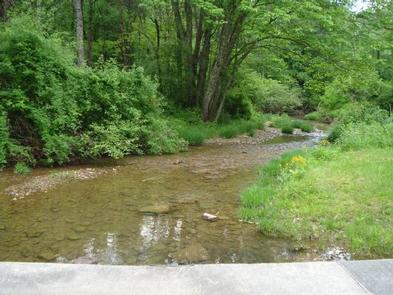
Stony Fork, tucked in a dense forest setting, is located at the foot of Big Walker Mountain beside the Big Walker Mountain Scenic Byway. The East Fork of Stony Fork Creek winds through the campground, providing a serene setting for trout fishing and water play for visitors at the welcoming campground.
The 1 mile Stony Fork Nature Trail takes campers through groves of pine and hardwoods, and the campground loop road makes for a scenic walk, too.
Recreation
The Big Walker Mountain Scenic Byway is an incredible drive for viewing blooms of rhododendron, azalea and mountain laurel in spring, and fiery red and gold foliage in fall. Scenic overlooks highlight views of Mount Rogers and many ridges and valleys. A horseshoe pit at the campground provides hours of fun for families. Experienced hikers love the Seven Sisters Trail, approximately 5 miles, which leads from the campground to the top of Little Walker Mountain, then onto the Scenic Byway.
Facilities
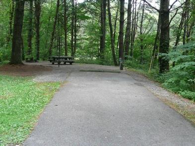
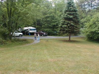
Volunteer hosts are on hand to answer questions and make campers feel welcome. Campsites are ideal for both RV and tent camping. Warm showers and flush toilets are available, plus parking aprons are paved. Most sites come with electric hookups.
Natural Features
Stony Fork sits in a valley of the Appalachians at a 2,400 foot elevation. Its creekside setting provides a peaceful soundtrack of running water. In springtime, wildflowers and rhododendron dot the region with spectacular colors, and fall is reliably scenic with its red and yellow foliage.
Nearby Attractions
Within 10 miles of the campground, hike the popular Appalachian Trail, which extends more than 2,175 miles throughout the Appalachian Mountains across 14 states. It is the first trail designated as a National Scenic Trail. There is an outdoor shooting range a few miles from the campground.