
Directions
Visitors can get to the island via passenger ferry or private watercraft. The ferry departs from Grand Island Landing on the mainland, located on State Route 28. Look for the Grand Island National Recreation Area signs. Prices and schedules vary from season to season. For information or reservations, call 906-387-3503 or click here.
Juniper Flats is located approximately 4 miles from where the ferry boat docks at Williams Landing. Visitors must hike or bike from the landing to Juniper Flats. Private vehicles and off-road vehicles are not allowed on the island. The campground is also accessible by kayaking to Waterfall Beach and walking 1,000 feet to the site.
Phone
906-387-2512
Activities
BIKING, BOATING, HISTORIC & CULTURAL SITE, CAMPING, FISHING, HIKING, HUNTING, WILDLIFE VIEWING, FIRE LOOKOUTS/CABINS OVERNIGHT, SWIMMING SITE
Keywords
Grand Island Group Site,Juniper,JUNIPER FLATS GROUP CAMPSITE on GRAND ISLAND (MI),Juniper Flats,Juniper Flats Group,GRAND ISLAND NATIONAL RECREATION AREA
Related Link(s)
Michigan State Road Conditions
Overview
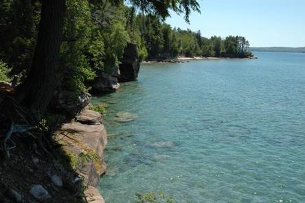
Juniper Flats Group Campground is one of only a few places to stay on beautiful Grand Island. The island’s scenic natural beauty and interesting history make it a popular place for camping and other outdoor activities.
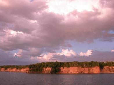
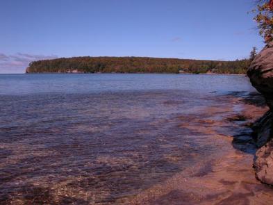
The Grand Island National Recreation Area boasts massive 300-foot wave-cut sandstone cliffs, 13,500 acres of lush forest, beaches of fine sand, winter ice caves and historic buildings and artifacts dating back as far as 2000 B.C.
Recreation
The island offers more than 30 miles of hiking and mountain biking trails, complete with spectacular scenery. Visitors also enjoy fishing on the island. Anglers will find plentiful salmon, trout, perch, pike, walleye and bass. A variety of wildlife also make its home on the island.
Kayaking, canoeing and boating are also popular pastimes. Boats, however, must be anchored offshore because of the rocky lake bottom and heavy surf.
Facilities
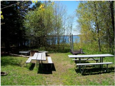
The campground provides one large group tent campsite, equipped with tables and a campfire circle. Vault toilets and drinking water are provided. Bear poles and bear boxes are available for food storage.
Natural Features
Juniper Flats Group Campground is located on the west side of Grand Island near the Waterfall and Mather beaches.
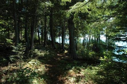
The area is heavily forested and primarily shady throughout the day. The campground is situated away from the beach, but the lake is visible from the site.