
Directions
From Highway 160, turn north on Highway 150 and follow for 16 miles to the entrance of Great Sand Dunes National Park & Preserve. Continue 5 miles north on the park’s main road to reach the campground entrance.
From Highway 285, turn south onto CO-17 and follow for 36 miles. Turn east onto Lane 6 and follow for 16 miles to Highway 150. Turn north onto Highway 150 and follow for 2.6 miles to the entrance of Great Sand Dunes National Park & Preserve. Continue 5 miles north on the park’s main road to reach the campground entrance.
Phone
1-877-444-6777
Activities
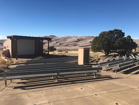
CAMPING, HIKING, STAR GAZING, BIRDING, EVENING PROGRAMS, AMPHITHEATER, EDUCATIONAL PROGRAMS
Keywords
PINYON (Pinon) FLATS CAMPGROUND,THE DUNES,SAND DUNES,Pinon Flats Campground,Pinon Flats Campground,Pinon,PINON
Related Link(s)
Colorado State Road Conditions
Overview
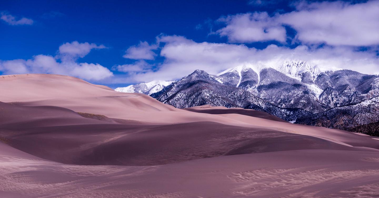
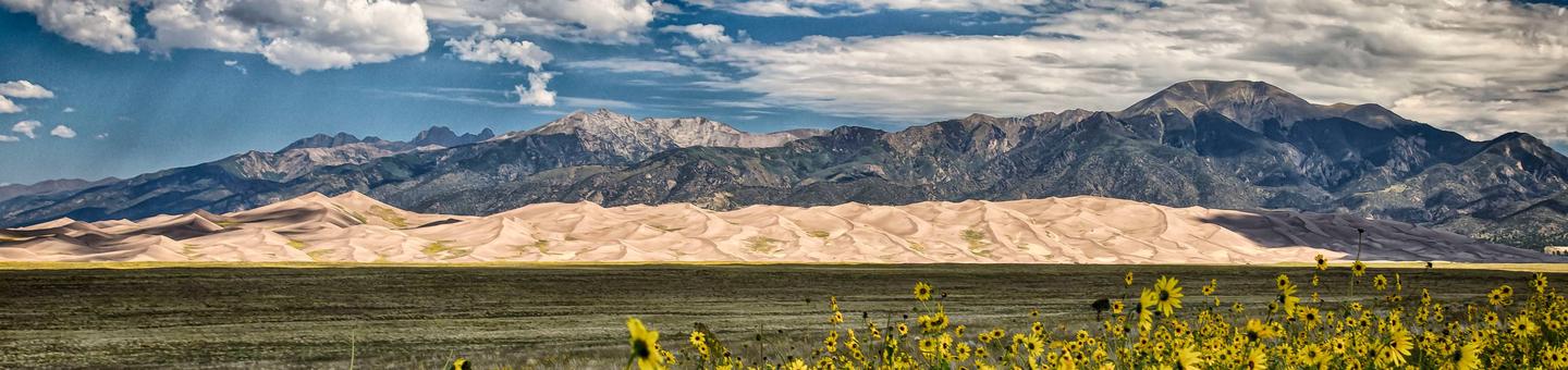
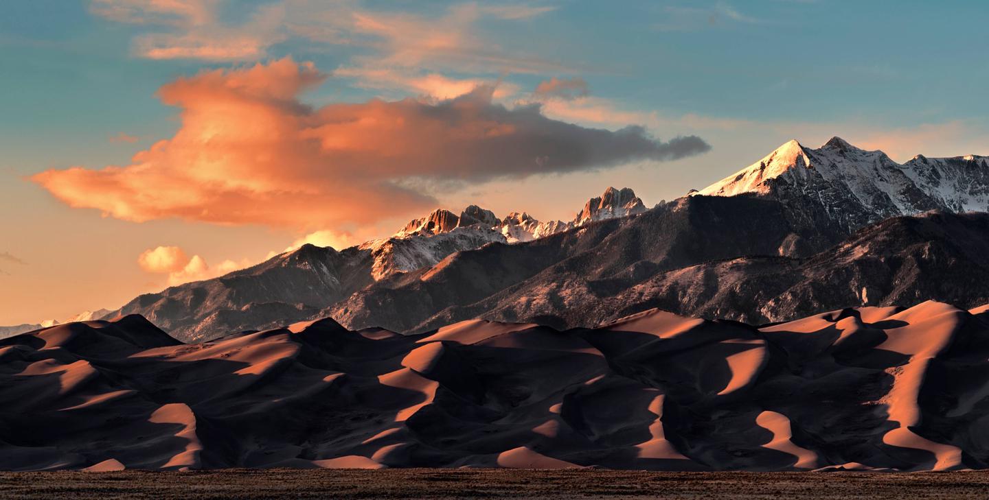
Pinon Flats Campground is located in Great Sand Dunes National Park & Preserve in southern Colorado. The huge dunes are the tallest in North America and comprise about 11 percent of an enormous sand deposit that covers more than 330 square miles.
The dunes have long stood as a landmark for travelers from ancient North Americans to Southern Ute, Jicarilla Apaches, Navajos, early explorers, gold miners, homesteaders, ranchers, farmers and migrant field workers, to you – today’s park visitor.
Recreation
Great Sand Dunes’ wide range of natural features provides endless outdoor recreational activities. The park is perfect for kids, who love exploring the dunefield on foot or by sled. Medano Creek, at the base of the dunes, is a popular place in the summertime. Kids and adults alike love to splash in the cool water.
Many kid-friendly, ranger-led activities and a junior ranger program are available.
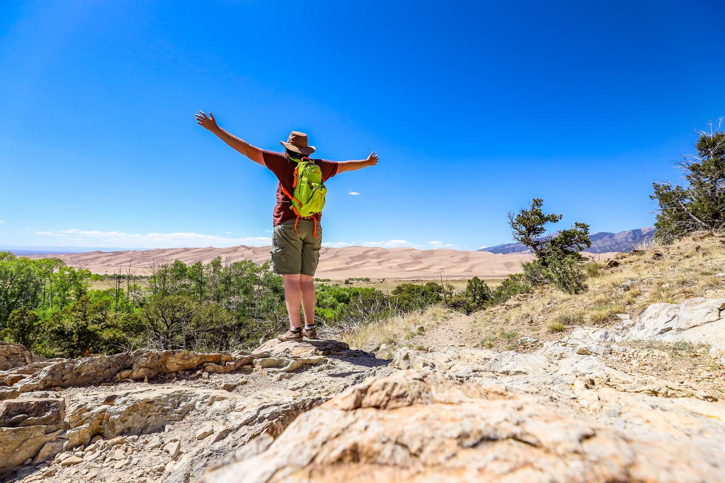
Many miles of hiking and backpacking trails lead through the park’s forests and alpine terrain, including the Mosca Pass Trail, Dunes Overlook/Sand Ramp Trail and Indian Grove Trail.
Facilities
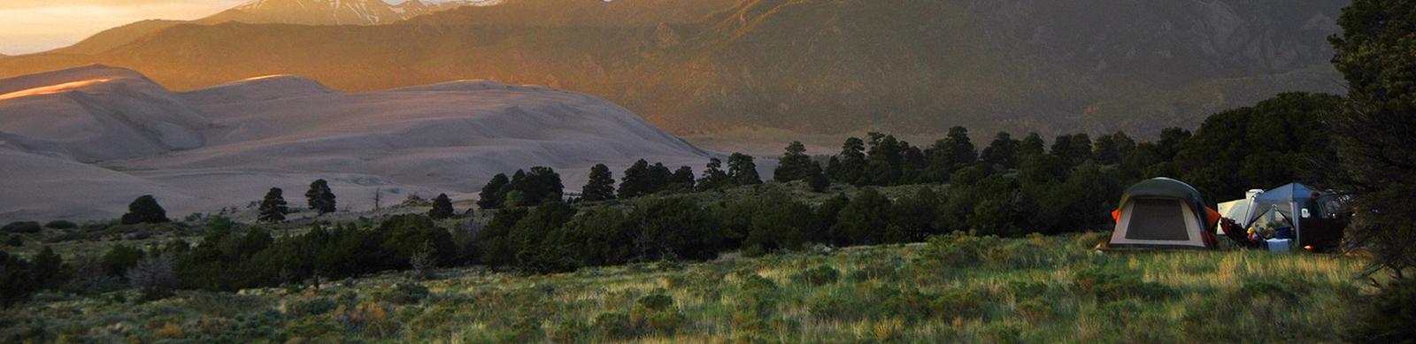
Pinon Flats campground offers 86 campsites; all are available to reserve in advance. Sites that are not reserved will be offered on a first-come, first-serve basis at the park. The park recommends making a reservation in advance, especially for peak summer weekends and holidays. Private first-come, first-served camping is also available just outside the park boundary. For more information about camping, visit www.nps.gov/grsa/planyourvisit/camping.htm. During visitor center operating hours, you can see a park film, experience interactive exhibits, speak with a helpful ranger and visit the Western National Parks Association store. Kids of all ages can pick up a Junior Ranger booklet or participate in the Junior Ranger Explorer program.
Natural Features
Great Sand Dunes are the magnificent centerpiece of a natural system that includes high mountain peaks, sparkling streams, vast grasslands and lush forests.
The campground is situated among pinon pines and sagebrush beneath the majestic Sangre de Cristo Mountains. Most sites have beautiful views of the snow-covered peaks.
A wide variety of grasses and wildflowers can be found throughout the area, and mule deer are commonly seen in and around the campground.
Nearby Attractions
Zapata Falls is just south of the national park off Highway 150. A short but slippery 1/2-mile hike leads to a 25-foot high cascade. Simply driving to the trailhead provides an excellent view of the entire dunefield and San Luis Valley, especially at sunrise or sunset. San Luis State Wildlife Area is located at the western edge of Great Sand Dunes National Park. It features a large natural lake popular for boating, water skiing, sailing, windsurfing and fishing.