

Directions
There are several ways to drive to the Buckeye Recreation Area, all requiring driving on dirt and graveled roads that can become quite muddy, if not impassable, af after storms. The site can be accessed from the north via the Taylor Flat Road via the Castleton-Gateway Road. From the west the area can be accessed from either the Upper or Lower Two Mile Roads. The primary access is through the town of Paradox, Colorado (which is just north of Highway 90). Take the paved County U5 Road at the west end of town to the forest boundary; the road then becomes the unpaved Forest Road 0371 which you take for approximately 7 miles to the Recreation Area.
Phone
1-435-587-2041
Activities
CAMPING, FISHING, HUNTING, WILDLIFE VIEWING, DAY USE AREA, PADDLING, PADDLE BOATING, WATER ACTIVITIES, KAYAKING, CANOEING, STAR GAZING, WATER ACCESS, OFF HIGHWAY VEHICLE TRAILS
Keywords
Buckeye Reservoir,reservoir
Related Link(s)
Colorado State Road Conditions
Overview
The Buckeye Recreation Area is located adjacent to Buckeye Reservoir in Montrose County, Colorado. The area is popular for camping, OHV/ATV trails, hunting and fishing.
Recreation
Recreation in the area centers around the reservoir which provides excellent opportunities for fishing and canoeing. Forest roads in the area provide for off-highway vehicle touring and the nearby state lands provide motorized trails for Off-highway vehicles and motorcycles. The La Sal Mountains are nearby which provide many hiking and biking trails.
Facilities
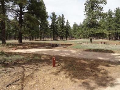
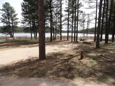
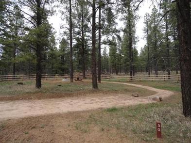
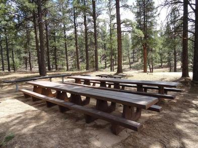
The Buckeye Recreation Area is located adjacent to Buckeye Reservoir. The Recreation Area is spread out around the reservoir and consists of the Pioneer Campground (30 single family reservable campsites), a boat ramp for small fishing boats (5 HP motor limit and wakeless speed), a reservable group site, a day-use picnic area and 18 less developed dispersed campsites scattered around the reservoir. Campsites in the Pioneer Campground include graveled parking spurs, concrete picnic tables, fire rings, a utility table and access to vault toilets. There is a 14 day stay limit at this campground.
Natural Features
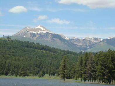
The recreation area is located in a valley at 7,600 feet in elevation and is set amongst mature stands of Ponderosa Pines. The high peaks of the La Sal Mountains are visible from much of the area. The scenic Paradox Valley and the town of Paradox, Colorado are located approximately 10 miles to the southeast.
Nearby Attractions
The scenic La Sal Mountains are very close to the area and provide numerous opportunities for recreation. Canyonlands and Arches National Parks are about 1.5 hour drive away from the area as well as numerous recreation opportunities around the towns of Monticello and Moab, Utah.