Lookout Campground, CA Campground Reservation, Info, Images, Map, Directions

Lookout Campground, California Campground Images, Info & Reservations

Directions

From Truckee, CA travel east on I-80. Take Exit 2 toward Verdi, NV. Turn right on 3rd St./US 40. Travel 1 mile then turn left on Bridge St. From Reno, NV travel west on I-80. Take Exit 5 toward Verdi, NV/State Route 425. Stay on Route 425 for 2.5 miles. Turn right on Bridge St. NOTE: Bridge Street has 2 one lane bridges with a maximum allowable height of 13 feet. Travel 0.6 miles on Bridge St, then turn right on Dog Valley Road. This road will turn into a dirt forest road (Road #002). Travel 7.2 miles. This road can be rough and often develops washboards. It can be navigated with 2-wheel drive (although low clearance vehicles are not recommended). Continue to follow signs to campground.

Phone

(775) 882-2766

Activities

CAMPING

Keywords

Related Link(s)

Rec Area Info & Images

California State Road Conditions

California State Tourism

Overview

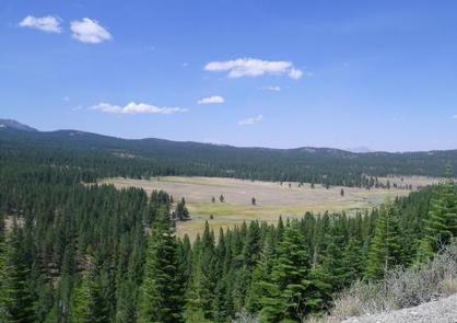
Lookout Campground is located on the California/Nevada border just west of Reno, Nevada. It sits at an elevation of 6,770 feet in a large aspen grove. It is not a highly developed campground, but it is considered a secret hideaway by those lucky enough to know about this remote gem.

Recreation

Adjacent to the campground is ‘Crystal Peak’, which can be accessed by vehicle or a short hike. This area is also popular for off-highway vehicles, wildlife viewing, and hunting opportunities.

Facilities

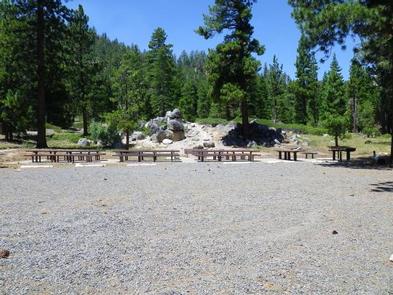
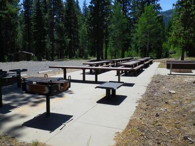
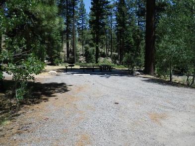
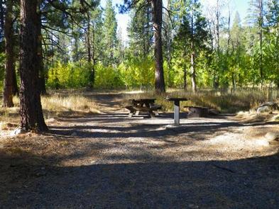
This campground has 17 first-come, first-served campsites (including two double sites) and one reservable group picnic area that can accommodate up to 100 people. Each campsite has a picnic table, fire ring, grill, and tent pad. There are four vault toilets and trash service. There are no electric hookups and no dump stations. Trailers and RVs should be limited to 15 feet in length (however, two sites could accommodate up to 30 foot lengths). To ensure that campfires are extinguished completely, there is non-potable water available on site (no drinking water available). Please bring your own firewood as none is available on site.

Natural Features

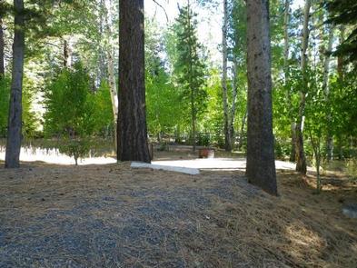
Visitors to this campground will be surrounded by a lush aspen, pine, and fir forest. Sites are well spaced to afford visitors plenty of privacy.

Nearby Attractions

Crystal Peak is known for its impressive crystal formations. Dog Valley and Peavine Mountain are popular off-highway vehicle and mountain biking areas. The American Discovery Trail also runs through this area.

Reservation

More from CampingHiking.net:

THIRTY MILE, Colorado Campground Images, Info & Reservations

Directions From Alamosa, go west on US 160 to South Fork. Turn northwest on State Highway 149 through Creede. Continue on Highway 149 to mile marker 41, turn west (gravel road) on Rio Grande Reservoir Road and continue for 12 miles to Thirty Mile Campground. Phone 719-658-0829 Activities CAMPING, FISHING

NOISY CREEK, Washington Campground Images, Info & Reservations

Directions Campground is located ninety miles north of Spokane, Washington. From the junction of State Highway 20, take Highway 31 north for three miles to the junction of the Sullivan Lake Road (County Road 9345Follow the Sullivan Lake Road for 8 miles to the campground entrance. The campground is located

KASPIAN CAMPGROUND, California Campground Images, Info & Reservations

Directions The campground is located 4 miles south of Tahoe City, on California Highway 89. Phone 530-583-3642 Activities BIKING, BOATING, CAMPING, INTERPRETIVE PROGRAMS, FISHING, HIKING, WATER SPORTS, SWIMMING SITE Keywords KASP,LAKE TAHOE,WEST SHORE,LAKE TAHOE BASIN – FS Related Link(s) Rec Area Info & Images California State Road Conditions California State

SALMON LAKE CABIN SITKA, Alaska Campground Images, Info & Reservations

Directions Accessible nearly year round, depending on mode of access. Located 11 miles southeast of Sitka on Baranof Island, approximately 10 minutes by floatplane. Access by boat from Sitka to Silver Bay is 10 miles, and a 2-mile trail leads to the cabin. Trail begins near mooring buoy at the

CAPE PERPETUA, Oregon Campground Images, Info & Reservations

Directions Campground is located North of Florence, Oregon along Highway 101, 22 miles north of Florence, Oregon and 3 miles south of Yachats, Oregon. Campground is located on the east side of the highway in the Cape Perpetua Scenic area. After turning off Highway 101, take a right at the

LAKE HILL, Utah Campground Images, Info & Reservations

Directions Located approximately 5 miles east of Ephraim, Utah on Forest Highway 8 in Ephraim Canyon. Phone 435-283-4151 Activities BOATING, CAMPING, FISHING, HIKING Keywords LAKH,MANTI-LASAL NF -FS Related Link(s) Rec Area Info & Images Utah State Tourism Utah State Road Conditions Overview Lake Hill Campground is situated next to pretty