

Directions
From Phoenix, Arizona, Take I-17 north for 61.8 miles. Take exit 262 toward Cordes Junction/Prescott. Merge onto State Route 69 west and follow for 33.8 miles. At the split, take the ramp for Route 89 south. Turn slight left onto East Gurley Street/89 and follow for about 0.8-mile. Turn left at Mt. Vernon Street (Senator Highway, County Road #56) and continue for 7.2 miles to Horse Camp on the right. Groom Creek Loop Trailhead #307 is east of the campground, across Forest Road #52.
From downtown Prescott, Take Gurley Street east to Mt. Vernon Avenue. Take Mt. Vernon (Senator Highway, County Road #56) south for about 7.2 miles to Horse Camp on the right. Groom Creek Loop Trailhead #307 is east of the campground, across Forest Road #52.
Phone
1 (877) 444-6777
Activities
CAMPING, HORSEBACK RIDING, VISITOR CENTER
Keywords
GROOM CREEK HORSE CAMP,HORSE CAMP,GROOM CREEK
Related Link(s)
Overview
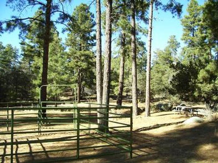
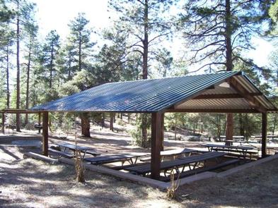
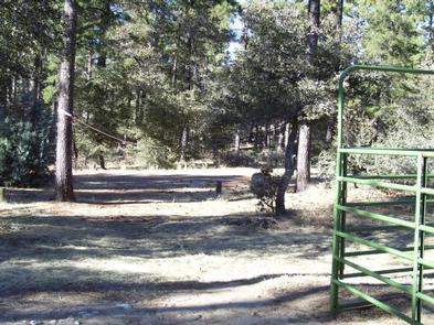
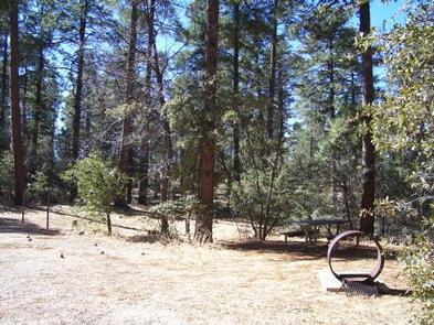
Equestrian campers will find Groom Creek Horse Camp seven miles south of Prescott, Arizona at an elevation of 6,398 feet. The ponderosa pine setting, nearby trails and limited equestrian camping opportunities make this a popular destination. Each campsite has a steel corral enclosure and an overhead tether line that accommodates two to four horses. Two group picnic sites are also available for reservation for group gatherings within this campground. To make reservations click on the availability button to the right to book this site or call 1 (877) 444-6777. For general horse camp questions contact the Bradshaw Ranger District at 1 (928) 443-8000.
Recreation
Three trails are in close proximity to Groom Creek Horse Camp. Horse Camp Loop Trail 383 (2 miles) is accessed from Loop C, across from the group site or at the campground’s entrance. Wolf Creek Loop Trail 384 (5 miles) is accessed from Horse Camp Loop Trail 383 and from Forest Service Road C101. Groom Creek Loop Trail 307 (9 miles) is accessed from the trailhead across from the entrance to Horse Camp. These trails are shared with other users including mountain bikers and hikers. Off-highway vehicle use occurs on designated roads and trails.
Facilities
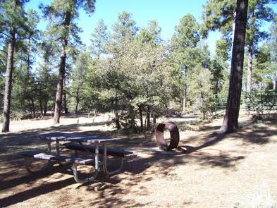
Horse Camp has two reservable loops (Loops B and C) and one first-come, first-serve loop (Loop A). Each of the 30 campsites in Loop B and C have a picnic table, steel fire ring, 16’x16′ steel corral, and an overhead tether line. Of the 30 campsites, 27 campsite driveways are pull-through, three driveways are back-in, and all have packed gravel surfacing. The internal access roads are also packed gravel. Four vault toilets, five trash dumpsters, and six water faucets service the campground. Nearly all water faucets are located at a vault toilet. Facilities are not accessible for persons with disabilities.
A reservable group site is located in Loop B and one in Loop C. The group site in Loop B has six picnic tables, five pedestal fire grills, one group fire ring, and limited parking for a maximum of two vehicles. Trailers cannot be accommodated. The group site in Loop C has a steel ramada with six picnic tables, a steel ramada-covered cooking area with two triple cooking surface fire pedestal grills, water faucet, one large and one small steel fire ring, overhead tether line, a 16’x16′ steel corral, and limited parking for a maximum of two vehicles.
Natural Features
Horse Camp occupies an area dominated by ponderosa pine mixed with alligator juniper, oak species, and a variety of forbs and native grasses. Colorful wildflowers bloom in the spring, and during the summer monsoon seasons. Visitors may see a variety of wildlife including deer, mountain lion, bobcat, coyotes, fox, rabbits, lizards, snakes, and birds.
Nearby Attractions
Prescott is a 15 minute drive from Horse Camp. Many activities including arts, crafts and music festivals are scheduled throughout the summer. Goldwater Lake, located within minutes of Horse Camp, is managed by the City of Prescott. The City of Prescott’s recreation pass and day-use fee should not be confused with the Prescott National Forest Day-Use Passes or day-use fee.