JIM CREEK GROUP CAMPGROUND, OR Campground Reservation, Info, Images, Map, Directions

JIM CREEK GROUP CAMPGROUND, Oregon Campground Images, Info & Reservations

Directions

Travel north on Highway 62 for approximately 6 miles. Turn left on Forest Road 68 for approximately 2 miles. Immediately after crossing the Rogue River, turn left on Forest Road 64 for approximately 0.5 mile. Turn right on Forest Road 6470 for approximately 0.1 mile. Turn right into Jim Creek Group Campsite (Forest Road 6470.100, behind locked gate). Parking is limited; leave ample room for turnarounds. Jim Creek Group Site is approximately 8.5 miles from the Prospect Ranger Station.

Phone

541-560-3400

Activities

HIKING, SWIMMING, MOUNTAIN BIKING, OFF ROAD VEHICLE TRAILS

Keywords

JIM CREEK GROUP CAMPGROUND

Related Link(s)

Rec Area Info & Images

Oregon State Road Conditions

Oregon State Tourism

Overview

Jim Creek Group Campground provides your group with a peaceful camping experience on the Rogue River-Siskiyou National Forest.

Recreation

A popular day use area with access to the Upper Rogue River Trail is just a few minutes away. This trail traverses the scenic section of the upper Rogue River and provides fishing access in many places. A managed off-highway vehicle (OHV) trail system with two play areas and an OHV friendly campground are within a few minutes drive of this group campground.
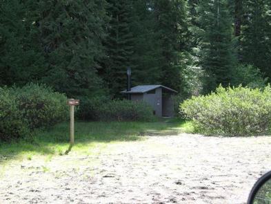
Facilities

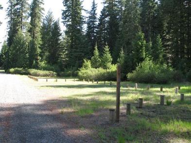
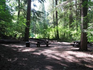
Jim Creek Group Campground is a rustic site with limited amenities. The campground accommodates tents only and up to 40 people. Picnic tables and campfire rings are available as well as a vault toilet just a short hike down the trail set away from the camp area. No water or garbage service is available.

Natural Features

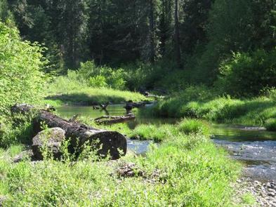
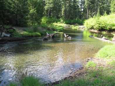
This campground is very secluded and is set in an old growth grove of Douglas-fir trees adjacent to Abbott Creek. Abbott Creek, a tributary of the Rogue River, offers a sandy beach and swimming and wading during hot summer days.

Nearby Attractions

Visit Crater Lake National Park and learn about its unique natural and cultural history. At a depth of 1,943 feet, Crater Lake is the deepest lake in the United States and one of the ten deepest lakes in the world.

Experience 172 miles of river and mountain landscapes along the Rogue-Umpqua Scenic Byway. Travel from rolling oak-covered hills and towering coniferous forests, to roaring white water rapids and incised inter-canyon lava flows. The highway travels alongside the Upper Rogue and North Umpqua Wild and Scenic Rivers that contain world-class fisheries.

Reservation

More from CampingHiking.net:

KADING CABIN, Montana Campground Images, Info & Reservations

Directions Located 25 miles southwest of Helena, Montana in the Little Blackfoot drainage, the cabin can be reached via US Highway 12, turning left (south) onto Little Blackfoot River Road just east of Elliston. From this intersection, it is approximately 16 miles to the cabin. The cabin is located on

BERRY BEND, Missouri Campground Images, Info & Reservations

Directions From Z Highway, travel approximately 2 miles south on the Berry Bend Access Road. Phone 660-438-3872 Activities BOATING, CAMPING, FISHING, HIKING, FISH HATCHERY, SWIMMING SITE Keywords BERR,TRUMAN LAKE,BERRY BEND SOUTH,HARRY S TRUMAN Related Link(s) Rec Area Info & Images Missouri State Road Conditions Missouri State Tourism Overview Berry Bend

CLEAR CREEK GUARD STATION, Idaho Campground Images, Info & Reservations

Directions From Montpelier, take Highway 89 east for 7 miles. At the Montpelier Reservoir (Crow Creek Road)/ Forest Road 111, turn north and travel 13 miles to the guard station. Maps are available upon request at the district office. From Afton, Wyoming, take Highway 89 south and turn right on

BELLE STARR, Oklahoma Campground Images, Info & Reservations

Directions From Eufaula, Oklahoma, take Highway 69N to the OK-150 exit toward Texanna Road/State Park/Lake Eufaula.Turn right onto E1140 Rd/Texanna Rd. Travel east for 2 miles, turn right onto Belle Starr Rd/Northsouth 420, travel south for 2 miles and you will arrive at Belle Starr Campground. Phone 918-799-5843 Activities BOATING,

MATHEWS ARM CAMPGROUND, Virginia Campground Images, Info & Reservations

Directions From Washington, D.C. metro area, travel west on Interstate 66 to exit 43A. Take US Highway 29 South to Warrenton, Virginia, then take US Highway 211 west for 28 miles to Shenandoah National Park and Skyline Drive Thornton Gap Entrance. Follow Skyline Drive north approximately 9 miles and turn

OLD FOLKS FLAT, Utah Campground Images, Info & Reservations

Directions The campground is located 21 miles from Huntington, Utah, along Highway 31. Phone 435-384-2372 Activities BIKING, CAMPING, HIKING, WILDLIFE VIEWING Keywords OLFF,MANTI-LASAL NF -FS Related Link(s) Rec Area Info & Images Utah State Road Conditions Utah State Tourism Overview Old Folks Flat Campground is nestled in beautiful Huntington Canyon