

Directions
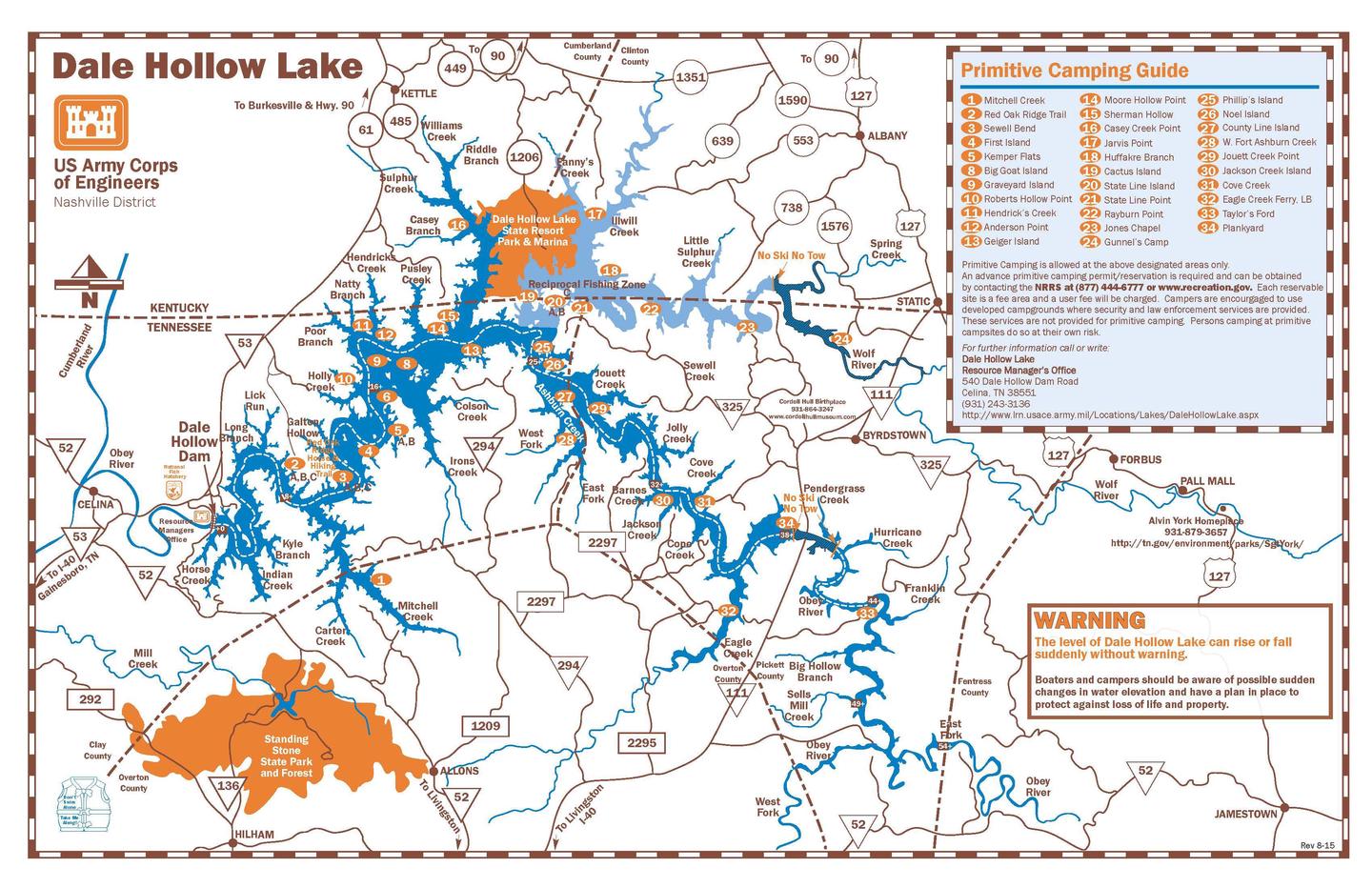
Camping locations are dispersed throughout Dale Hollow Lake. Reference primitive camping map or site details for information on how to get to the specific site. Mailing and contact information is for the Resource Manager’s Office.
Phone
DALE HOLLOW LAKE RESOURCE MANAGERS OFFICE-931-243-3136. SHERIFF’S DEPARTMENT EMERGENCY CONTACTS: CLAY COUNTY 931-243-3266 OVERTON COUNTY 931-823-5404 PICKETT COUNTY 931-864-3210 CLINTON COUNTY 606-387-5111 CUMBERLAND COUNTY 270-864-4141
Activities
CAMPING, FISHING, WATER SPORTS, SWIMMING
Keywords
DALE HOLLOW LAKE – PRIMITIVE CAMPING,DALE HOLLOW LAKE,DALE HOLLOW,PRIMITIVE CAMPING,SHORELINE CAMPING,REMOTE CAMPING
Related Link(s)
Tennessee State Road Conditions
Overview
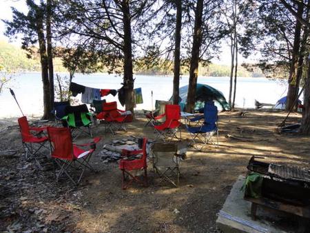
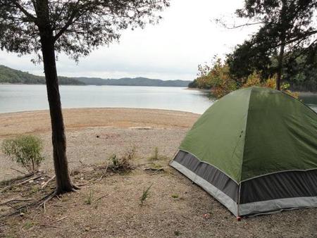
Dale Hollow Lake Primitive Camping is a unique series of 32 locations with a total of over 70 individually designated family campsites dispersed over 620 miles of shoreline. Campsites are located in both the states of Tennessee and Kentucky. Primitive camping offers a unique rustic lake front camping experience. Remote locations along the shoreline offer campers a peaceful nature experience. Most designated tent sites are accessible only by boat; while a few can be reached by country road.
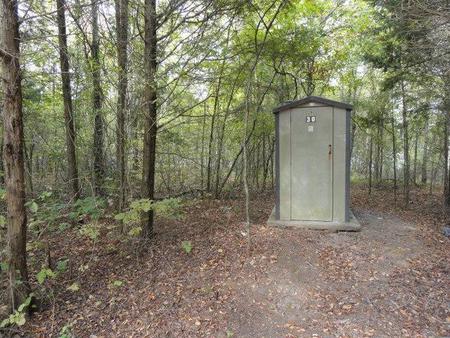
Campers are advised that these areas are remote, primitive sites. Toilets are vault/pit type outhouses. Campers desiring on-site attendant, security and law enforcement services are encouraged to use developed campgrounds where such services are provided. These services are not provided for primitive camping.
Recreation
Dale Hollow Lake, with its crystal clear water and forested hillsides, is an outdoor enthusiast’s paradise. Dale Hollow is renowned for its fishing opportunities and holds the world record for smallmouth bass and is known as a trophy smallmouth lake. Boating and water skiing are popular activities, and with 27,700 surface acres of water and 620 miles of shoreline, there is plenty of space for campers to explore the lake.
Facilities
Primitive camping sites are remote and accessible by boat; a few have vehicle access. Each location is designated and marked. Each area has a vault or pit type toilet and a ground grill or fire circle. Tent camping is permissible within the designated areas. Cove Creek, Eagle Creek Ferry, Gunnel’s Camp, Jones Chapel, Plank Yard, Red Oak Ridge A, and Taylors Ford are the only locations which provide for vehicle access. All areas are considered pack-it-in, pack-it-out locations with minimal services. Campers are expected to bring plenty of water and garbage bags. Cove Creek is the only location with drinking water.
Camping is limited to a 14-day stay within a 30-consecutive day period.
Natural Features
Dale Hollow Dam and Lake was completed in 1943. Although the dam was built for flood control and power generation, it has now become a recreational oasis for more than 3 million visitors each year. The dam is located on the Obey River, about three miles east of Celina, Tennessee. Surrounded by a thick expanse of forest, the clear blue lake creates a stunning scenic backdrop for a variety of water and land recreational activities. In the late fall through early spring, the American bald eagle can be spotted flying overhead or perched on low-lying limbs. Dale Hollow hosts the second-largest wintering eagle population in the states of Tennessee and Kentucky.
Charges & Cancellations
Full rules and reservation policies for fees associated with changes and cancellations can be found at https://www.recreation.gov/rules-reservation-policies
There is no fee to make a reservation.
- A $10 service fee will be withheld from any refund for a cancellation.
- A $10 service fee may be charged to changes made to an existing reservation (see full policies for when this is applicable).
- A customer who cancels a reservation the day before or on the day of arrival will pay a $10.00 service fee AND forfeit the first night’s use fee (not to exceed the total paid for the original reservation).
- No-shows are assessed $20.00 service fee and forfeit the first nights recreation fee for a campsite.
- Applicable fees, including service/cancellation fees and change fees, are non-refundable and subject to change.
- No refunds for recreation use fees may be made locally at the lake.