
Directions
From the North: Driving from Albuquerque or Farmington, NM, drive on Highway 550, exit to County Road (CR)7900 at mile marker 112; drive CR 7900 then turn westbound to CR 7950 which will turn into a dirt road after three miles. Drive 13 miles of dirt road to reach Chaco Culture NHP.
From the South: Exit Highway 9 to State Road 57. State Road 57 is a rough dirt road for about 20 miles before reaching Chaco Culture NHP. South entrance is not recommended during inclement weather.
Phone
505-786-7014 x221
Activities
BIKING, HISTORIC & CULTURAL SITE, CAMPING, INTERPRETIVE PROGRAMS, HIKING, DAY USE AREA
Keywords
Gallo Campground,Chaco Culture National Historical Park – Gallo Campground,Chaco Culture National Historical Park,Chaco,Chaco Culture,Chaco Canyon
Related Link(s)
New Mexico State Road Conditions
Overview
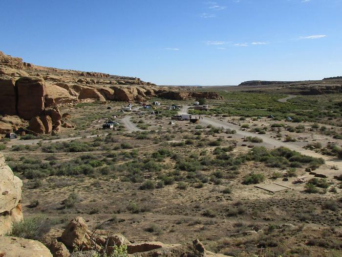
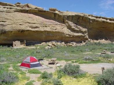
Gallo Campground is located within Chaco Culture National Historical Park. Tucked among the fallen boulders and cliffs of Gallo Wash, the campground offers camping in a rugged environment, surrounded by petroglyphs, a cliff dwelling, inscriptions and a high desert landscape. The area is remote with no services. Please be prepared with plenty of food, water, shade, sunscreen and cold weather necessities.
Recreation
The Visitor Center is located one mile from the Gallo Campground which offers a staffed information desk. There is an additional charge for Park entry separate from the camping fees. All campers are required to pay entrance fee at the Visitor Center. The Visitor Center offers a brief introductory information, a 25-minute introductory video and a bookstore with many selections of educational materials, books and gift items. After checking in at the Visitor Center, one can drive the canyon loop road where there are six front country and our backcountry hiking trails that lead to ancient cultural sites.
Facilities
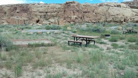
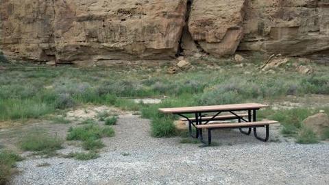
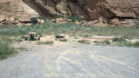
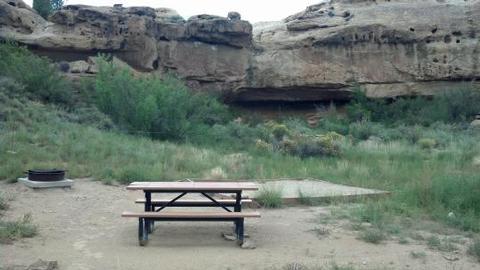
Gallo Campground has 32 individual campsites, one of which is designated as handicapped accessible. Each campsite has a picnic table and a fire grate. There are five campsites for RV ONLY and the remaining 27 campsites allow either tent, small RV or travel trailer. Please read details featured for each campsite before reserving.
There are two (02) group campsites available to accommodate groups with 10-30 people, tent camping only. Each group campsite has picnic tables and a fire grate. Groups reserving group campsite(s) must call the Park for additional arrangement.
The campground has restroom facility with flushable toilets. There are no showers, hookups, and convenience store or food services. There are no cell phone services. Please call the Park for road condition.
Natural Features
Gallo Campground is located in a lowland desert surrounded by canyon walls, arroyos and wash with plenty of southwestern desert plants and brushes, but there are no trees.
Nearby Attractions
Chaco Culture NHP is isolated from various towns and cities. Within two to three hour drive, there are some attractions such as Aztec Ruins, Salmon Ruins, Mesa Verde National Park, El Malpais National Monument, El Morro National Monument, Canyon De Chelly National Monument, Four Corners Monument, Navajo Nation Headquarters and Museum in Window Rock, Arizona.