COLD SPRINGS CAMPGROUND - BOISE NF, ID Campground Reservation, Info, Images, Map, Directions

COLD SPRINGS CAMPGROUND – BOISE NF, Idaho Campground Images, Info & Reservations

Directions

Cold Springs Campground is located in southwestern Idaho, 41.5 miles north of Boise. Take State Highway 55 north to Banks (35 miles). Proceed north on Highway 55 (6.5 miles) to campground on westside of highway. Watch for recreation signs.

Phone

541-351-1182

Activities

BOATING, CAMPING, FISHING, WATER SPORTS

Keywords

COLD SPRINGS CAMPGROUND – BOISE NF,COLD SPRINGS CAMPGROUND,COLD SPRINGS,BOISE NF

Related Link(s)

Rec Area Info & Images

Forest Service Concessionaire

Idaho State Road Conditions

Idaho State Tourism

Overview

Cold Springs Campground is one of four campgrounds along Idaho’s State Highway 55, next to the North Fork of the Payette River. This area is a popular location for river rafting trips and camping. This campground rests at 3,878 feet.

Recreation

The North Fork of the Payette River is a very popular location for expert kayaking. Whitewater rafting is nearby on the Main and South Fork sections of the Payette River.

Anglers will find good to excellent fishing for whitefish and rainbow trout.

Facilities

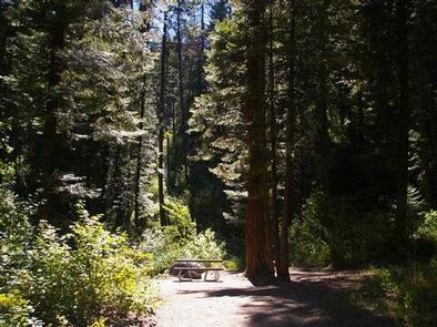
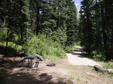
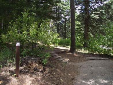
This campground has five sites situated as a group area, each with a picnic table and campfire ring. Vault toilets are provided. Because of its proximity to the highway, some noise from passing traffic is to be expected.

Natural Features

The campground is situated in a scenic canyon just above Highway 55. The mountains are forested with a mix of ponderosa and lodgepole pines and shade is plentiful within most of the campground. Summer days are warm, reaching 80-90 degrees; nights are cooler.

Nearby Attractions

Near the boat and kayak launch of the Payette River.

Reservation

More from CampingHiking.net:

KNUTSON DAM, Minnesota Campground Images, Info & Reservations

Directions The campground is located 6 miles east of Cass Lake on U.S. Highway 2, and 5 miles north on County Road 10. Phone 218-835-4291 Activities BOATING, CAMPING, FISHING, WATER SPORTS, WILDLIFE VIEWING, SWIMMING SITE Keywords KDam,Knutson Related Link(s) Rec Area Info & Images Minnesota State Road Conditions Minnesota State

MEL RIEMAN REC, North Dakota Campground Images, Info & Reservations

Directions The main route to the park is via Interstate 94 to Valley City exit 292. Follow the signs through Valley City and turn left onto County Road 19. Travel for 10 miles. Phone 701-845-2970 Activities CAMPING, FISHING, HIKING, PICNICKING, SWIMMING SITE Keywords MELR,MAIN USE AREA,MRRA,LAKE ASHTABULA Related Link(s) Rec

CHARBONNEAU PK, Washington Campground Images, Info & Reservations

Directions From Pasco, Washington, take Highway 12 east. After crossing the Snake River Bridge, take the first exit and proceed to Highway 124. Continue east through Burbank, Washington. Turn north on Sun Harbor Drive and follow for 1.5 miles, then take a left on Charbonneau Road. Campground is on the

QUINN RIVER CAMPGROUND, Oregon Campground Images, Info & Reservations

Directions From Bend, travel about 50 miles southwest on Cascade Lakes Hwy (46). Campground will be on left-hand side of the highway. Phone 541-323-1746 Activities CAMPING Keywords Related Link(s) Rec Area Info & Images Oregon State Road Conditions Oregon State Tourism Overview Quinn River Campground is located on the western