
Directions
To reach Grandview from Beckley follow I-64 East five miles to Exit 129 B. From Lewisburg follow I-64 West forty miles to Exit 129. From either exit, turn right and follow Route 9 North six miles to Grandview.
Phone
304-465-0508
Activities
HIKING, PICNICKING, DAY USE AREA
Keywords
.
Related Link(s)
West Virginia State Road Conditions
Overview
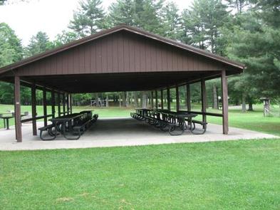
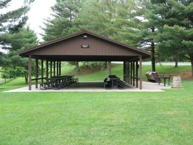
The Playground Picnic Shelter is the main shelter at Grandview. It is closest to the main playground and ball fields, located just past the amphitheater.
Recreation
The Grandview area of New River Gorge National River features five hiking trails, overlooks, a seasonal visitor center, ranger-led activities, summer outdoor dramas (Theatre West Virginia), playgrounds, volleyball court, baseball field, and basketball court.
Facilities
The Playground Picnic Shelter at Grandview is the largest and can accommodate up to 200 people. It is ideal for large family reunions or picnics. It offers a covered eating area, three charcoal grills, and six electrical outlets. Restrooms and drinking fountain are nearby.
Natural Features
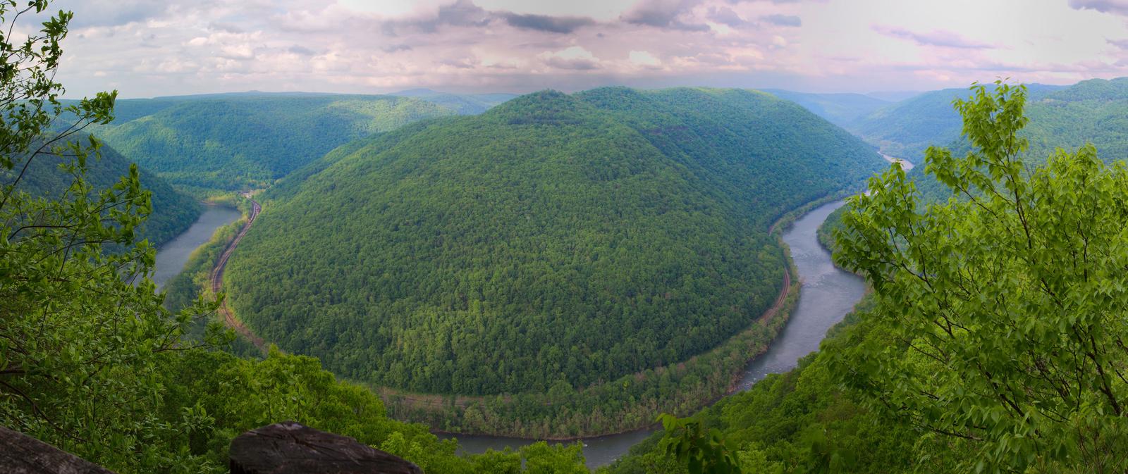
Grandview became part of New River Gorge National River in 1990, after more than 50 years as one of West Virginia’s most popular day use state parks. The area offers spectacular views of the New River and stunning displays of rhododendron. At the Main Overlook, 1,400 feet above the river, you see an active railway and the town of Quinnimont, where coal companies first shipped coal out of the gorge in 1873.
Nearby Attractions
The city of Beckley is approximately 12 miles from Grandview and offers a wide variety of shopping, restaurants, and hotels. Popular attractions include a children’s museum and Exhibition Coal Mine.