Grandview Shelter 3, WV Campground Reservation, Info, Images, Map, Directions

Grandview Shelter 3, West Virginia Campground Images, Info & Reservations

Directions

To reach Grandview from Beckley follow I-64 East five miles to Exit 129 B. From Lewisburg follow I-64 West forty miles to Exit 129. From either exit, turn right and follow Route 9 North six miles to Grandview.

Phone

304-465-0508

Activities

HIKING, PICNICKING, DAY USE AREA

Keywords

Grandview State Park

Related Link(s)

Rec Area Info & Images

West Virginia State Tourism

West Virginia State Road Conditions

Overview

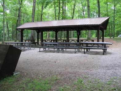
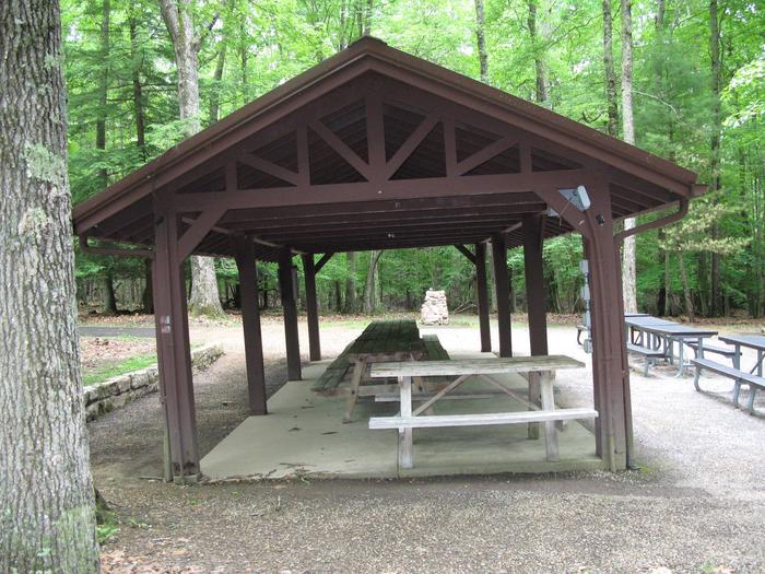
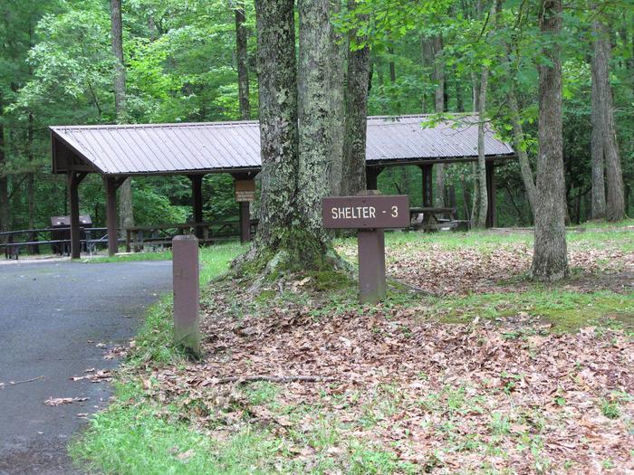
Grandview Shelter #3 is a small shelter shaded by the canopy of the forest. It will hold approximately 30 people inside and 42 outside.

Recreation

The Grandview area of New River Gorge National River features five hiking trails, overlooks, a seasonal visitor center, ranger-led activities, summer outdoor dramas (Theatre West Virginia), playgrounds, volleyball court, baseball field, and basketball court.

Facilities

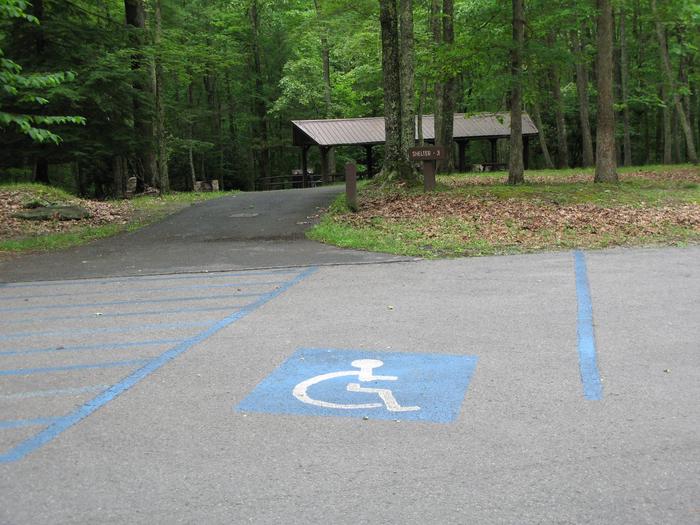
Shelter #3 offers two charcoal grills, and one electrical outlet. Playground equipment, drinking fountain with side spigot, and a handicapped accessible restroom are nearby. This shelter is also handicapped accessible with an asphalt walkway to the shelter for handicapped/elderly. Additional chairs, tables, and canopy tents are allowed.

Natural Features

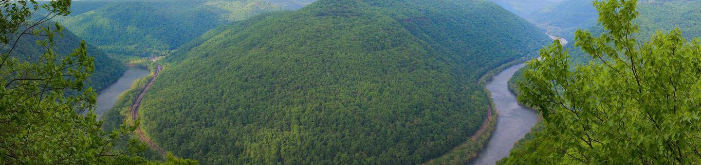
Grandview became part of New River Gorge National River in 1990, after more than 50 years as one of West Virginia’s most popular day use state parks. The area offers spectacular views of the New River and beautiful displays of rhododendron. At the Main Overlook, 1,400 feet above the river, you see an active railway and the town of Quinnimont, where the first coal was shipped out of the gorge in 1873.

Nearby Attractions

The city of Beckley is approximately 12 miles from Grandview. It offers a wide variety of shopping, restaurants, and hotels. Popular attractions include a children’s museum, and Exhibition Coal Mine.

Reservation

More from CampingHiking.net:

RIVER HILL, Colorado Campground Images, Info & Reservations

Directions From Alamosa, CO, go west on Highway 160 to South Fork. Take Highway 149 southwest through Creede and continue on Highway 149 for about 20 miles to milepost 41 (Forest Road 520) and Rio Grande Reservoir Road. Travel about 10 miles on this gravel road to the campground. Phone

SUNSET COVE CAMPGROUND, Oregon Campground Images, Info & Reservations

Directions From Crescent, OR: Travel 12.2 miles west on County Road 61/ Crescent Cut-Off Road, then 6.2 miles north and west on Highway 58. Phone 541-323-1746 Activities CAMPING Keywords Related Link(s) Rec Area Info & Images Oregon State Road Conditions Oregon State Tourism Overview Located next to Odell Lake, Sunset

POWER CREEK CABIN, Alaska Campground Images, Info & Reservations

Directions Access to the cabin is by hiking only. Visitors must hike 4.2 miles on the Power Creek Trail to reach the facility. Due to construction along the beginning of Power Creek trail, hikers and cabin users are being detoured onto the new Power Creek Valley access road. This road

TYEE CAMPGROUND, Oregon Campground Images, Info & Reservations

Directions From Florence, OR, travel south on Highway 101, six miles to Pacific Avenue. Turn left on Pacific Avenue and travel approximately 100 feet. Campground is located on the right (south) side of Pacific Avenue. Phone 541-271-6000 Activities BOATING, CAMPING, FISHING, HIKING, WILDLIFE VIEWING Keywords TYEE,OREGON DUNES,SIUSLAW NF – FS

RADEKE CABIN, New Hampshire Campground Images, Info & Reservations

Directions From NH Route 16 in Conway, take NH route 112 (Kancamagus Highway) west for 14 miles. The cabin is on the right, a quarter mile before Passaconaway Campground. From Interstate route 93 in Lincoln, take exit 32 for NH Route 112. At bottom of exit ramp, turn left (east)